


More news on this day
Heavy rain across metro Atlanta led to a flash flood warning for Cobb and Fulton counties on Wednesday, prompting air-traffic control delays at Hartsfield-Jackson Atlanta International Airport and complicating travel for thousands of passengers.
Get the latest news straight to your inbox!
Flash Flood Warning Targets Cobb and Fulton Counties
Radar estimates and local observations indicate that intense bands of rain moved repeatedly over central and northwest metro Atlanta, with some neighborhoods in Cobb and Fulton counties seeing rapid water rises on streets and low-lying areas. Publicly available information from the National Weather Service shows that the flash flood warning focused on urban zones with extensive pavement, a factor that can accelerate runoff when storms linger.
The warning covered a wide swath of the metropolitan area that includes major residential communities, business districts, and key transportation corridors. Streams that respond quickly to heavy rainfall, along with underpasses and dips in major roadways, were flagged as particularly vulnerable to rapid inundation.
Local broadcast and online weather coverage described water ponding on highways and feeder roads that connect into Atlanta’s core, including routes that funnel travelers toward Hartsfield-Jackson Atlanta International Airport. Reports also noted that prior rounds of rain over recent days left soils saturated, increasing the risk that additional downpours could trigger flash flooding rather than slow, manageable runoff.
Information from municipal and county channels highlighted the potential for localized power interruptions and impacts to traffic signals where drainage systems became overwhelmed. Residents in Cobb and Fulton counties were urged via broadcast and digital alerts to avoid driving through flooded streets and to allow extra time for all forms of travel, including trips to and from the airport.
Ground Delay Program Slows Departures at Atlanta Airport
Hartsfield-Jackson Atlanta International Airport, one of the world’s busiest hubs, experienced weather-related disruptions as the storms moved across the region. According to flight-tracking dashboards and Federal Aviation Administration status pages, an air-traffic ground delay program was instituted for departures bound for Atlanta, citing reduced arrival rates due to thunderstorms and low visibility in the vicinity of the airfield.
Published data showed that flights heading into Atlanta from across the eastern United States were assigned controlled departure times, spacing traffic more widely to accommodate slower operations on the ground and in the terminal area. This kind of program commonly leads to a cascade of delays across airlines’ networks, and early indications from tracking services pointed to extended waits for some departures and arrivals.
Information shared by airlines and airport status boards indicated that passengers faced a mix of late departures, diversions, and a smaller number of outright cancellations. Some aircraft remained on the tarmac longer than scheduled as lightning and heavy rain periodically limited ramp activity, including refueling and baggage handling.
Coverage by national and local outlets noted that the timing of the storms, overlapping with busy midweek travel, amplified the impact. Travelers connecting through Atlanta, an important national and international transfer point, were advised through carrier notifications and public flight boards to monitor their itineraries closely and to prepare for potential missed connections.
Travelers Confront Road Hazards and Longer Airport Timelines
For many passengers, the flash flood warning created a two-layered challenge: hazardous roads on the way to the airport and unpredictable conditions once inside the terminal. Traffic-mapping services and local transportation reports showed slowdowns and backups on major arteries in Cobb and Fulton counties, including segments that feed into the interstate network serving Hartsfield-Jackson.
Publicly available information from the airport and transportation agencies pointed to delays in bus and shuttle services that rely on those same corridors, particularly in areas where surface flooding forced temporary detours. Ride-hailing and taxi services also appeared to be affected, with drivers reporting via social media and travel forums that they were avoiding sections of road known to flood quickly.
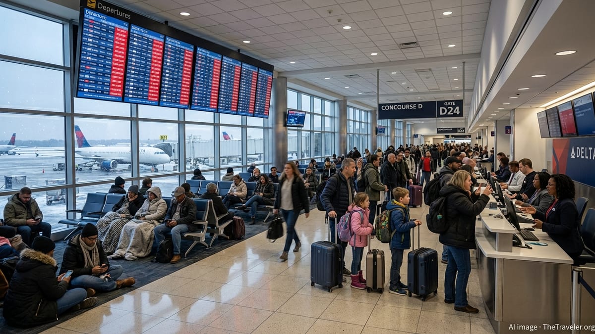
Inside the airport, travelers described via online posts and user-generated updates a familiar pattern of congested gate areas, longer lines at customer service desks, and difficulty rebooking missed connections. Screens displaying departure and arrival times showed columns of delayed flights, with estimated departure times updated frequently as the ground delay program evolved.
Travel-focused publications noted that Hartsfield-Jackson’s stature as a primary connecting hub means that even a few hours of weather-related disruption can ripple outward, affecting passengers whose journeys begin or end far from Atlanta. On days when thunderstorms and heavy rain concentrate over the metro area, delays at the airport often echo across airline networks for the rest of the day.
Guidance for Passengers Navigating the Disruptions
Based on patterns observed during prior severe weather events, travel analysts recommend that passengers headed to or through Atlanta during a flash flood warning build in extra time for every stage of the journey. That includes allowing a wider cushion for driving or transit to the airport, as water-covered lanes and collisions can slow traffic beyond typical rush-hour conditions.
According to airline advisories reviewed by travel media, carriers often respond to weather-related ground delays by offering fee waivers for itinerary changes within a defined time window. While each airline applies its own rules, publicly posted policies suggest that passengers who can shift travel to later in the day or another date may avoid the longest waits at the airport.
Experienced travelers contributing to online forums also emphasize the importance of monitoring both airline apps and independent flight-tracking tools, which can provide early clues about incoming disruptions. When ground delay programs are in effect, estimated departure times may change repeatedly, so frequent checks can help passengers decide whether to remain at the gate, visit a nearby seating area, or seek assistance at a customer service counter.
Travel writers note that, during weather episodes that involve flooding, visitors unfamiliar with Atlanta’s layout should weigh the risks of leaving the airport for short excursions between flights. With intermittent downpours and rapidly changing road conditions in Cobb and Fulton counties, what appears to be a brief trip into the city can quickly become a stressful return drive if storms redevelop over the highway network.
Broader Context for Summer Travel Through Atlanta
Recent summer travel seasons have highlighted how vulnerable large hubs are to clusters of thunderstorms and heavy rain systems. Analyses by aviation researchers and federal data compiled in public reports show that ground delay programs related to convective weather remain a leading source of schedule disruptions at major U.S. airports.
For Atlanta in particular, the combination of high passenger volumes, complex runway operations, and the region’s tendency for slow-moving storm clusters increases the likelihood that a flash flood warning in neighboring counties will intersect with flight operations. Travel media often identify the city as a bellwether for broader network performance, since delays at Hartsfield-Jackson can quickly propagate to regional and cross-country routes.
Industry observers suggest that travelers planning itineraries through Atlanta in the peak storm season may benefit from selecting longer connection times and earlier departures when possible. Morning flights, before daily heating fuels thunderstorm development, are frequently cited in published advice columns as having a better chance of avoiding the worst of afternoon and evening disruptions.
As metro Atlanta absorbs another day of intense rainfall, the flash flood warning in Cobb and Fulton counties and the associated ground delays at Hartsfield-Jackson serve as a reminder that even brief bouts of severe weather can reshape travel plans. Passengers moving through the region are encouraged, via widely available guidance from airlines and travel services, to stay flexible, informed, and prepared for evolving conditions on both the roads and in the air.