


More news on this day
Intense thunderstorms over metro Atlanta have prompted a flash flood warning for Cobb and Fulton counties and led to ground delays at Hartsfield-Jackson Atlanta International Airport, disrupting travel across one of the nation’s busiest hubs.
Get the latest news straight to your inbox!
Flash Flood Warning Covers Key Metro Atlanta Counties
The National Weather Service has placed Cobb and Fulton counties under a flash flood warning as slow-moving storms track across the Atlanta metropolitan area, bringing bursts of heavy rain over already saturated ground. Publicly available weather bulletins indicate that rainfall rates in some neighborhoods are high enough to overwhelm drainage systems in a short period of time.
The warning encompasses a dense urban corridor that includes much of the city of Atlanta and several major suburbs. Low-lying intersections, underpasses, creeks and small streams are considered particularly vulnerable, with forecasters cautioning that conditions can change quickly as new cells redevelop over the same locations.
Residents across Cobb and Fulton are being urged, through local media coverage and weather statements, to avoid driving through standing water and to monitor rapidly changing conditions through trusted broadcast and digital outlets. Reports indicate that some roads are experiencing ponding and reduced visibility, especially during the most intense downpours.
The warning comes during a period of heightened awareness around flooding risk in the Atlanta region, where development, steep terrain and a dense network of creeks can combine to create hazardous runoff during strong storms. Observers note that even brief cloudbursts can produce localized flooding when storm drains are clogged or ground conditions are already wet.
Ground Delay Program Slows Departures at Atlanta Airport
The stormy weather has triggered a ground delay program at Hartsfield-Jackson Atlanta International Airport, one of the primary gateways for domestic and international air travel in the United States. Data posted through the Federal Aviation Administration’s national airspace status reports show that departures bound for Atlanta are being metered, with airlines receiving assigned takeoff times from origin airports.
Ground delay programs are a standard air traffic management tool used when airport arrival rates must be temporarily reduced, often because of thunderstorms, low clouds or other weather-related constraints. In this case, strong cells around the Atlanta area have lowered the number of arrivals air traffic controllers can safely handle at a given time, leading to extra time on the ground for flights across the network.
Passengers transiting through Atlanta are experiencing a mix of moderate to significant delays, depending on their route and airline. Public flight-tracking services and airline status pages show a growing number of flights with pushed-back departure times, as carriers adjust schedules to comply with the FAA program and to wait out the most active storms.
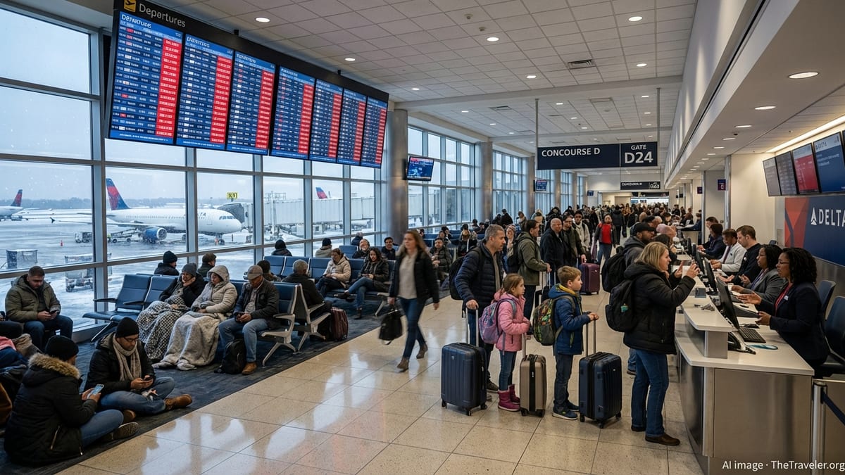
Travelers already at Hartsfield-Jackson are encountering busier-than-normal gate areas and rebooking lines, though the full impact varies by terminal and time of day. Airport-focused coverage indicates that some flights are being held at their origin cities rather than on the taxiways in Atlanta, in an effort to minimize time spent onboard aircraft awaiting clearance.
Impact on Travelers and Ground Transportation
The combination of flash flooding potential in Cobb and Fulton counties and metered arrivals at the airport is creating a challenging environment for both air passengers and those using ground transportation to reach or leave Hartsfield-Jackson. When storms pass directly over major highways, visibility can drop quickly, and pooling water may slow traffic on interstates that feed into the airport corridor.
Rideshare drivers, taxis and shuttle services serving the airport are contending with sporadic slowdowns where heavy rain bands cross key routes. Local traffic maps and media reports show intermittent congestion on stretches of interstate near downtown Atlanta and on feeder roads that link to the airport’s terminals and rental car facilities.
Travel advisories from airlines and travel services are encouraging passengers to allow additional time to reach the airport, particularly those traveling from northern and western suburbs in Cobb County, where rainfall has been especially intense at times. For travelers already in the terminals, publicly available guidance suggests staying close to departure gates, monitoring airline apps for updated times and being prepared for gate or terminal changes as operations are adjusted.
The situation also has implications for regional rail and bus riders heading to the airport. Any localized flooding near stations or along bus routes in low-lying parts of Fulton County can slow connections, adding another layer of uncertainty for passengers trying to make tight flight connections during a day of irregular operations.
What Airlines and Passengers Can Expect Next
Forecast discussions indicate that additional waves of showers and storms may pass over metro Atlanta over the next several hours, which could prolong or reintroduce ground delays at Hartsfield-Jackson depending on how conditions evolve. If lightning, strong gusts or very low visibility persist near the airfield, airport arrival and departure rates may continue to be constrained.
Airlines typically respond to these situations by trimming schedules, consolidating flights where possible and prioritizing connections that help passengers reach their final destinations with the least disruption. Publicly accessible scheduling data show carriers adjusting aircraft assignments and swapping equipment on some routes to better match the evolving operational environment.
For passengers, industry guidance emphasizes the importance of monitoring flight status frequently, even after boarding passes have been issued. Same-day schedule changes are common during active weather periods, and rebooked itineraries can sometimes route travelers through alternative hubs if delays in Atlanta become prolonged.
Those with flexible plans are being encouraged, through travel advisories and airline communications, to consider later flights or voluntary changes where fee waivers are offered. Travelers with time-sensitive commitments, such as international connections or cruise departures, may need to explore backup plans, including overnight stays or alternate routings, if the thunderstorms linger into the night.
Travel Advice for Visitors Heading to or Through Atlanta
Visitors bound for Atlanta in the coming hours are being urged by travel and weather outlets to factor in both the flash flood warning and the airport ground delays when finalizing plans. Those staying in hotels in low-lying or creek-adjacent areas of Cobb and Fulton counties are advised to review local flood information and to park vehicles in locations less prone to standing water when heavy rain is in the forecast.
For those connecting through Hartsfield-Jackson, travel experts recommend carrying essential items in hand luggage, including medications, chargers and a change of clothes, in case delays extend overnight. With thunderstorms affecting a broad portion of the southeastern United States, some onward flights beyond Atlanta may also experience rolling disruptions as aircraft and crews fall out of position.
Tourism-focused organizations are reminding visitors that, despite the weather-related disruption, many attractions in the Atlanta area can resume normal operations quickly once storms pass. However, outdoor activities near rivers, creeks or flood-prone parks may remain limited until water levels recede and conditions are assessed.
As the storm system evolves, travelers are encouraged to rely on official weather information, airline status tools and airport communications to make informed decisions, while allowing extra flexibility in their schedules until the flash flood warning is lifted and normal arrival and departure rates at Hartsfield-Jackson are restored.