


More news on this day
A broad Flood Watch is in effect across Southeast Florida from Tuesday afternoon November 17 through at least Thursday evening November 19, 2026, with the National Weather Service in Miami warning that rounds of heavy rain and training thunderstorms could produce impactful flash flooding in urban areas and along key road corridors that serve Miami’s airports and cruise ports.
Get the latest news straight to your inbox!
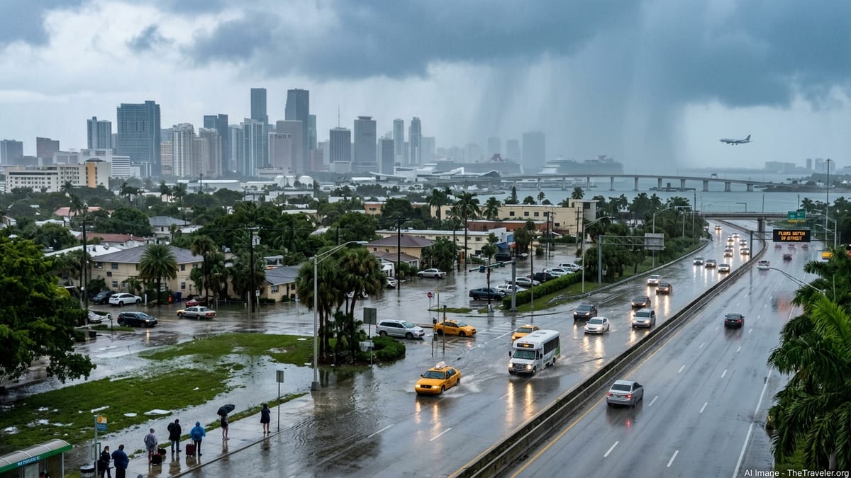
Flood Watch Scope, Timing and Rainfall Forecast
The National Weather Service (NWS) Miami office has placed all of Southeast Florida under a Flood Watch beginning at 5 p.m. Tuesday November 17, citing a deep moisture plume and the potential for repeated thunderstorms along the east coast metro corridor from Miami through Fort Lauderdale and into Palm Beach County. Recent Area Forecast Discussions highlight that the pattern favors training bands of rain over the same locations, increasing the risk of flash flooding in built-up areas with poor drainage.
Forecasters are calling for widespread rainfall totals on the order of 4 to 6 inches across parts of Miami-Dade, Broward and Palm Beach counties through Thursday, with locally higher pockets where the most persistent storms develop. In its Tuesday discussions, NWS Miami notes that some spots could reach roughly 7 to 12 inches if heavier bands stall, a scenario that would raise the likelihood of significant street flooding and rapid rises in canals.
Local alert products for coastal and metro zones, including the Fort Lauderdale area, specify that the Flood Watch is currently scheduled to run through Thursday evening November 19. The Weather Prediction Center’s excessive rainfall outlook also highlights the east coast of the peninsula, including the Miami metro, for an elevated risk of flash flooding tied to this multi-day event.
How Heavy Rain Could Disrupt Flights, Cruises and Transfers
As of late Tuesday November 17, the Federal Aviation Administration’s public airport status information did not show a formal ground delay program in place for Miami International Airport. However, thunderstorms and tropical downpours in South Florida frequently lead to uneven, time-dependent disruptions rather than a single systemwide stop, and NWS guidance anticipates periods of intense convection over the region on Wednesday November 18 in particular.
At Miami International (MIA) and Fort Lauderdale–Hollywood International (FLL), strong storms can temporarily reduce arrival and departure rates as controllers space aircraft farther apart in heavy rain and low visibility. Lightning near the airfield may force ramp closures, pausing boarding, deplaning and baggage handling until conditions improve. Even when runways remain open, such pauses often create knock-on delays as airlines reset their schedules and aircraft and crew circulate through the network.
On the ground, water-covered lanes on low-lying routes leading to MIA, FLL, Palm Beach International (PBI), PortMiami and Port Everglades are a concern if heavier bands repeatedly cross the same neighborhoods. In previous South Florida rain events, localized ponding has slowed ride-share pickups, taxis and airport shuttles, while lower-elevation surface lots and some garage entrances have become temporarily inaccessible. With the current Flood Watch, travelers should be alert to similar localized issues rather than expecting uniform conditions across the region.
What Travelers Should Do Between November 17 and 19
Passengers with flights into or out of MIA, FLL or PBI from Tuesday November 17 through Thursday November 19 should build additional time into their plans for airport transfers, particularly during the afternoon and evening hours when thunderstorms are most likely. Monitoring airline mobile apps and airport social media feeds for gate changes, rolling delays or cancellations will be important, as schedules may shift quickly around the strongest cells.
Travelers who encounter flooded or heavily congested main roads may want to consider alternate ground routes where safe and available. Regional rail options such as Tri-Rail and the privately operated Brightline can sometimes offer a more predictable connection between city centers and airports when surface traffic stalls, though these services can also be affected if tracks or stations in low-lying areas experience water problems. Before setting out, passengers should confirm that trains and local buses are running normally and check for any storm-related detours.
Visitors booked on cruises from PortMiami or Port Everglades should allow extra time to reach their terminals, since heavy rain near downtown Miami or along the I-95 and I-595 corridors could slow access roads even if port operations continue. Checking hotel policies on late arrivals and weather-related cancellations in advance can provide flexibility if transfers are significantly delayed by flooded streets or traffic incidents.
Recent Flooding, Seasonal Outlook and What Comes Next
This week’s Flood Watch follows Florida’s early-November “Election Day” floods, a separate event that produced record-breaking rainfall and damaging flash flooding in parts of the state. While the worst impacts of that episode struck communities north of Miami, some drainage canals and waterways across South Florida remain elevated, which NWS discussions indicate may increase sensitivity to new rounds of heavy rain in certain low-lying neighborhoods.
In its dry-season outlook released on November 3, 2026, NWS Miami noted that a very strong El Niño is expected to shape the 2026–2027 winter and dry season, with odds favoring a wetter and stormier pattern than normal and an above-average number of flood episodes for South Florida. The current mid-November heavy-rain setup is consistent with that outlook, although forecasters emphasize that individual events still depend on the specifics of each storm system.
Forecast guidance suggests that the heaviest rain associated with this episode should begin to taper after Thursday November 19 as the moisture plume gradually shifts or weakens. In Miami’s urban core, shallow street flooding often drains away relatively quickly once intense rainfall ceases, but some suburbs, coastal zones and areas with saturated ground or tidal influences may see lingering standing water and slower receding levels.
Information To Monitor Before Finalizing Plans
Because conditions are evolving from hour to hour, travelers should continue to track updated NWS forecasts, Flood Watch statements and any flash flood warnings that may be issued for specific parts of Miami-Dade, Broward and Palm Beach counties. Local emergency management agencies may provide information on road closures, flooded intersections and any advisories related to public transit or coastal flooding.
At the airport and airline level, passengers should look for real-time updates on the FAA’s national airspace status and on individual airport channels for any ground delay programs, runway impacts or terminal issues that could affect check-in and security queues. Airlines may decide to publish weather waivers for South Florida routes if confidence in disruptive storms increases; if that happens, travelers should review the eligible dates, origin and destination list, and fee and fare-difference rules directly from carrier communications.
For those already in South Florida or arriving during the event, remaining flexible over the next 24 to 72 hours will be key. Adjusting transfer times, staying informed about neighborhood-level flooding, and being ready to rebook flights or modify hotel and cruise connections if official advisories escalate will help keep travel plans workable while heavy rain persists over the Miami metro area.