


More news on this day
A magnitude 4.4 earthquake that struck near The Geysers geothermal field in Northern California on May 7, 2026 is prompting renewed scrutiny of travel safety across nearby wine‑country corridors, even as authorities report no significant damage to key highways, airports or major visitor infrastructure.
Get the latest news straight to your inbox!
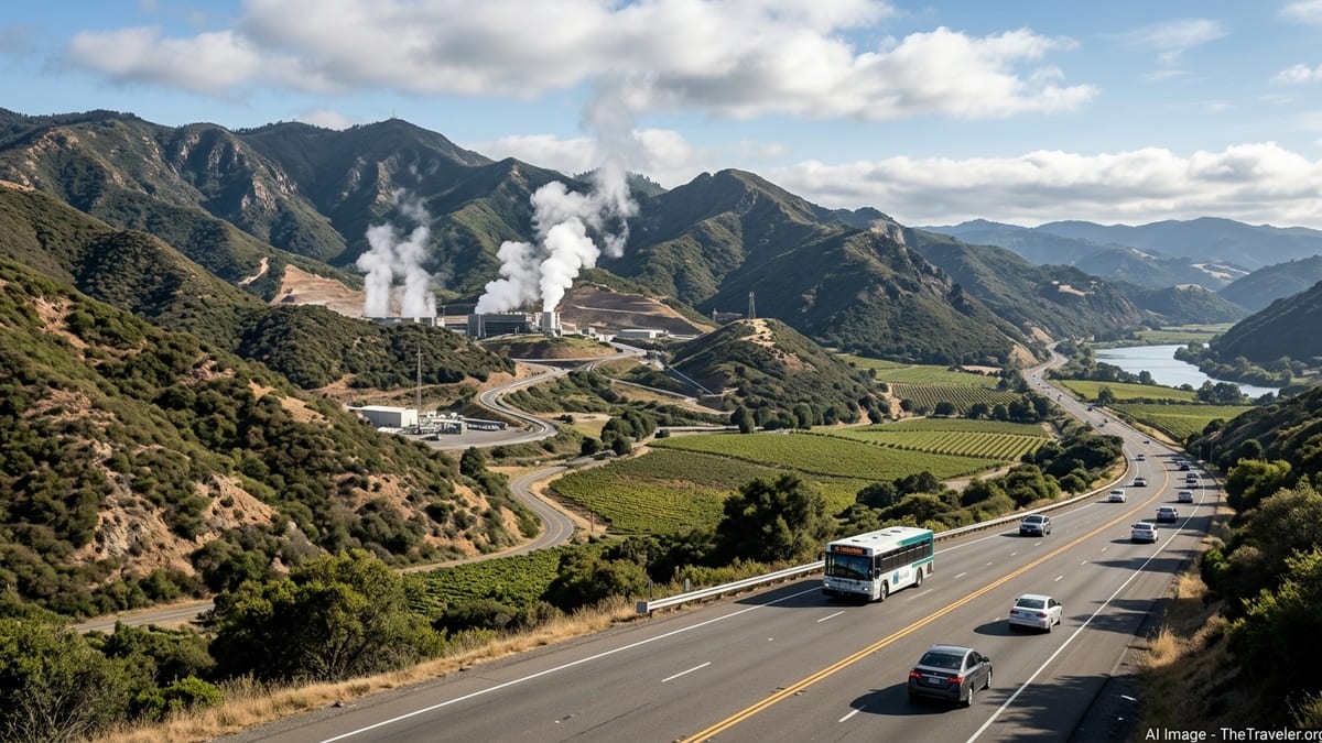
What Officials Confirm About the May 7 Earthquake
According to the United States Geological Survey, a magnitude 4.4 earthquake occurred at 09:42:43 UTC on May 7, 2026, with an epicenter roughly 2 kilometers northwest of The Geysers in Sonoma and Lake counties. USGS data classifies the event as a shallow crustal quake typical of the seismically active geothermal field and notes that shaking was felt across parts of Sonoma, Lake and Mendocino counties.
The Northern California Seismic System, operated by USGS and the University of California, Berkeley, recorded the event as part of the region’s dense instrument network. Early estimates placed the magnitude slightly lower, but subsequent analysis converged on 4.4, which is toward the upper end of what USGS modeling expects from The Geysers area under normal geothermal‑related seismicity.
Local emergency management offices in the surrounding counties reported no widespread structural damage, no fatalities and only limited minor impacts such as items knocked from shelves and short‑lived localized power fluctuations. There were no tsunami advisories associated with the quake, which occurred inland in a mountainous area north of the core wine‑tourism towns of Healdsburg, Calistoga and Sonoma.
Crucially for travelers, there were no verified long‑term closures at regional airports, and primary north–south road arteries such as U.S. Highway 101 and State Route 29 remained open. Any temporary inspections or brief slowdowns on smaller county roads near the epicenter were handled at the local level and did not translate into extended region‑wide transport disruption.
How The Geysers’ Seismicity Relates to Travel Safety
The Geysers hosts the world’s largest geothermal power complex, and small to moderate earthquakes are a routine feature of the area’s underground steam‑field operations. USGS and state hazard‑mitigation documents describe the field as capable of frequent earthquakes around magnitude 3, with occasional events in the low‑to‑mid 4 range, but not a source expected to generate the large, destructive quakes associated with major plate‑boundary faults elsewhere in California.
Recent bulletins from the USGS California Volcano Observatory, which also monitors The Geysers–Clear Lake volcanic region, characterized seismic activity in mid‑2026 as typical for the geothermal field, with more than one hundred earthquakes above magnitude 1 over a 30‑day period and a largest event of about magnitude 3.1 during that window. This context indicates that the May 7 magnitude 4.4, while on the stronger side for the area, remains within the historically observed range rather than signaling a major change in hazard level.
For visitors, this distinction matters. The risk of feeling noticeable shaking on any given trip through northern Sonoma or southern Lake County is higher than in many other U.S. destinations, but the probability that a quake from The Geysers alone will cause widespread building collapse or sever multiple primary highways at once is assessed as relatively low compared with segments of the San Andreas or Hayward faults. Travelers are more likely to experience brief shaking, possible short power interruptions and precautionary infrastructure inspections than large‑scale evacuations or long‑term closures.
Local hazard‑mitigation plans for nearby cities highlight The Geysers as a dense cluster of small‑to‑moderate quakes about 14 miles northeast of Healdsburg, but emphasize that long‑term planning priorities remain reinforcement of bridges, retrofitting older masonry structures and preparing for larger regional faults. In practice, this means most hotels, tasting rooms and tour operators in the main North Bay visitor towns continue to operate with standard California seismic building standards and emergency procedures rather than implementing special protocols unique to The Geysers field.
Immediate Impact on Roads, Rail and Air Travel
Following the May 7 quake, transportation authorities focused on rapid checks rather than major shutdowns. Caltrans and county public works departments inspected key bridges and slopes near the epicentral area, particularly on local access routes serving the geothermal plants and sparsely populated upland areas. Available official information and regional news coverage indicate that inspections did not uncover serious structural damage requiring long closures on those routes.
Along U.S. Highway 101, the main spine for visitors driving between San Francisco, Santa Rosa and points farther north, traffic reports referenced light to moderate congestion tied more to regular commuter patterns than to earthquake damage. The quake’s shaking intensity in major corridor towns such as Santa Rosa and Healdsburg appears to have been strong enough to be felt but not high enough to trigger prolonged emergency traffic controls beyond routine bridge checks.
Regional commercial air travel continued largely uninterrupted. Charles M. Schulz–Sonoma County Airport near Santa Rosa, the primary commercial gateway for many wine‑country visitors, did not report structural issues that would affect runway operations or terminal access. Oakland, San Francisco and Sacramento international airports, which also funnel visitors toward the North Bay, reported normal operations on and after May 7 in airline and airport status updates.
Rail impacts were limited. The SMART commuter rail line, which runs between Larkspur and the Santa Rosa–Windsor area, lies well south of the epicenter. Standard safety protocols require operators to check tracks and structures after felt events, but there were no public indications of prolonged service suspensions or earthquake‑related damage in the days following the quake.
What Changes for Travelers Planning North Bay Trips in 2026
The central practical outcome for travelers is that the May 7 magnitude 4.4 quake does not, on its own, significantly alter how visitors get to or move around Northern California’s wine country. Highways, airports and rail lines that leisure and business travelers rely on remained intact, and tourism businesses in Santa Rosa, Healdsburg, Calistoga and surrounding communities continued operating on normal schedules.
However, the event has sharpened focus on personal preparedness and itinerary flexibility. Emergency managers routinely advise that anyone spending time in seismically active parts of California carry or have access to basic supplies such as potable water, snacks, a flashlight and a battery pack for phones, in case a moderate quake causes short‑term power or communications disruptions. For self‑drive visitors planning to explore back roads near The Geysers, Lake County or rural Mendocino County, allowing extra travel time and keeping fuel tanks from running low can provide a buffer if inspections or minor rockfalls cause brief delays.
Travel insurance policies that cover trip interruption due to natural disasters may be worth reviewing, especially for itineraries involving nonrefundable boutique accommodations in hillside or remote locations. Insurers generally respond only to officially declared emergencies or documented property damage, so the May 7 event, which did not trigger such declarations for the main tourist centers, would not typically have resulted in broad claim eligibility. Future, more damaging events in the wider region could change that calculus, so travelers booking far in advance may wish to confirm exactly which seismic scenarios are covered.
For organized tours, many North Bay operators already have contingency routes that avoid landslide‑prone or steep minor roads after heavy rain, and similar flexibility would apply if a moderate quake led to localized closures. In 2026, there is no evidence of tour operators permanently dropping The Geysers or adjacent areas from their offerings specifically because of the May 7 quake, but itineraries could shift temporarily if officials request reduced traffic on certain service roads to facilitate inspections or repairs.
Watching The Geysers and Wider Northern California Faults Going Forward
While the May 7 event is the focal point for current concern, USGS monitoring shows that seismicity near The Geysers has continued at levels typical for the field in the months since, with numerous small events and occasional quakes of around magnitude 3. Travelers visiting late 2026 should expect that low‑level seismic activity will remain a background feature of the area rather than an anomaly.
At the same time, The Geysers exists within a broader Northern California fault network that includes segments capable of larger and more damaging earthquakes. Statewide forecasts published by geological agencies estimate a high probability of at least one magnitude 6.7 or greater earthquake in California within a multi‑decade window. That broader risk picture, rather than the May 7 The Geysers quake alone, continues to drive building codes, bridge retrofits and emergency‑response planning that ultimately shape how resilient the region is for residents and visitors.
In practical terms, travelers can benefit from monitoring two types of official information before and during trips. First, real‑time resources such as USGS earthquake notifications and state ShakeAlert‑enabled apps can provide a few seconds of warning in some scenarios and confirm whether a felt jolt is part of a larger regional event that might affect infrastructure. Second, county emergency‑management sites and Caltrans road‑status tools can help confirm whether any particular quake has resulted in closures along planned routes.
Looking ahead, there are no firm indications of regulatory changes that would directly alter visitor access to The Geysers geothermal facilities or nearby recreation areas as a result of the May 7 quake. Authorities may update local hazard‑mitigation documents and outreach materials to highlight lessons learned and reinforce guidance on securing interiors, checking slopes and improving communication with visitors. For travelers, the most useful step is to treat earthquake awareness as a standard part of Northern California planning in 2026, much like wildfire season awareness or winter‑storm checks in other parts of the state.