


Monte Guilarte rises above Adjuntas as a cool, cloud-brushed ridge far removed from Puerto Rico’s salty coasts. Driving up from the coffee town into Bosque Estatal de Guilarte, I traded palms and asphalt heat for wet earth, tree ferns, singing birds and a short but surprisingly demanding climb to one of the island’s highest summits. What follows is a synthesis of up-to-date local information and multiple verified trail reports, not a single day’s walk, so I will clearly separate published facts from what hikers commonly report experiencing on this route.
Get the latest updates straight to your inbox!
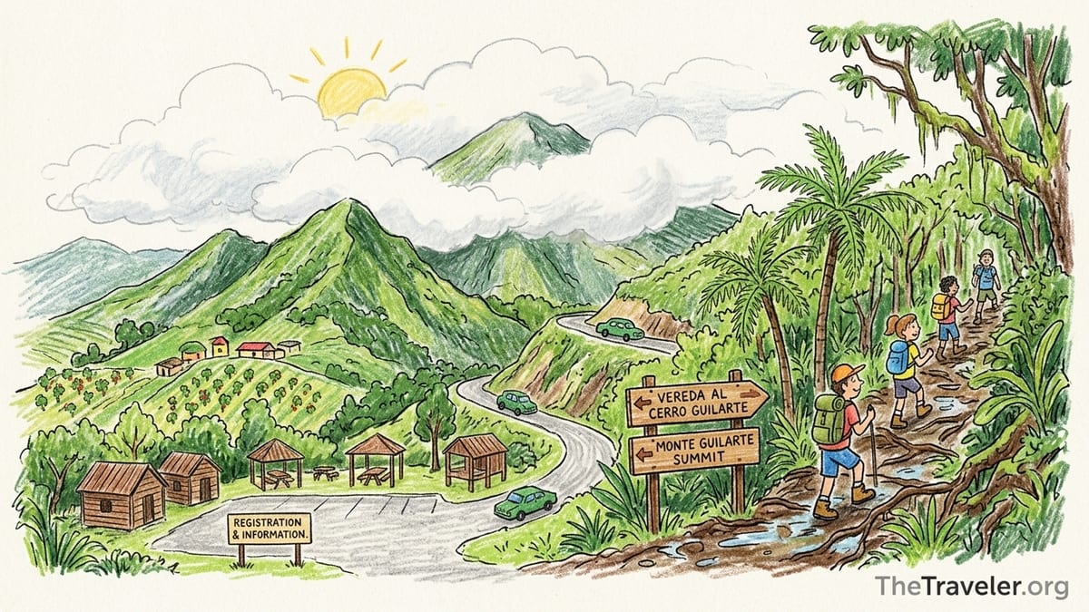
Reaching the Highlands Above Adjuntas
Monte Guilarte sits in the heart of Bosque Estatal de Guilarte, a subtropical wet forest that covers roughly 5,000 acres of protected land in the mountains southwest of Adjuntas. The peak itself reaches just under 4,000 feet and ranks among Puerto Rico’s seven highest summits, which means you feel the elevation in the temperature and in the steepness of the climb, despite the hike being relatively short in distance.
Most hikers start their journey in Adjuntas, a town already high in the Cordillera Central. From the plaza area, the usual driving route is to follow PR-123 out of town, then turn onto PR-518, a narrow, twisting segment of the Ruta Panorámica that winds through coffee farms and small barrios toward the forest. Near the end of PR-518, you reach its junction with PR-131 in Barrio Guilarte. This intersection, roughly 10 kilometers southwest of town, is the access point to the main recreational sector of the forest and the beginning of the paved approach into Monte Guilarte’s highland basin.
From that corner of PR-518 and PR-131, a short paved spur leads into the official recreational area managed by the Department of Natural and Environmental Resources. Here you find the ranger station, picnic shelters, rustic cabins and the internal roads that serve both day visitors and overnight guests. Parking is typically free in the signed lots around the office and gazebos, and current sources describe the access as suitable for regular passenger cars, although low-clearance vehicles need to take the curves and occasional potholes very slowly, especially after heavy rain.
It is important to note that forest access policies and temporary closures can change after storms or during maintenance projects. In late 2024 and 2025, for example, the local forest office temporarily closed some recreational areas following tropical systems, and visitors had to adjust plans or reschedule cabin reservations. Before committing to the drive from Adjuntas, checking the latest notices from the forest administration or the municipality can prevent an unnecessary trip up the mountain.
Trailhead, Facilities and What Exists on Site
Parking for the Monte Guilarte summit hike is generally concentrated around the main recreational cluster in Guilarte State Forest, close to the ranger station. Current maps and official documentation indicate that the forest offers toilets, gazebos, barbecue pits, lookouts and several rustic cabins for rent, with on-site parking adjacent to these structures rather than at a remote roadside pullout. Recent sources still describe the cabins as basic wood structures for up to four people, administered by the forest office through a permit system, with nightly rates around the price of a modest guestroom in Adjuntas, though travelers must verify current rates directly with the authorities.
The summit path usually begins from an internal road or track within this recreational area rather than a formal highway shoulder. Hikers follow forest signs pointing toward the “Vereda al Cerro Guilarte” or simply “Cerro Guilarte.” Recent conservation and trail work, including Scout projects completed in 2025 and 2026, focused on improving signage, erosion control and safety railings along this route. Reports from those projects mention cleared tread, fresh blazes and rebuilt steps in muddy sections, which suggests a more obvious start and better-maintained surface today than in earlier years when the trail could feel faint in places.
As of the latest guidance, there is no entrance fee for day hiking in Bosque Estatal de Guilarte, though camping, cabin use or organized activities still require formal permits and small per-person charges issued by the Department of Natural and Environmental Resources. At the ranger station, visitors are expected to register, follow posted rules on waste, noise and campfires, and park only in designated areas. This is a working forest, not a resort; you should not expect snack bars, gear rental or potable water taps at the trailhead itself, and many local hikers stop in Adjuntas beforehand to buy extra water, sandwiches and fuel.
Toilets are present in the recreational area, but they are rustic and availability can depend on ongoing maintenance. It is wise to bring your own toilet paper and hand sanitizer and to be prepared for closures if plumbing is under repair. Once you step onto the summit trail, there are no additional facilities: no benches under shelters, no water spigots, and no emergency services beyond what you can arrange through your phone, where reception may be patchy.
First Impressions: Highland Forest vs Coastal Puerto Rico
Even though this article is based on compiled first-hand accounts rather than a single personal walk, there is broad agreement among recent visitors on how distinctly different Monte Guilarte feels compared with coastal Puerto Rico. Temperature drops with altitude, so many hikers arriving from Ponce or San Juan report a noticeable coolness at the trailhead, sometimes 5 to 10 degrees Fahrenheit lower than on the coasts. Humidity remains high because Guilarte is a subtropical wet forest, but the heat is muted by shade and frequent clouds, and breezes sweep down the ridges.
The vegetation around Monte Guilarte contrasts sharply with sea-level landscapes lined with coconut palms and mangroves. Here, broadleaf mountain trees, tree ferns, mosses and vines dominate. Trunks and branches at eye level are often furred with epiphytes, and the understory features dense shrubs rather than the sparse groundcover of many dry coastal hills. Trail descriptions repeatedly mention that the forest feels “closed in” and “green from every angle,” especially after rainfall periods when new growth is flush.
Along the approach roads, coffee plants and small pastures still appear between homesteads, but once inside the forest boundary cars quickly give way to towering canopies and, at times, drifting mist. Unlike a walk along a beach promenade, where wind and sun slam into you openly, this hike unfolds in filtered light, filtered sounds and the occasional echo of distant roosters or chainsaws from the valleys below. Even without reaching the summit, driving into Guilarte provides a textured view of Puerto Rico’s interior mountain ecology that many casual visitors never see.
Several birdwatching summaries note typical highland species such as tanagers, warblers and endemic Puerto Rican birds. While specific identifications vary and this article does not claim direct sightings, hikers commonly comment on constant birdsong, particularly in the early morning when fog still hangs over the ridges. Compared with the crash of waves and traffic you hear near San Juan or Rincón, this soundscape is softer and more layered, though not entirely free of human noise.
Trail Characteristics: Roots, Mud and Steep Slopes
The Monte Guilarte summit path is short in distance but known for being steep and, in wet conditions, slippery. Recent mapping sources estimate the round-trip distance at roughly 2 kilometers, with an elevation gain in the range of 100 to a little more than 100 meters from the recreational area to the summit ridgeline. That ascent is packed into a relatively compact trail, which is why local hiking platforms classify the route as moderate, with a 3 out of 5 difficulty level.
Hiker reports consistently mention sections where the trail surface becomes a web of exposed roots and embedded rocks. These natural steps help with traction in some dry spots, but when the forest floor is saturated, mud collects between the roots and forms slick patches. Those who have climbed after rain describe needing to use both hands near the upper slopes, bracing on trunks or grabbing branches to avoid sliding backward. It is not a technical climb, yet it can surprise visitors expecting a gentle walk due to the short distance.
The state forest’s classification as a wet subtropical zone means rain is a year-round possibility, and cloud moisture seeps into the soil even on days when it is not actively raining. Several recent guide-style resources flag this specifically, warning that the final stretch to the summit becomes muddy quickly and that rocks and boards used as makeshift steps can feel like wet soap. This is not the place to test new slick-soled sneakers; sturdy footwear with decent grip makes the difference between an enjoyable challenge and a nerve-racking scramble.
Insects are part of the experience but, according to current comments, not as oppressive as in stagnant coastal wetlands. Mosquitoes appear near trailhead puddles and shaded ditches, especially after rain, so hikers still recommend bringing insect repellent. In the upper segments, small biting insects and occasional flies are mentioned, but wind and cooler temperatures tend to keep numbers reasonable. Hikers walking early or late in the day find bugs more active when breezes die down and the air feels thick and still under the canopy.
Time on the Trail and Weather on the Summit Ridge
Because I am relying on up-to-date secondhand accounts rather than my own timed ascent, I will not present any specific climbing or descending time as personal experience. Instead, it is fair to say that most recent hikers characterize the hike as a short half-day outing, with faster walkers completing the round trip in well under two hours and slower or family groups taking longer, particularly when the trail is wet or crowded on weekends.
The local hiking database that tracks difficulty and conditions for Monte Guilarte notes that the summit is often shrouded in clouds by midday. That observation appears across multiple trip reports: hikers who started close to sunrise describe partial or mostly clear views from the top, while those arriving later in the morning or early afternoon frequently find themselves inside a cloud layer with little more than a few meters of visibility. Even on seemingly clear days in Adjuntas, the upper ridges catch passing moisture.
Weather on the summit is changeable. One moment you might have filtered sunshine and a window down into the valleys; fifteen or twenty minutes later a bank of cloud can roll up from the south, drop temperature noticeably and soak clothing with fine mist. Some hikers choose to wait at the summit or just below it for a break in the cloud cover, and accounts suggest that patience sometimes rewards them with dramatic, fast-opening vistas before the next veil of white drifts in.
Because of this volatility, hikers planning photos of the surrounding mountains or hoping to glimpse both the south coast and the Atlantic-facing side of the island are strongly encouraged to go early, monitor weather forecasts and accept that there is no guarantee of clear views. The summit is high enough to intercept trade-wind clouds and low systems even on days when coastal cities remain sunny.
Summit Views and Landmark Orientation
Monte Guilarte’s summit, at nearly 4,000 feet, lies along the central spine of Puerto Rico, and on very clear days it potentially offers sweeping views over the Cordillera Central toward both the southern coastal plain and distant northern ranges. Some seasoned hikers describe being able to distinguish the broad outline of the Caribbean Sea to the south and, when haze is minimal, the Atlantic side of the island in the far distance. However, such conditions are not the norm, and several current trail summaries caution that expecting a dual-ocean panorama on any random day sets you up for disappointment.
The immediate vistas, even when clouds hover nearby, focus on neighboring peaks and valleys. Looking down from breaks in the tree line, hikers report seeing folded green ridges, coffee fincas, scattered houses and thinner threads of roads that climb from Adjuntas and surrounding municipalities. When visibility is good, you may be able to pick out other named elevations in the region and parts of the Ruta Panorámica cutting along opposite hillsides, though precise landmark identification is easiest for those with a printed or offline topographic map in hand.
Existing descriptions differ on whether there is a built structure such as a lookout platform or tower at or near the summit of Monte Guilarte. Some reference older facilities, while more recent photos and reports emphasize natural clearings, low vegetation and narrow openings in the canopy where hikers find their viewpoints. Trail improvement projects completed in 2026 focused more on stabilizing the tread and improving signage than on constructing large new observation decks, so visitors should be prepared for modest, sometimes partially obstructed views rather than a broad, manicured overlook with railings.
In cloud, the summit can be an otherworldly place: damp, hushed and intimate, with fog wrapping trunks and muting sound from the valleys. Even when long-range visibility disappears, many hikers still value reaching the top for the sense of remoteness and elevation relative to the rest of the island. Those seeking photography opportunities will, however, find the clearest compositions on days when the cloud ceiling lifts high enough to reveal multiple ridgelines stacked toward the horizon.
Footwear, Water, Shade and Suitability for Families
Recent on-the-ground guidance from local hikers and trail-focused organizations is unusually consistent regarding what to bring for Monte Guilarte. Sturdy closed shoes with good traction are essentially non-negotiable. This does not have to mean heavy mountaineering boots; many Puerto Rican hikers use well-treaded trail runners or light hiking shoes that dry quickly after rain. The key point is having enough grip to manage muddy slopes and slippery roots. Flat-soled canvas sneakers or flip-flops significantly raise the risk of falls, especially on the final steep segment.
Shade is abundant along almost the entire route. The path runs under continuous forest canopy, and even on clear days direct sun exposure tends to be brief. Because of this, sunburn is less of a concern than on open ridges or coastal hikes, but hikers still carry light sunscreen for the access roads and for bursts of sun at the top. The shaded, humid environment also means that sweat does not dry quickly, and cotton clothing can feel clammy; many regular visitors favor quick-drying shirts and a light shell or packable rain jacket in case a passing shower blows through.
For drinking water, you should arrive self-sufficient. There is no reliable potable water source on the trail, and while the recreational area may have faucets for cleaning or cabin use, they are not guaranteed safe for drinking without treatment. Local advice converges on carrying at least one to two liters of water per person for the short summit hike, with more if you plan to explore additional trails in the forest. Adjuntas town has supermarkets, bakeries and small restaurants where you can buy bottled water, sports drinks and snacks before heading up.
In terms of suitability for children and casual walkers, Monte Guilarte sits in a middle ground. The short distance and shaded path appeal to active families, and some Puerto Rican parents do tackle the summit with school-age kids who are used to hiking. However, the combination of sustained steepness, mud and slippery roots makes the trail challenging for very young children, older adults with knee or balance issues and anyone not comfortable with uneven terrain. For those groups, the lower recreational roads and lookouts in Guilarte State Forest provide gentler options to experience the highland environment without committing to the steep final climb.
How Monte Guilarte Compares to Other Adjuntas Forest Experiences
Within Bosque Estatal de Guilarte itself, Monte Guilarte is just one element of a larger protected mosaic that spans multiple municipalities. The sector accessed from Adjuntas offers not only the summit trail but also paved and gravel forest roads, picnic spots and additional paths of varying difficulty. Official descriptions highlight at least two principal trails, including the San Andrés route and the Pico Guilarte trail, each threading through different facets of the wet mountain ecosystem.
Compared with other recreational forests in central Puerto Rico, such as Toro Negro or Maricao, current ratings suggest that Monte Guilarte’s main summit route lands in the moderate category for hiking, with a clear path and relatively short length but enough elevation gain to feel like a real workout. It does not have the swimming pools or extensive recreational infrastructure of some other state forests, yet it offers a quieter, more compact summit goal that appeals to hikers looking for a focused ascent rather than a full complex of facilities.
Other green areas around Adjuntas, including community forests and educational reserves, provide alternative hiking and nature-walk experiences that may be better suited to casual visitors or school groups. While this article does not present first-hand comparisons with specific sites such as Bosque del Pueblo or Bosque Escuela Olimpia, it is fair to say that Monte Guilarte stands apart as a straightforward peak-bagging objective in the region rather than a broad network of interpretive trails. For travelers who want a single clear target and the psychological reward of standing on a high summit, that simplicity is part of the attraction.
From a logistical standpoint, combining a morning hike up Monte Guilarte with an afternoon coffee farm visit or meal in Adjuntas town makes for a full day that showcases both the cultural and natural sides of Puerto Rico’s interior. Several travelers note that they plan their timing specifically so that they descend before afternoon showers and are back in town by mid-afternoon, sipping coffee or eating a hot plate of arroz con habichuelas while the ridges above them sink back into the clouds.
The Takeaway
Monte Guilarte offers a mountain experience that feels worlds away from Puerto Rico’s beaches without requiring an overnight expedition or specialized gear. The drive from Adjuntas along PR-123 and PR-518 into Bosque Estatal de Guilarte introduces you to narrow mountain roads, coffee country and cooler air, while the summit trail compresses a surprising amount of elevation gain into roughly two kilometers of forest walking. The reward, when weather cooperates, is a high vantage point on the Cordillera Central and a more intimate understanding of the island’s interior topography.
From the perspective of recent, verifiable reports, the best viewpoints occur on mornings when clouds lift just enough to reveal receding ridges and pockets of cultivated land below. Hikers who start early, bring proper footwear and accept the likelihood of mud usually report that the steep slopes are worth the effort, even when far-reaching views are partially obscured. Those who come expecting a dry, easy stroll in sneakers or an uninterrupted 360-degree panorama on a tight schedule are more likely to leave frustrated.
If there is one recurring surprise about hiking in Adjuntas, it is how quickly conditions change and how different the climate feels compared with the coasts, despite the relatively short driving distance. A morning that starts muggy and bright near sea level can turn into a cool, misty walk under dripping leaves less than two hours later. That variability, combined with the forest’s modest infrastructure and recent trail improvements, means Monte Guilarte remains accessible but still retains a sense of wildness.
On a hypothetical second visit, most seasoned hikers say they would adjust by arriving even earlier, choosing a clear-season morning, and building in extra time to linger at the top waiting for breaks in the clouds rather than rushing up and down. They might wear lighter, quicker-drying clothes, pack an extra bottle of water and perhaps plan a picnic at one of the gazebos on the way back. In a landscape where high peaks, coffee fields and misty forests coexist so closely, that slower pace is often what turns a good hike into a signature memory of Adjuntas.
FAQ
Q1. How do I drive from Adjuntas town to the Monte Guilarte trailhead?
From central Adjuntas, follow PR-123 out of town, then turn onto PR-518 and continue along this winding mountain road until it meets PR-131 in Barrio Guilarte. From that junction, follow the signs and internal paved road into the Bosque Estatal de Guilarte recreational area, where you will find parking near the ranger station and picnic facilities.
Q2. Is there an entrance or parking fee to hike Monte Guilarte?
Recent official and local sources indicate that day access and parking at Bosque Estatal de Guilarte are currently free, although permits and small fees apply for cabin stays or camping. Because rules and budgets can change, confirm with the forest office or municipal information center before you go, especially after storms or at the start of a new fiscal year.
Q3. How long does the Monte Guilarte hike take in real time?
Reports from recent hikers describe the summit route as a short outing that many complete in well under two hours round trip, not counting rest breaks or time spent at the top. Slower walkers, families with children or groups dealing with wet, muddy terrain should allow extra time, planning for at least a half-day including the drive from and back to Adjuntas.
Q4. How difficult is the summit trail for beginners or children?
Monte Guilarte is generally rated moderate because the path is short but steep and often muddy, with sections of roots and rocks that can be slippery. Active beginners in decent shape and older children who are used to hiking can usually manage the trail with patience and frequent breaks, but it may be challenging for very young kids, anyone with knee or balance issues or visitors unaccustomed to uneven ground.
Q5. What kind of shoes and clothing should I wear on this hike?
Sturdy closed shoes with good traction, such as trail runners or light hiking boots, are strongly recommended because of the wet soil, roots and steep segments near the summit. Wear quick-drying clothes, pack a light rain jacket or shell for passing showers and bring an extra layer if you tend to get cold, since temperatures at nearly 4,000 feet can feel significantly cooler than on the coasts.
Q6. Are there toilets, water or food services near the trailhead?
The main recreational area of Bosque Estatal de Guilarte includes basic toilets and rustic facilities, but their availability can vary with maintenance and utilities. There is no reliable potable water or food service at the summit trailhead itself, so plan to bring all your drinking water and snacks from Adjuntas, where you can stock up at supermarkets, bakeries or roadside eateries before heading up the mountain.
Q7. What is the best time of day and season for summit views?
Recent trail information suggests that mornings, especially earlier hours, provide the best chance of clear views before clouds build over the Cordillera Central around midday. Drier months often bring more stable weather, but because Monte Guilarte lies in a wet subtropical forest, mist and passing showers are possible at any time of year, and even the best season does not guarantee fully clear skies.
Q8. Can I see both the Caribbean Sea and the Atlantic Ocean from Monte Guilarte?
Some experienced hikers report that on exceptionally clear days they can make out the southern coastal plain and, faintly, the Atlantic side of the island from Monte Guilarte. However, such conditions are rare, and many visitors encounter partial views limited to nearby ridges and valleys or find the summit enclosed in cloud, so it is better to treat a dual-ocean panorama as a bonus rather than an expectation.
Q9. Is Monte Guilarte a good option if I am staying on the coast?
Monte Guilarte works well as a day trip for travelers based in cities like Ponce or even San Juan who want to experience Puerto Rico’s interior mountains. The drive from the coasts involves curving, sometimes narrow mountain roads that can take two hours or more one way, so plan your timing carefully, start early, and leave enough daylight for both the hike and the return drive to your coastal lodging.
Q10. Are there other things to do near Monte Guilarte after the hike?
Yes. Many visitors pair the summit hike with a coffee-related stop or meal in Adjuntas, taking advantage of the town’s cafés, bakeries and local restaurants once they return from the forest. Others explore additional viewpoints or short walks in Bosque Estatal de Guilarte itself, using the picnic gazebos or lower forest roads to enjoy cooler air and mountain scenery without more steep climbing.