


More news on this day
Hurricane Isaias, a strengthening Category 2 storm in the central Gulf of Mexico, is already disrupting flights, cruise schedules, and ground transportation across the northern US Gulf Coast as coastal communities brace for a potentially dangerous landfall late on October 9.
Get the latest news straight to your inbox!
Storm Track Focuses on Northern Gulf Hubs
Publicly available data from the National Hurricane Center on October 9 indicates that Hurricane Isaias is centered over the central Gulf of Mexico, moving northeast at around 14 miles per hour with maximum sustained winds near 105 miles per hour. The current forecast cone brings the core of the storm toward the northern Gulf Coast, with a landfall risk focused between southeastern Louisiana and the Florida Panhandle late Friday into early Saturday.
Storm surge and hurricane warnings are in effect along portions of the northern Gulf shoreline, covering low lying areas that include key travel gateways such as New Orleans, Gulfport and Biloxi on the Mississippi coast, Mobile in Alabama, and Pensacola and Destin in Florida. Forecast guidance points to a large wind field and significant coastal flooding potential, which could temporarily close or severely limit access to airports, seaports, interstate highways, and intercity bus routes in the region.
Regional National Weather Service offices along the Gulf report that squalls, heavy rain and tropical storm force winds are already reaching offshore platforms and some coastal communities. Conditions are expected to deteriorate through the day on October 9, with hazardous driving conditions and intermittent loss of power and communications becoming increasingly likely in areas closest to the projected landfall zone.
Air Travel: Delays, Cancellations and Route Changes
The Federal Aviation Administration’s daily air traffic report for October 8 highlighted Hurricane Isaias as a key operational risk, noting the potential need for oceanic route closures and en route flow restrictions over the Gulf of Mexico. As the system has strengthened, major carriers serving Gulf airports appear to be consolidating schedules, preemptively canceling flights into the most exposed airports and rerouting others through inland hubs.
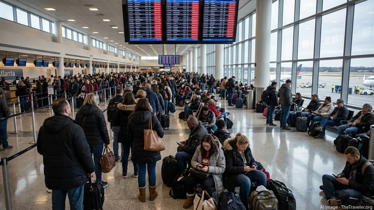
Early morning status boards at large hubs such as Houston, New Orleans and Atlanta show mounting delays and cancellations linked to the storm and its outer bands. New Orleans Louis Armstrong International Airport and Gulfport Biloxi International Airport are expected to experience the most severe disruption if hurricane conditions reach airfield thresholds that require temporary suspension of operations. Travelers connecting through these hubs may encounter missed connections even if their origin and final destination are outside the Gulf region.
Published airline advisories indicate that many US and international carriers have introduced temporary travel waivers for itineraries touching Gulf Coast airports between October 9 and October 11. These waivers typically allow a one time change to travel dates without a change fee, provided passengers rebook within a specified window and keep the same origin and destination. Some carriers also permit rerouting through alternate hubs at no additional fare if comparable inventory is available, although specific terms vary by airline and booking class.
Authorities responsible for the national airspace are also signaling that temporary ground delay programs or short notice ground stops are possible at inland hubs if thunderstorm bands from Isaias expand and interact with existing congestion. Passengers with tight onward connections, particularly on evening departures, face an elevated risk of misconnection and are being encouraged by airlines in public advisories to monitor flight status closely on the day of travel.
Ports, Ferries and Cruise Operations Adjust Plans
Along the northern Gulf Coast, multiple ports that normally handle cruise vessels, offshore supply traffic and roll on roll off cargo are preparing for high winds and storm surge associated with Isaias. Public information from port authorities in New Orleans, Mobile and the Florida Panhandle indicates that harbor conditions may be restricted to essential or emergency movements only as wind speeds increase, with non critical operations paused until post storm inspections can be carried out.
Cruise lines operating short voyages from Gulf ports during the shoulder season are adjusting itineraries to avoid the forecast path of the hurricane. Some departures have been advanced, delayed, or reassigned to alternate berths farther east, while a small number of short sailings have been canceled outright. Passengers booked on near term cruises are being redirected to online portals and customer service centers for rebooking options and, in some cases, future cruise credits, in line with each company’s published policies.
Regional ferry services across bays and inlets in Louisiana, Mississippi and Alabama are also expected to suspend operations during the height of the storm. These links, which often provide vital connections between barrier islands, coastal communities and mainland road networks, typically resume only after marine safety checks confirm that channels are clear of debris and that vessels and terminals have not sustained significant damage.
Highways, Rail and Local Transit Face Weather Hazards
State transportation departments along the Gulf Coast are issuing regular bulletins warning of heavy rainfall, localized flash flooding and potential river rises as outer rainbands from Isaias move inland. Low lying sections of Interstate 10 and feeder highways in Louisiana, Mississippi, Alabama and the Florida Panhandle are particularly susceptible to ponding and short notice closures when storm surge overlaps with torrential rain and high tide.
Rail operators that run long distance and regional passenger trains along the Gulf Corridor are monitoring track conditions and bridge exposure. Service adjustments may include re routing trains away from the immediate coast, implementing slower operating speeds through sections prone to flooding, or temporarily suspending portions of a route if high winds, downed trees or signal outages are reported. In previous Gulf hurricanes, such measures have led to multi day disruptions, and a similar pattern is possible depending on the eventual track and intensity of Isaias.
Urban and regional bus networks in cities such as New Orleans, Mobile and Pensacola are preparing for service interruptions and detours as streets flood or become blocked by debris. Publicly posted contingency plans typically call for suspending service on routes that cross bridges or low causeways once sustained winds reach predetermined thresholds, with only limited emergency transport maintained in coordination with local emergency management plans.
What Travelers Should Do Now
With Hurricane Isaias forecast to approach the northern Gulf Coast as a dangerous hurricane on October 9, travel industry advisories strongly emphasize early action. Airline and cruise waivers are most flexible before systems become overloaded with same day rebooking requests, and travelers with non essential plans into the higher risk zone between southeastern Louisiana and the Florida Panhandle are being urged by public guidance to consider postponing or rerouting well ahead of landfall.
For travelers who must remain in or transit through the region, publicly available emergency planning guidance recommends confirming that accommodation is in a location outside mandatory evacuation zones, with backup power or contingency supplies where possible. Those driving should plan additional time for detours, anticipate fuel demand spikes ahead of landfall, and avoid attempting to cross flooded roadways once the storm’s rain bands move onshore.
Forecast updates from national meteorological agencies indicate that changes in track and intensity are still possible in the final 24 hours before landfall, which can shift the corridor of greatest impact. Travelers, airlines, cruise lines and ground transport operators across the broader Southeast, including inland areas of Alabama, Georgia and the Carolinas, are therefore likely to see ongoing schedule adjustments as Isaias moves inland and weakens over the weekend.