
More news on this day
Nagoya is sharpening its cartographic tools, updating printed maps, transport diagrams and digital navigation aids as it prepares for a surge of visitors ahead of major international events in 2026.
Get the latest news straight to your inbox!
Revamped Tourist Maps Highlight Core Attractions
Recent updates to Nagoya’s official sightseeing materials are reshaping how visitors read the city. A portable “Nagoya sightseeing MAP” now anchors many information desks, with a simple city overview that clusters major attractions such as Nagoya Castle, the Sakae shopping district and the museum quarter around Sakae and Nagoya stations. The latest edition, prepared with information current to late 2025, emphasizes walkable distances between landmarks and clearer neighborhood labeling to help first-time visitors understand how compact central Nagoya can feel.
Supplementary brochures now segment the city into themed experiences. A “Nagoya New Adventures” guide focuses on model itineraries, while niche publications zero in on coffee culture and wagashi confectionery, each accompanied by small inset maps that pinpoint local businesses in areas like Osu and around Nagoya Station. These layered print resources give travelers a multi-scale view, from metropolitan overview down to backstreet detail.
The city’s map strategy also reflects Nagoya’s reputation as a less crowded alternative to Japan’s most visited destinations. Travel coverage and online commentary increasingly position Nagoya as a “normal” working city that still offers major sights, and the new maps lean into that narrative by blending tourist icons with everyday infrastructure such as business districts, university campuses and residential parks.
English and multilingual annotations have expanded in these materials, particularly around transport interchanges, major hotels and popular food districts. This shift is intended to reduce reliance on generic mapping apps that may not always display bus stops or smaller landmarks clearly in English.
Integrated Subway and Bus Diagrams Redraw the Mental Map
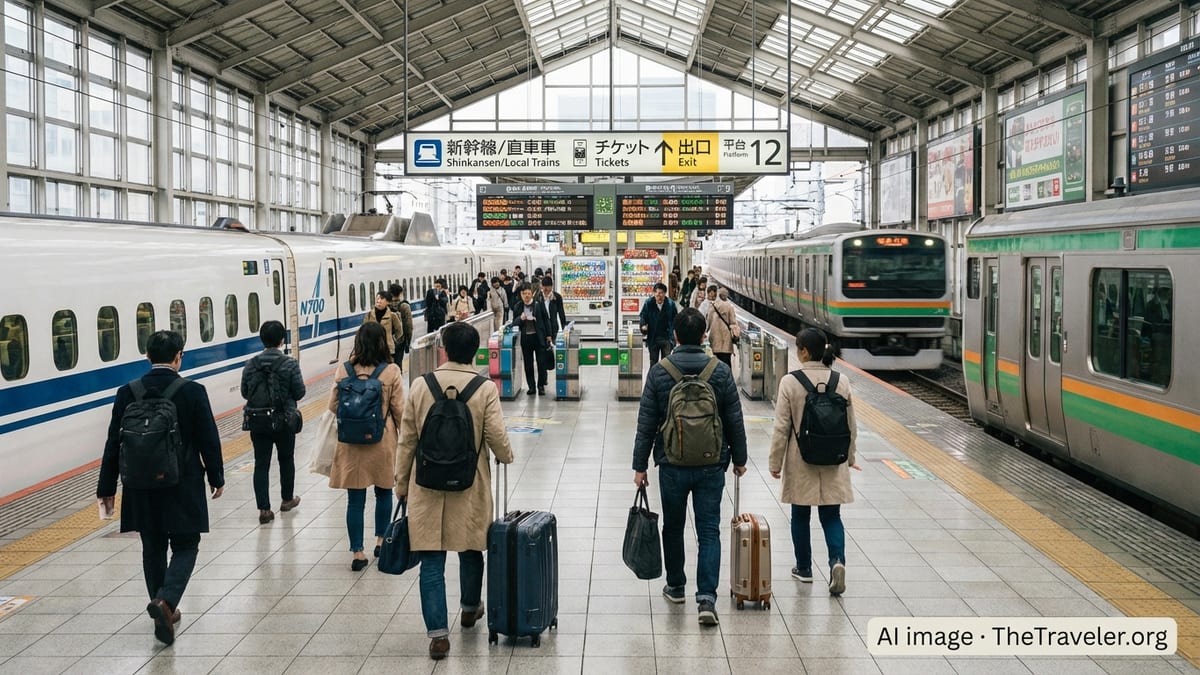
A parallel effort is under way in Nagoya’s transport mapping. Updated combined subway and city-bus route diagrams now show rail lines, trunk bus routes and the dedicated Me~guru sightseeing loop on a single graphic. The latest English-language route map released by the municipal transport bureau links each subway line color to its primary destinations while adding icons for intercity rail connections and airport access.
Digital tools are reinforcing this visual language. A recently introduced “bus route map” function within the city’s online journey planner allows users to select any bus stop and see all city bus routes displayed on a basemap. Public information indicates that the feature is designed to help residents and visitors understand point-to-point connectivity beyond the subway, which often dominates conventional tourist diagrams.
Stored-value IC cards such as Manaca and TOICA, widely usable across subway, city buses, private rail lines and the Me~guru sightseeing bus, are highlighted on these transport maps. Explanatory panels illustrate transfer points between card-compatible services and note where day passes offer unlimited rides, encouraging visitors to think in terms of areas and corridors rather than isolated attractions.
Conference organizers and event guides are also circulating their own annotated subway schematics, particularly around venues such as Chukyo University and planned arenas. These diagrams, while simplified, are feeding back into how travelers conceptualize Nagoya’s layout, reinforcing the idea of concentric movement around Nagoya Station, Sakae and Kanayama.
Me~guru Sightseeing Loop Anchors Visitor Orientation
At the center of Nagoya’s tourism mapping sits the Me~guru sightseeing route bus, a city-operated loop that links many of the main visitor attractions. Official brochures and timetables for the 2025 to 2026 service plan combine a detailed line map with a schematic diagram, showing clearly how the loop connects Nagoya Station to Nagoya Castle, Tokugawaen Garden, major museums and the central skyline around the TV Tower.
Newer map editions increasingly treat the Me~guru route as an overlay on the broader city map, helping visitors read it both as a point-to-point service and as a tool for basic orientation. Stops are labeled not only with attraction names but also with district identifiers, giving travelers an intuitive sense of which neighborhoods they are traversing.
Printed and digital information highlights how the Me~guru integrates with other services. Manaca-compatible ticketing and dedicated day passes are underlined in route materials, and some guides note that the pass can unlock discounts at attractions along the line on the day of use. That combination of cartography and pricing information positions the Me~guru as both a map in motion and a cost-management strategy for sightseeing.
Independent travel media have adopted the loop as a backbone for their own Nagoya maps, often plotting suggested walking detours from each stop. This layering means that for many visitors, the city’s geography is first learned through the shape of the Me~guru route, then filled in street by street as they explore on foot.
Digital Navigation and AI Concierge Experiments
The city’s cartographic update is not confined to paper. Nagoya is using its “NAGOYA CITY LAB” demonstration program to test AI-based tourism concierge systems that sit on top of geospatial data. A trial in the historic Endoji and Nagono areas, for example, uses an AI-enabled video dialogue system to recommend nearby attractions in multiple languages, effectively generating real-time, map-based guidance tailored to the user’s location and interests.
Separately, city transport planners are encouraging use of online journey planners that integrate the new bus route mapping functions with live timetable data. This approach aims to solve a recurring issue identified by visitors, who report that generic mapping apps can struggle with local bus networks or imperfectly translated stop names.
These efforts are unfolding alongside a wave of privately produced digital maps from travel platforms and guide publishers. Recent interactive maps portray Nagoya’s attractions clustered around a central axis from Nagoya Station to Sakae, with extensions to Ghibli Park via suburban rail, and to coastal recreation areas along the port. The consistency between official and third-party mapping is gradually standardizing how the city’s core zones are depicted online.
By overlaying these tools with conventional print guides, the city is moving toward a hybrid navigation ecosystem in which tourists can switch fluidly between a smartphone screen, station wall map and pocket brochure without having to relearn the geography each time.
Preparing the City Map for Aichi–Nagoya 2026
The pace of mapping updates is closely tied to Aichi–Nagoya 2026, when the region is scheduled to host the Asian Games and Asian Para Games. Publicly available planning documents highlight the need for clear wayfinding to venues spread across Aichi Prefecture and within Nagoya itself, including the port area, new arenas and upgraded stadiums.
City promotion materials released in 2026 show stylized maps that extend beyond the urban core to include suburban sports facilities, tidal flats recognized for conservation, and transport corridors leading to and from the airport. These visuals suggest that Nagoya’s official map narrative is widening from an inner-city focus to a metropolitan perspective that can accommodate large-scale visitor flows.
Organizers are expected to rely heavily on updated transport diagrams that highlight key transfer nodes, shuttle lines and spectator routes. Early promotional graphics already echo this approach, with icons indicating competition clusters and fan zones superimposed on simplified city and regional outlines.
Together, these developments signal that Nagoya’s city map is becoming a strategic tool in its international positioning. As new brochures, transport diagrams and digital overlays roll out in the lead-up to 2026, visitors are likely to encounter a city that feels more legible at a glance, whether they arrive for a major sporting event or a quieter, off-peak stay.