
More news on this day
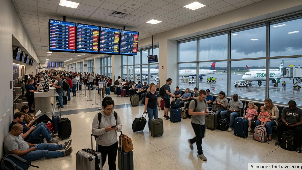
Power outages triggered by severe storms are disrupting operations at several major U.S. airports, and forecasts indicate more weather-related delays and cancellations are likely through Thursday.
Get the latest news straight to your inbox!
Storm systems bring flooding rain and high winds to key hubs
Storm systems sweeping across the Midwest and Northeast are producing heavy rain, damaging winds and localized flooding, creating difficult conditions for airport operations from Chicago to the Great Lakes and interior Northeast. Forecast discussions point to repeated rounds of thunderstorms, with strong upper-level winds helping to drive fast-moving squall lines across multiple states.
In the Chicago area, recent coverage notes torrential rainfall, flood alerts and a ground delay program at O’Hare International Airport, with the Federal Aviation Administration citing low ceilings, thunderstorms and reduced arrival rates. Publicly available information describes widespread rainfall totals of one to three inches around the metro area, on top of saturated ground from previous storms, a combination that can slow ramp operations and increase taxi times.
Farther east, broadcast forecasts for upstate New York and northern New England highlight the risk of thunderstorms with wind gusts approaching 60 miles per hour. Those conditions are strong enough to down tree limbs and power lines, raising the prospect of scattered outages near regional airports and along key approach corridors. Advisories for the Finger Lakes and Vermont–New York border region emphasize that winds may remain elevated even outside thunderstorms, prolonging operational impacts into Thursday.
Across the Southeast and Gulf Coast, moisture tied to the remnants of Tropical Storm Arthur and a separate disturbance over the Gulf of Mexico is feeding another corridor of heavy rain. Outlets tracking the storm environment indicate that parts of the Deep South could see several inches of rain through late week, prompting flood watches and a heightened risk of lightning, both of which can slow turn times and lead to ground stops at busy hubs.
Power outages compound airport disruption
While thunderstorms routinely cause delays, the current pattern is notable for its potential to trigger localized power outages around airports and surrounding communities. Utility monitoring and regional weather briefings for the Great Lakes and Northeast reference wind advisories with gusts capable of knocking out power in pockets, even if the overall event is not categorized as widespread or catastrophic.
Recent examples underscore how vulnerable airport operations can be when the grid falters. In March, passenger accounts from Denver International Airport described a sudden loss of electricity that temporarily darkened concourses and slowed security, forcing crews to rely on backup systems until full power was restored. Earlier this month in Pittsburgh, travelers reported a separate outage that affected lighting and some terminal services during a strong storm.
Although major U.S. airports are generally equipped with generators and redundancy for critical functions such as runway lighting, communications and essential security, those backups do not always cover every part of a terminal complex. Baggage systems, concessions, some jet bridges and noncritical lighting can all be affected when a storm interrupts commercial power, adding another layer of difficulty on top of weather-driven air traffic delays.
When outages coincide with lightning or high winds, ramp personnel may be pulled back from the aircraft for safety while terminal systems reboot, extending turn times. In that environment, even a brief interruption can create a backlog of aircraft waiting for gates or tugs, particularly at hub airports already operating near capacity.
More delays and cancellations expected on Thursday
Forecasts for Thursday point to continued disruption potential, with multiple regions facing a renewed round of storms and the lingering risk of additional power issues. In the Midwest, meteorologists tracking the same system that affected Chicago indicate that showers and thunderstorms may redevelop along a trailing front, keeping ceilings low and visibility variable at times.
Across the interior Northeast, a strong low-pressure system and associated jet stream energy are expected to cross the eastern Great Lakes, maintaining wind advisories into Thursday morning. Surface gusts in the 40 to 50 mile per hour range are possible in some corridor locations, conditions that can trigger crosswind concerns for certain runway configurations and add turbulence on approach and departure.
In the Southeast, outlooks for Georgia and Alabama highlight a window Thursday afternoon and evening when storms tied to tropical moisture could intensify, with a focus on heavy rain and gusty winds rather than widespread tornado activity. Public forecasts for the Atlanta metro area mention the potential for one to three inches of rain and wind gusts of 40 to 50 miles per hour, a combination that has historically led to arrival spacing restrictions and occasional ground stops at Hartsfield–Jackson Atlanta International Airport.
Taken together, these patterns suggest that passengers traveling through major hubs from Chicago and Detroit to Atlanta, New York state and northern New England may encounter continued schedule disruptions, especially during the evening peaks when convective activity typically maximizes.
Impact on passengers and airline operations
The operational ripple effects of storm-driven outages and delays are already visible in passenger accounts and airline network data. Travelers in recent days have shared reports of multi-hour waits at hub airports, missed connections and overnight rebookings as ground delay programs and weather diversions compress available capacity. In some cases, flights that departed hours late still landed too late for onward connections, forcing passengers to seek hotels or alternate itineraries.
Airlines manage severe-weather disruptions through a combination of schedule reductions, dynamic re-routing and use of spare aircraft and crews where possible. However, power interruptions at or near airports can complicate those efforts by disrupting crew scheduling systems, gate-management tools and automated baggage handling. Carriers may respond by trimming schedules further, preemptively canceling select flights to reduce the risk of large numbers of passengers being stranded on aircraft or in terminals.
From an infrastructure standpoint, the current events highlight ongoing debates over grid resiliency at major transportation nodes. Industry analyses have noted that while primary runway and air-traffic systems are typically well protected, noncritical areas of the airport campus and surrounding neighborhoods may lack the same level of investment, creating vulnerabilities when back-to-back storm systems hit within days.
As Thursday’s storm threat continues, publicly available information from utilities and regional planners suggests that priority restoration efforts will focus on critical facilities, including airports, hospitals and emergency services. Even so, scattered outages near feeder lines, substations and nearby neighborhoods can still affect traveler access to airports, ride-share availability and the broader transportation network that supports air travel.
What travelers can expect in the next 24 hours
With more storms and possible power interruptions expected through Thursday night, passengers passing through affected regions are likely to see longer-than-usual lines at check-in and security, full flights and evolving departure times. Dynamic messaging from airlines and airports indicates that same-day schedules may continue to shift as convective cells develop, weaken and redevelop along the main storm corridors.
Weather briefings for airline operations centers emphasize the importance of keeping aircraft and crews positioned ahead of the most intense storms, while also avoiding extended tarmac delays. That balance can lead to instances where flights are held at origin to avoid gridlock at a hub already under ground delay procedures, a situation that may not be immediately obvious to passengers watching clear skies from their departure gate.
Travelers connecting through multiple storm-affected regions may face the greatest uncertainty, as an initial delay can quickly cascade into missed connections later in the day. Given the potential for renewed thunderstorms and gusty winds across the Midwest, Southeast and Northeast, airlines are expected to lean on flexible rebooking options and encourage customers to monitor their flight status frequently.
For now, the combination of active storm tracks, saturated ground and pockets of grid vulnerability suggests that the pattern of delays, cancellations and intermittent power issues at and around airports is likely to persist at least into late Thursday, keeping pressure on airline operations and passenger itineraries alike.