


More news on this day
Early winter travelers in North America are facing sharply different challenges this week, as thin natural snow cover limits early-season options around Banff National Park while U.S. forecasters issue multiple warnings and advisories for a strong Pacific storm sequence expected to bring heavy rain, mountain snow and hazardous coastal conditions to California in the second half of November 2026.
Get the latest news straight to your inbox!
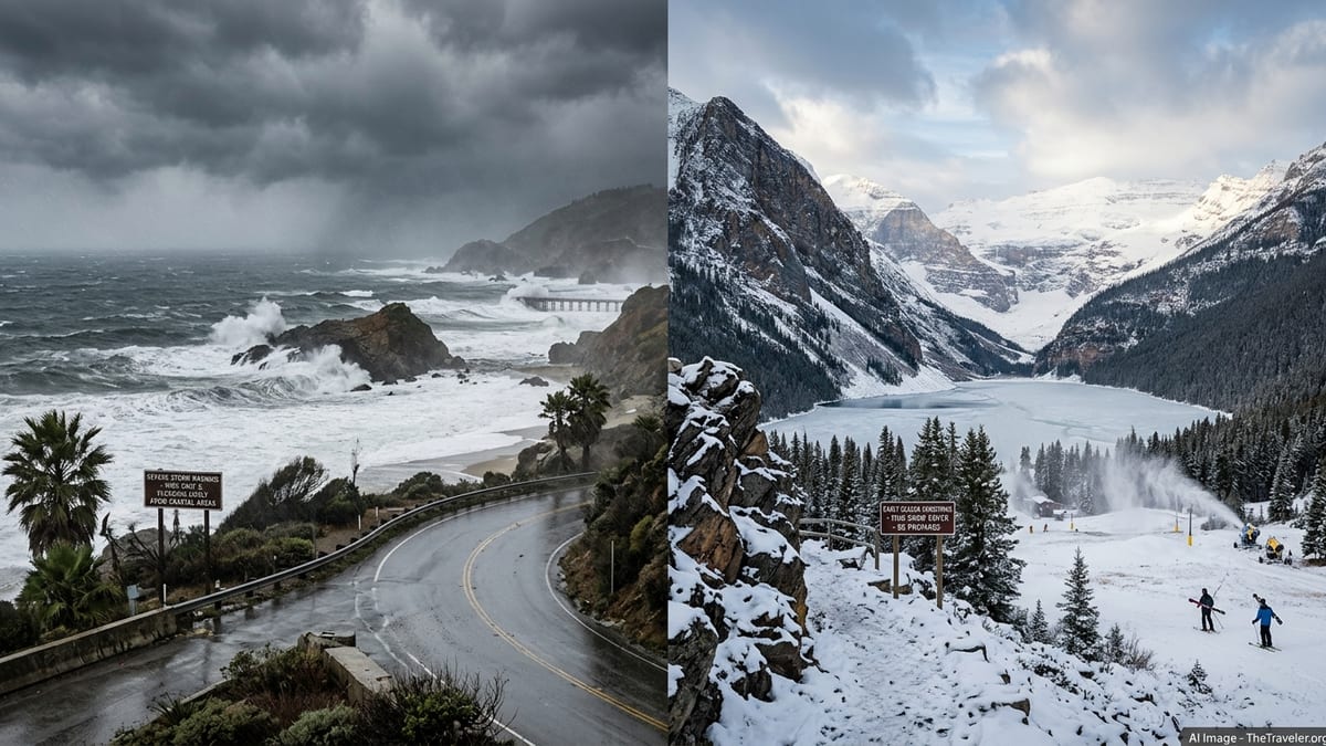
The key development: California storm warnings ahead of holiday travel
The most consequential development for travelers is a series of strong Pacific storm systems that U.S. forecasters say could impact California between roughly November 20 and November 27, 2026, coinciding with the busy U.S. Thanksgiving travel period. A medium-range hazards outlook from the National Weather Service highlights the potential for renewed atmospheric river activity affecting California, with heavy rain and mountain snow that could disrupt road and air travel if the strongest scenarios materialize.
California authorities have been preparing for an unsettled 2026 to 2027 wet season. In late September 2026, the governor’s office declared a statewide emergency related to a strengthening El Niño, citing National Weather Service assessments that there is a greater than 90 percent chance of a very strong El Niño event during the coming winter and noting that recent atmospheric river storms have already caused widespread flooding, landslides, infrastructure damage and transport disruption in previous years. That statewide order does not in itself close roads or attractions, but it frames current storm warnings within a broader season of elevated weather risk.
More immediately, coastal and marine alerts have been posted along parts of the California shoreline as large swell from the Pacific has brought dangerous surf. Over the weekend of November 14 to 15, 2026, the National Weather Service office serving the San Francisco Bay Area warned of breakers potentially reaching 35 feet, and local authorities in Santa Cruz County ordered closures and issued evacuation warnings in low-lying coastal areas as high waves damaged piers and battered beaches. These confirmed impacts show how quickly conditions can deteriorate when the current storm pattern intensifies.
What the storms could mean for California-bound travelers
For travelers heading to or through California in the second half of November, the practical risk is less about a single named event and more about a period of unstable weather that may produce multiple rounds of heavy rain, strong winds, high surf and Sierra Nevada snowfall. Forecasters stress that specific storm tracks and intensities several days out are still uncertain, but their guidance consistently highlights the week around U.S. Thanksgiving as a time when impactful weather is more likely than usual, particularly along the coast and in higher terrain.
In past atmospheric river episodes, the main travel headaches have included temporary closures of key highways due to flooding, mud and debris flows or downed trees, delays and cancellations at major airports when wind and low visibility reduce capacity, and localized evacuations in flood prone communities. The governor’s emergency order points to this pattern, citing repeated road closures and disruption of essential services caused by recent strong storms. While this does not guarantee that the same level of disruption will occur this November, it underlines why transport agencies and emergency managers are treating the current outlook seriously.
Travelers planning to drive across the Sierra Nevada toward Lake Tahoe, Yosemite or other mountain destinations around late November should be prepared for rapidly changing road conditions. Chains or winter-rated tires are often required when heavy snow coincides with holiday traffic, and parts of Interstate 80 or U.S. 50 have in the past experienced long delays when plows and crews work to keep passes open. Those flying into California around the peak Thanksgiving period may want to allow extra time for connections or consider earlier or later travel dates if their plans are flexible, since even moderate delays can cascade at already busy hubs.
Banff and Lake Louise: open lifts but thin early-season snow
While California deals with too much water in places, early-winter visitors to Banff National Park are encountering the opposite problem in some areas: limited natural snow away from the highest elevations. Parks Canada trail condition reports for late October 2026 describe several popular walking routes near Lake Louise as having “thin snow cover,” and local condition summaries checked on November 16 report that most cross-country ski tracks around Banff town still lack sufficient depth for machine-set tracks, with only a few routes near Lake Louise groomed on a thin base.
Despite the modest natural snowpack at lower elevations, the main downhill ski season in the Banff and Lake Louise area has already begun. Lake Louise Ski Resort opened its 2026 to 2027 season on November 6, with Sunshine Village and Mt. Norquay also spinning lifts on limited terrain using a combination of early storms and aggressive snowmaking. Independent snow report aggregators on November 16 show only a small percentage of runs open at each resort, reflecting the fact that many off-piste and lower-mountain areas still lack coverage even as groomed front-side runs operate on man-made or machine-groomed snow.
Forecasts compiled from Environment and Climate Change Canada data and specialist mountain weather services suggest that colder air and additional light to moderate snow are possible around Banff and Lake Louise through the coming week. One Canadian Rockies snow forecast issued on November 15 notes that an approaching cold front should improve snowmaking conditions in the Banff and Lake Louise corridor. However, long-range seasonal guidance for the 2026 to 2027 winter, influenced by the strong El Niño, leans toward temperatures that may be warmer than average for parts of western Canada. That is a probabilistic outlook rather than a guarantee, and conditions in the Rockies can still swing abruptly from dry to stormy.
How the split pattern affects winter trip planning
The combination of thin early-season snow in parts of the Canadian Rockies and an active storm track into California is not unusual on its own, but the specific timing around late November 2026 has direct planning implications. For travelers eyeing Banff and Lake Louise for early downhill skiing, the confirmed situation as of mid November is that resorts are open with limited terrain and many natural-snow activities such as lower-elevation cross-country skiing and snowshoeing remain constrained by shallow coverage. Visitors focused on scenery, short walks and hot springs will still find Banff accessible, but those expecting mid-winter snow depth on hiking trails or lake surfaces may need to adjust expectations or push travel later into December or January.
By contrast, travelers bound for California’s cities and national parks face a different sort of uncertainty tied to heavy rain and storm hazards rather than lack of snow. The National Weather Service has not yet issued detailed day-by-day warnings for the Thanksgiving week systems, but its broader hazards outlook, combined with the governor’s emergency framing of the 2026 to 2027 storm season, signals a meaningful chance that some roads, coastal access points or even low-lying campground areas could be temporarily closed or restricted if flooding or debris flows develop. Coastal visitors in particular should be aware that high surf advisories and beach or pier closures can be imposed at short notice, as seen with recent wave damage to piers along the central coast.
For a traveler comparing the two regions for a late November escape, this means that Banff currently offers more predictable, if somewhat limited, alpine operations on machine-supported snow, while California offers more variability: potentially dramatic storm watching opportunities on the coast or deep snow in the Sierra, but also a higher risk of short-notice disruptions. Neither pattern is inherently better for every traveler, but each calls for a distinct approach to flexibility, insurance and on-the-ground decision making.
Practical steps travelers should take now
Given the confirmed forecasts and observed conditions, the most useful step for California-bound travelers is to build flexibility into late November itineraries. When possible, that could mean arriving a day earlier than strictly necessary for important family gatherings, opting for midday flights that preserve options if morning departures are delayed, or choosing refundable bookings along routes that are historically vulnerable to flooding or landslides. Drivers planning Sierra crossings should monitor highway advisories in the days leading up to departure and be prepared for chain controls, temporary closures or calls to delay nonessential trips if storm warnings escalate.
For those heading to Banff and Lake Louise, the key is to match activities with the current snow reality. Travelers intent on alpine skiing can already book lift tickets and lodging around the existing limited operations, but should confirm how many runs and which lifts are scheduled to be open for their dates, as some terrain expansions depend on additional snowfall and sustained cold for snowmaking. Visitors more interested in winter walking or cross-country skiing may wish to wait for stronger evidence of a deeper natural snowpack or remain open to shifting toward other activities, such as sightseeing drives on clear days, gondola rides or spa visits, if trail surfaces remain icy or thin.
Across both destinations, the recurring message from official agencies and long-range forecasters is that the early 2026 to 2027 winter is shaping up to be highly variable, influenced by a very strong El Niño event that can tilt the odds toward heavy Pacific storms for California and mixed signals for interior mountain snow. Forecasts at this range carry uncertainty, and actual outcomes could still deviate significantly, but travelers who track updates from national meteorological services, local parks and transport authorities in the days before departure will be better positioned to adjust plans as real-world conditions rather than seasonal expectations dictate.