
More news on this day
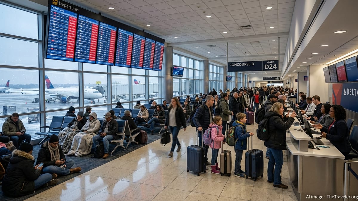
A fast-developing line of severe thunderstorms over Maryland prompted a ground stop at Baltimore/Washington International Thurgood Marshall Airport, triggering at least 189 flight delays and 26 cancellations and disrupting itineraries across the United States, Canada, Mexico, Jamaica, Iceland and the wider Caribbean region.
Get the latest news straight to your inbox!
Thunderstorm Cell Forces Halt to Departures and Arrivals
Publicly available aviation advisories and weather alerts show that convective storms built rapidly over central Maryland, creating hazardous conditions in the airspace around Baltimore/Washington International Thurgood Marshall Airport. The combination of low visibility, intense rainfall, and frequent cloud-to-ground lightning led air traffic managers to institute a temporary ground stop, restricting both arrivals and departures.
Operational summaries for the day indicate that the most significant disruption window coincided with the peak of the storm activity, when controllers limited the rate of arrivals into the already constrained Mid-Atlantic corridor. With BWI operating at reduced capacity, inbound flights were held at origin airports or rerouted, while outbound services were held at gates or on taxiways until the worst of the weather cleared.
The decision to ground traffic at BWI quickly cascaded into schedule changes systemwide. Airlines adjusted flight plans to avoid cells moving through the Baltimore and Washington region, while crews and aircraft were repositioned to protect later bank departures from hubs in the Midwest and along the East Coast.
Even after the heaviest storms passed, the airport faced a backlog of departures waiting for takeoff clearance and arrivals circling or diverted to alternates. Recovery operations extended into the evening as airlines attempted to re-synchronize aircraft and crew rotations.
Wide Airline and Route Impact Across the Americas
According to flight tracking data and carrier status boards surveyed after the event, at least 189 flights connected to BWI experienced departure or arrival delays, with a minimum of 26 services cancelled outright. The disruption touched a wide array of domestic and international routes, affecting travel throughout North America and key leisure markets.
Southwest Airlines, which maintains one of its larger East Coast operations at BWI, absorbed a substantial share of the schedule irregularities, with delays rippling across its point-to-point network. Delta Air Lines and United Airlines also reported affected services, particularly those linking Baltimore to their primary hubs, where missed connections compounded the impact on onward itineraries.
International carriers were not spared. Publicly available schedules show that Icelandair’s transatlantic services, which rely on precise timing for connections in Keflavik, faced knock-on delays tied to BWI’s reduced operating rate. Flights between Baltimore and Canada, Mexico, Jamaica and multiple Caribbean islands also recorded extended ground times, diversions or cancellations, temporarily cutting links for both leisure travelers and those returning home.
The mix of affected routes underscores BWI’s role as a hybrid airport serving both domestic business corridors and high-demand vacation destinations. When thunderstorms shut down local airspace, the resulting disruption extends far beyond the Mid-Atlantic, touching short-haul shuttles, international long-haul services and intra-Caribbean connections alike.
Passengers Confront Long Waits, Missed Connections and Diversions
Reports from flight-status boards and traveler accounts point to a familiar pattern for passengers caught up in the BWI ground stop. Many travelers experienced rolling departure estimates as airlines waited for updated air traffic flow restrictions, with some flights ultimately cancelled after crew duty limits were reached.
Connections were particularly vulnerable. With tight transfer windows through hubs already under weather strain, delayed arrivals from BWI left passengers stranded overnight in cities across the United States and Canada. Some travelers arriving from Mexico, Jamaica and other Caribbean destinations were rebooked onto next-day flights, while others were rerouted through alternate airports in an effort to preserve onward connections.
In several cases, aircraft destined for BWI diverted to other East Coast airports when holding patterns became unsustainable. Flight-tracking data and publicly visible airline updates show diversions into cities such as New York, Boston, and Washington-area alternates, where passengers were re-accommodated or bussed onward once conditions improved in Baltimore.
Inside terminal buildings, high passenger volumes and constrained seating translated into crowded concourses as travelers monitored airline mobile apps and overhead displays for revised departure times. Some carriers issued travel waivers for the Mid-Atlantic and Northeast regions, allowing customers to adjust itineraries without change fees if they preferred to avoid same-day travel amid the instability.
Weather Vulnerability and Structural Constraints at BWI
Recent planning and performance documents highlight that BWI has been operating through a period of construction and capacity constraints, factors that can make the airport more sensitive to sudden weather disruptions. When runways or taxiways are temporarily restricted for works, the margin for handling surges in arrivals and departures shrinks, especially during peak travel days.
The Mid-Atlantic region’s convective weather pattern adds another layer of complexity. Thunderstorms that develop rapidly in warm, humid air masses are notoriously challenging for both meteorologists and traffic managers, since even small shifts in storm track can alter which arrival and departure corridors remain usable. When a line of thunderstorms settles over key approach paths, the only safe option is to slow or halt traffic until cells move away.
Publicly available performance analyses for early 2026 already point to elevated delay risk at BWI during periods of active construction and strong storm potential. The latest ground stop event fits that pattern, demonstrating how a single afternoon of severe weather can translate into widespread disruption, even when airport and air traffic control teams move quickly to adapt.
The complexity of managing this risk is heightened by BWI’s role in connecting low-cost domestic operations with a growing portfolio of international routes. Airlines aiming to maximize aircraft utilization have limited slack in their schedules, which means that when a ground stop hits during a peak bank of departures, recovery can stretch well into the following day.
What Travelers Can Expect in the Coming Days
Although aircraft movements typically resume soon after a ground stop is lifted, residual effects can linger for several cycles. Flight data from previous severe weather events in the region show that misaligned aircraft and crews can lead to sporadic cancellations and longer-than-normal delays into the next morning, especially on the first and last flights of the day.
Industry guidance and historical statistics suggest that passengers flying through BWI and other Mid-Atlantic airports in the days following a major thunderstorm episode should budget extra time for potential disruptions. Early morning departures often offer the best chance of an on-time start, while late evening departures may be more exposed if delays accumulate over the course of the day.
Travelers are encouraged, based on widely shared consumer advice, to monitor their airline’s mobile applications and sign up for text or email alerts, which typically reflect schedule changes more quickly than gate displays. Checking the federal aviation status tools before leaving for the airport can also provide a snapshot of developing issues, including new ground delay programs or traffic management initiatives related to weather.
Looking ahead through the peak summer period, operational forecasts suggest that BWI and other major East Coast airports will continue to face intermittent disruption from convective storms. The latest ground stop tied to thunderstorms over Baltimore illustrates how quickly localized weather can scale into a multi-country travel event, affecting flights from U.S. business hubs to Caribbean resorts and transatlantic gateways in a matter of hours.