


I landed in San Juan expecting Utuado to be a single valley town with a few easy day trips around it. Instead, my four days based in the central mountains turned into a crash course in just how spread out, steep and wildly beautiful this municipality really is. I drove a compact rental car from the capital into the Cordillera Central, slept in two different countryside guesthouses, booked river and canyon tours, and threaded my way between Caguana’s Taíno ball courts, coffee fincas, and the Tanamá and Caonillas river systems. What looked like one pin on the map turned out to be roughly 115 square miles of folded mountains, narrow roads and deep river canyons, where a “quick hop” between sights often meant 40 minutes of hairpin curves.
Get the latest updates straight to your inbox!
Getting to Utuado and First Impressions of the Mountains
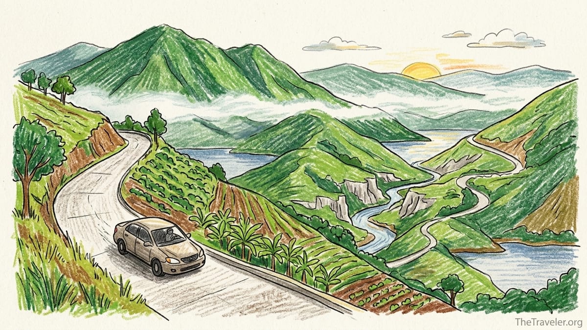
I started in San Juan, picking up a small front wheel drive rental sedan at Luis Muñoz Marín International Airport and heading toward Utuado via PR 22 and PR 10. With light traffic, it took a little under two hours to cover the roughly 70 miles into the central mountains. The highways out of the metro area are wide and fast, but as soon as PR 10 begins to climb inland the landscape shifts to tall green ridges, mist in the folds of the hills and deep cuts where the Río Grande de Arecibo and tributaries have carved the karst.
My first base was a rural guesthouse outside Utuado pueblo, reached by leaving PR 10 and climbing a single lane concrete road that felt more like a very long driveway than a public street. It took about 15 minutes from town, but the grade was steep enough that I kept the car in low gear and crawled along at 15 to 20 miles per hour. The payoff was a ridge top view over coffee fields and plantain groves, with morning clouds sinking into the valleys and roosters starting up well before dawn.
That first evening set the pattern for the trip. Daytime in Utuado felt busy with trucks, school buses and farmers’ pickups on the roads. By 8:30 or 9 p.m., especially away from the town center, the countryside grew quiet. Small comedores and panaderías outside the pueblo tended to close by early evening, and it was clear that this was not a place for late night strolling between bars or restaurants. The soundtrack at night was tree frogs, distant dogs and the rush of unseen rivers in the darkness below.
Before arriving, I expected to dip into Utuado for a day of river tubing and a quick visit to the Taíno ceremonial center, then maybe continue on to the west coast. Instead, I discovered that Utuado is a destination that makes you earn each experience through slow travel on twisting roads and longer stays in specific corners of the municipality.
How Big and Dispersed Utuado Really Is
Looking at a map, it is easy to assume that Utuado’s highlights sit practically on top of one another. In reality, the municipality covers roughly 115 square miles of rugged terrain, and the key places visitors care about are tucked into different valleys and plateaus. The Caguana Indigenous Ceremonial Center lies in the Caguana barrio west of town. The Tanamá River adventures tend to cluster toward the north and northwest, closer to the border with Arecibo. Cañón Blanco is tied to the Caonillas River system in another direction, while coffee farms and lakes like Caonillas and Dos Bocas are scattered again.
From my guesthouse east of town, it took about 25 minutes to drive into Utuado pueblo on PR 123, and that was just the first leg of most outings. From the town plaza to Caguana, the drive along PR 111 and PR 131 took roughly 25 to 30 minutes one way, with narrow, two lane roads that sometimes pinched effectively to a single lane where concrete bridges and blind curves forced everyone to slow down. The drive north toward Tanamá River access points required around 35 to 45 minutes each way, largely on PR 10 and then smaller roads that dropped sharply toward the water.
Distances that looked like 8 or 10 miles on a map were rarely less than 25 minutes on the ground. Cañón Blanco, reached on a guided tour along the Caonillas River, involved about 40 minutes of driving from the pueblo toward the Caonillas valley and then some careful navigation down to the put in point. Even coffee fincas within the same municipality might sit 45 minutes apart because there is simply no quick way to cut across the grain of the mountains. Utuado is less a single destination and more an entire highland district where each valley demands its own half day.
This dispersion also affects services. Mobile data was adequate near town and along PR 10, but it faded to weak or nonexistent in pockets along side roads near the Tanamá and Caonillas rivers. That meant I could not count on last minute re-routing with maps and had to download offline directions or ask hosts and guides to describe landmarks. Gas stations, too, cluster in and near the pueblo. Once in the smaller barrios, there were long stretches with only houses, small colmados and the occasional roadside barbecue stand.
Driving, Road Conditions and Why Night Travel Is Not Fun
Utuado driving ranges from comfortable four lane highway to steep, single lane concrete ribbons that cling to hillsides. Major routes like PR 10 and PR 123 are paved and reasonably wide, with posted speeds up to around 45 or 55 miles per hour in open stretches. Once you turn toward specific attractions, though, expect speeds to drop dramatically. The concrete access road to my first lodging narrowed to one lane without guardrails in some sections, and meeting an oncoming pickup required one of us to back up to a wider spot.
I initially underestimated how tiring this style of driving would be, especially when combining multiple activities in one day. On my second full day, I booked a morning Tanamá River tour and an afternoon coffee farm visit. The plan looked fine on paper. In practice, the morning involved a 40 minute pre dawn drive on dark, wet roads to reach the river meeting point, several hours of hiking and tubing, then another 40 minutes back out to the main road. My hands were already tense from gripping the wheel through constant hairpins when I turned south toward the coffee finca. By the time I finished another hour of mountain roads and the farm tour itself, I was thoroughly drained.
The worst decision of the trip was underestimating the challenge of driving after dark. One evening I lingered over dinner near the pueblo and only left around 8:15 p.m. It had rained lightly, and mist hovered in the cuts between hills. The combination of wet pavement, no street lighting, poorly marked curves and occasional dogs in the roadway turned a familiar 20 minute daytime drive into a nerve wracking 35 minutes. Locals in pickups seemed comfortable and moved quickly, but as a visitor it felt far too easy to misjudge a blind bend or miss a narrow bridge. After that night I set a firm rule for myself: be off the smallest rural roads by dusk.
Parking varied from straightforward to very tight. Around main attractions such as Caguana and in the center of Utuado there were small formal lots or obvious on street parking. For river and canyon access, parking usually meant pulling into a small gravel area or grassy shoulder near the tour operator’s outpost or designated meeting point. In the rainy season these surfaces could be muddy, so I was glad for closed toed shoes and kept a towel in the car to wipe mud before driving. Turning around on dead end backroads sometimes involved multi point maneuvers on narrow concrete, with steep drops just beyond the edge.
Caguana and the Taíno Heartland
Of all the places in Utuado, the Caguana Indigenous Ceremonial Center felt the most quietly powerful. The drive from Utuado pueblo out along PR 111 and up into the Caguana barrio took about half an hour each way. As the road climbed, the soundscape shifted from traffic to roosters, wind in banana leaves and intermittent birdcalls. When I arrived mid morning, a light mountain haze hung over the surrounding hills, and the temperature felt several degrees cooler than on the coast, especially in the shade of mature trees around the site.
Inside the park, the grassy plazas and stone outlined ball courts unfold under low mountains that seem to hold the space in a natural amphitheater. The stones carved with petroglyphs sit right on the edges of the bateyes, worn but still sharp enough that figures of faces and spirals emerge clearly when you stand close. It is easy to see why archaeologists and cultural historians regard Caguana as one of the most important Taíno ceremonial landscapes in the Caribbean, with use dating back many centuries before European contact.
The contrast with the adventure tourism scenes elsewhere in Utuado is striking. At Caguana the sounds are quiet footsteps on grass, the hum of insects and distant cowbells, in place of shouts from cliff jumpers or the scrape of helmets against cave roofs. There is a small interpretation center that explains the history of the Taíno presence here, and it anchors the rest of the day in a sense of place that goes beyond scenery. Walking back to the car, with a breeze rustling the leaves and afternoon thunder building far upriver, I felt how much of Utuado is layered on top of deep Indigenous histories.
Practically, visiting Caguana is relatively easy compared with river basins. The access road is paved, and there is a basic parking area near the entrance. I noticed mobile signal drop to weak in patches just before the site, but I still had enough coverage to pull up a translation app when reading some Spanish only panels. The main challenge is fitting Caguana into an itinerary that also includes physically demanding activities, because it sits off in its own valley. I was glad I dedicated a half day around the site instead of trying to squeeze it between other long drives and tours.
Rivers, Caves and Learning to Respect the Tanamá and Caonillas
The Tanamá River is what draws many adventurous travelers to Utuado, and I booked a guided river and cave tour with a local operator who bases their excursions along the Utuado stretch of the river. Their website described hikes, cave tubing, rappelling and cliff jumping, with outings typically lasting several hours and including helmets, life vests and guides who live in the area. The meeting point lay down a steep, narrow side road from PR 10, and I arrived just after sunrise, with fog still hanging low over the limestone ridges.
The tour started with a hike down a muddy trail toward the water, the sound of the river growing from distant murmur to a steady rushing as we descended. The Tanamá runs clear in dry weather, sliding over rounded boulders and dropping into pools that glow green in shafts of light filtering between trees. In the cave sections, cold water swirled around our legs as we walked or floated in tubes through darkness, headlamps catching stalactites and roots hanging from the roof. Bats flickered overhead. The rocks were slick, and I was grateful for the operator’s insistence on closed toed, grippy shoes after watching one guest in old sneakers nearly lose footing on a wet slab.
I made a mistake by underestimating how recent rain upstream would affect conditions. It had rained the previous afternoon, and although the guides judged the river safe and kept to known passages, the current felt faster and stronger than I expected in some narrow sections. A small side pool I might have considered swimming in on my own showed a subtle but real pull toward an underwater channel. Seeing that, and listening to the guides talk about how quickly the Tanamá can rise during heavy storms, cured me of any notion that every pretty river spot is automatically safe for unguided swimming after rain.
Cañón Blanco on the Caonillas River delivered a different but equally memorable lesson. I joined a half day outing with a local eco tour company that specializes in this white walled canyon. The approach drive wound deep into the Caonillas valley, with glimpses of terraced hillsides and the long surface of Lago Caonillas behind a dam. At the canyon itself, soft pale rock has been carved into smooth corridors and sculpted basins, some marked by petroglyphs carved by Indigenous inhabitants along the river. The sound there is both river and echo, water pounding into bowls and reflecting from walls just wide enough for two people to pass.
Physically, the Cañón Blanco route involved climbing over wet rock, wading through pools and scrabbling up short drops. I wore trail running shoes, which drained water but did not grip as well on algae covered stone as I wished. By the end of the day, my toes were bruised, and I would have preferred sturdy water shoes with tough soles and aggressive tread. Again, guides managed logistics and reading of water levels, reinforcing my sense that these rivers, while beautiful, are no place for unsupported experimentation in a land of sudden rain.
Coffee Country, Lakes and Misty Mornings
Even without a formal banner, Utuado feels like one of Puerto Rico’s coffee hearts. Hillsides fold into patchwork slopes of coffee trees under shade, interplanted with bananas, citrus and taller native trees. I visited a small coffee finca on a guided tour, which included walking between rows of coffee shrubs, seeing processing equipment and tasting beans roasted on site. Another nearby farm operated on a similar book ahead basis, with scheduled start times around mid morning and modest per person fees for the tour and tasting.
The drive to these farms again illustrated Utuado’s scale. What looked like a short hop from my lodging required 45 minutes of curving roads and slow descents into side valleys, often on pavement just wide enough for two careful vehicles to pass. Morning departures meant driving through low mist, beads of water gathering on roadside grass and the smell of wet earth drifting in through open windows. Even in late summer, air temperatures here sat comfortably in the 70s Fahrenheit during the early hours, rising into the 80s later in the day when the sun burned off clouds.
Lakes Caonillas and Dos Bocas delivered yet another face of the municipality. Where rivers felt dynamic and raw, the lakes were quiet, their surfaces broken only by small boats and fish rising. Approaching Lago Caonillas, I crossed a narrow bridge with guardrails that framed long views up reservoir arms, ringed by forested slopes. Simple roadside stalls sold snacks and drinks, and the mood shifted from adrenaline to low key countryside weekend pastime. Dos Bocas, partly shared with the neighboring municipality, offered dockside restaurants reached by small boats and a slower rhythm, though schedules and operations can vary depending on water levels and local conditions.
The sensory palette in these upland hours ran from the rich, slightly sweet smell of coffee cherries ripening on branches to the distant mechanical hum of depulping machines and the light metallic clink of drying racks being moved. Birds chattered in patches of forest, and in the background there was always some form of moving water, whether invisible streams in ravines or the spill from lake outlets. By late afternoon, clouds often built over the highest ridges, blowing cool air down into the valleys and signaling either a quick passing shower or a heavier storm if conditions aligned.
Where I Stayed, Ate and the Rhythm of Rural Evenings
Across four nights, I stayed in two different small guesthouses in the Utuado countryside, both booked through independent platforms and hosted by local families. The first sat on a ridge east of town, with a simple bedroom, private bathroom, and a shared balcony overlooking coffee trees and distant mountains. The second, closer to the Caonillas valley, occupied a small farmhouse where the hosts lived downstairs and rented two upstairs rooms. Both properties had air conditioning but relied more on cross ventilation and cool mountain air at night than constant AC use.
In both lodgings, mornings started early. Roosters and dogs kicked off before sunrise, and by 7 a.m. the hillsides around me already buzzed with farm activity and school traffic on the nearest road. Fog drifted in layers, thinning and thickening, while the smell of strong coffee brewing downstairs joined the scent of damp wood from overnight humidity. Light rain on a metal roof in the middle of the night became part of the experience rather than a nuisance.
Eating in Utuado meant planning around limited hours outside town. In the pueblo itself, I found bakeries and small restaurants open for breakfast from around 6 or 7 a.m., serving strong coffee, sandwiches and pastries. Midday comedores offered plates of rice, beans, meats and root vegetables. Dinner options existed but were largely concentrated near the center, and by 8 or 9 p.m. many rural eateries had already closed or were serving only locals finishing the day. One night I misjudged timing, returning from an afternoon drive along PR 10 only to find my preferred countryside spot shuttered. With no nearby alternatives, I drove back to town in drizzle and low visibility, another reminder to think ahead in these mountains.
Grocery stores and colmados in the pueblo helped fill gaps. I stocked up on basics like fruit, bread, cheese and eggs, which made it easier to self cater breakfast or a simple evening meal at the guesthouse. Outside of Utuado’s center, shopping options shrank to small convenience style shops with limited fresh produce. By 9 p.m. in the rural barrios, streets were mostly empty except for the occasional passing vehicle or glow from a house window. This early quiet felt peaceful, but it also underscored how much Utuado runs on an early to bed, early to rise rhythm tied more to farm work and school schedules than to tourism.
Mistakes, Dislikes and What I Would Change Next Time
Travel writing often polishes destinations into effortless narratives. My days in Utuado were anything but effortless, and some parts I would not repeat the same way. The biggest mistake was overbooking physically demanding activities on the same day in scattered corners of the municipality. The combination of a long Tanamá River tour in the morning and a separate coffee farm visit in the afternoon left me exhausted and less present for both experiences. The reality of 30 to 60 minute drives between each valley, much of it on narrow, steep roads, meant that even sitting behind the wheel required focus and drained energy.
Driving after dark was another clear regret. While technically possible, it felt unsafe to tackle unfamiliar mountain roads in rain, mist and near total darkness. Headlights from oncoming vehicles often hit my eyes directly because curves and grades made alignment unpredictable. Retroreflective paint lines were worn or absent in places, and sudden dogs or potholes emerged at the last second. In hindsight, I would plan days to finish river or canyoning tours early, enjoy an early dinner in or near the pueblo, and then return to lodging before twilight fully faded.
Footwear and clothing mistakes also shaped the trip. On my first river outing I wore quick drying shorts and an old synthetic shirt but paired them with basic running shoes, assuming they would be fine in and out of the water. They took on heavy water weight, offered poor grip on algae and stayed damp for hours afterward, leading to blisters. For Cañón Blanco I improved by wearing trail runners but still wished for dedicated water shoes with strong tread and toe protection. I also underestimated how quickly mountain rain can arrive; leaving a light rain shell in the car for a hike that looked clear at the start meant finishing cooler and wetter than necessary when a midday shower rolled in.
There were a few dislikes. Mobile coverage dead zones complicated navigation and communication with hosts. Noise from roosters and dogs could feel intense in the very early morning if you are not used to countryside soundscapes. Some road segments carried fast moving local traffic that felt intimidating on narrow stretches. Yet none of these were deal breakers. They simply reinforced that Utuado is an active rural municipality first and an adventure tourism hub second, and that visiting on its terms means accepting certain frictions.
Who Utuado Suits Best and How I Would Plan It Now
After several days of zigzagging across the municipality, I came away convinced that Utuado is not for everyone, and that is part of its appeal. It suits travelers who are comfortable driving long distances on mountain roads, who enjoy physical activity and do not mind early mornings or rural quiet at night. It works well for people who have already experienced Puerto Rico’s beaches and want a deeper look at the island’s interior, Indigenous history and coffee culture, paired with river and canyon adventures.
Families with older children or teens who like hiking, swimming and trying new experiences can thrive here, especially if they book guided tours for the Tanamá and Cañón Blanco and build in rest time around those outings. Couples seeking secluded stays in nature, with mornings on a balcony overlooking coffee fields and afternoons by rivers or lakes, will also find Utuado rewarding. Visitors who rely heavily on rideshares, expect walkable nightlife, or dislike driving in the mountains will likely be happier basing themselves in coastal towns and visiting Utuado on a guided day trip instead.
If I could redo the trip, I would make several concrete changes. First, I would stay at least three nights in one strategic area rather than switching lodgings midway, to reduce packing and unpacking and to get to know local roads better. Second, I would limit myself to one major physical activity per day, such as a Tanamá river tour, a Cañón Blanco outing or a longer coffee farm and Caguana cultural day, and accept that each deserves a half day or more. Third, I would plan grocery and meal stops earlier, treating 3 to 5 p.m. as prime time for stocking up and eating when rural businesses are open.
Finally, I would time my visit with weather patterns in mind, avoiding periods of forecast heavy rain that can swell rivers and complicate road conditions. Even with these constraints, Utuado remains one of the most memorable parts of Puerto Rico I have experienced, precisely because it demands presence, patience and respect for the land and history under your feet.
The Takeaway
Utuado is not the effortless mountain escape that guidebook maps sometimes suggest. It is a broad, folded municipality that stretches across roughly 115 square miles of central Puerto Rico, where rivers cut deep canyons, coffee fincas cling to slopes and Taíno ceremonial plazas sit in green basins framed by peaks. Getting between its highlights means slow driving on narrow roads, coping with patchy mobile coverage and adjusting to an early, rural rhythm that puts farm work and school life ahead of visitor convenience.
Yet for travelers willing to embrace those realities, Utuado offers a rare combination of adventure and depth. You can spend a morning floating through a dark river cave with bats overhead, an afternoon tracing petroglyphs at Caguana, and an evening sipping locally grown coffee while mist drifts up from the valleys below. The rushing of the Tanamá and Caonillas, the feel of wet limestone under your hands, the smell of roasted beans in the air and the quiet of mountain nights all work together to anchor the experience in memory.
What I learned most in Utuado was to slow down. To treat each valley as a separate destination instead of a quick stop, to listen to local guides who know how fast rivers can rise, and to accept that driving 10 miles may reasonably take half an hour in the mountains. Utuado rewards that slower, humbler approach with some of Puerto Rico’s richest encounters with landscape, culture and living history.
FAQ
Q1. Is Utuado a realistic day trip from San Juan, or should I stay overnight?
It is possible to visit Utuado as a long day trip from San Juan, but the two hour drive each way and slow mountain roads make at least one or two nights a better choice if you want to combine river activities, Caguana and coffee farms without rushing.
Q2. Do I need a 4x4 to drive around Utuado?
A regular rental car in good condition is usually enough for main roads and access to major attractions, but expect steep grades and narrow lanes; drive slowly, use low gear on descents and confirm access conditions with your lodging or tour operator before venturing onto smaller side roads.
Q3. How early do restaurants and shops close in the rural parts of Utuado?
In the countryside many small eateries and shops start closing by early evening, often between 6 and 8 p.m., so it is wise to plan main meals and grocery stops for the afternoon and not rely on finding food late at night outside the town center.
Q4. Is it safe to drive at night in Utuado?
While locals do drive at night, visitors often find it stressful because of sharp curves, lack of street lighting, wet pavement after rain and occasional animals on the road; finishing outings before dark and limiting night driving to better lit main routes is the more comfortable option.
Q5. Can I explore the Tanamá River or Cañón Blanco without a guide?
Some access points exist, but changing water levels, slippery rock and complex terrain mean that guided tours with local operators are strongly recommended for river caves, tubing and canyon routes, especially after recent rain.
Q6. What kind of footwear should I bring for river and canyon activities?
Closed toed shoes with strong grip that can get wet, such as sturdy water shoes or trail runners with good tread, work best; avoid basic sneakers or open sandals, which slip on algae covered rocks and offer poor toe protection.
Q7. How reliable is mobile phone coverage in Utuado?
Coverage is generally fair near Utuado town and along main highways, but it can drop to weak or nonexistent in river valleys and remote barrios, so downloading offline maps and confirming meeting points in advance is very helpful.
Q8. When is the best time of year to visit Utuado for outdoor activities?
Drier months tend to offer clearer river conditions and fewer heavy storms, while the rainier parts of the year bring lush vegetation but can cause higher, faster rivers and more slippery trails; checking local forecasts and consulting tour operators about recent rain is important whenever you go.
Q9. Is Utuado suitable for travelers who do not speak Spanish?
Basic tourism services and many guides can communicate in English, but Spanish is widely used in everyday life, so learning a few key phrases and being patient with language differences will make interactions in shops, gas stations and rural areas smoother.
Q10. Who will enjoy Utuado the most compared with coastal destinations?
Utuado is ideal for travelers who prioritize hiking, rivers, coffee farms and Indigenous history over beaches and nightlife, and for those who like quieter rural stays, early mornings and active days in the mountains rather than resort style amenities.