


Utuado sits in the mountainous heart of Puerto Rico, where weather shapes every river trip, cave tour and backroad drive. Unlike San Juan, this is not a place you time around perfect beach days. Here, upstream rainfall, slippery limestone and early sunsets in steep valleys matter more than sea temperatures. This guide compares seasons and conditions so you can decide when Utuado works best for your style of adventure, from Tanamá River tubing to Caguana archaeology, coffee farm visits and birding in Río Abajo.
Get the latest updates straight to your inbox!
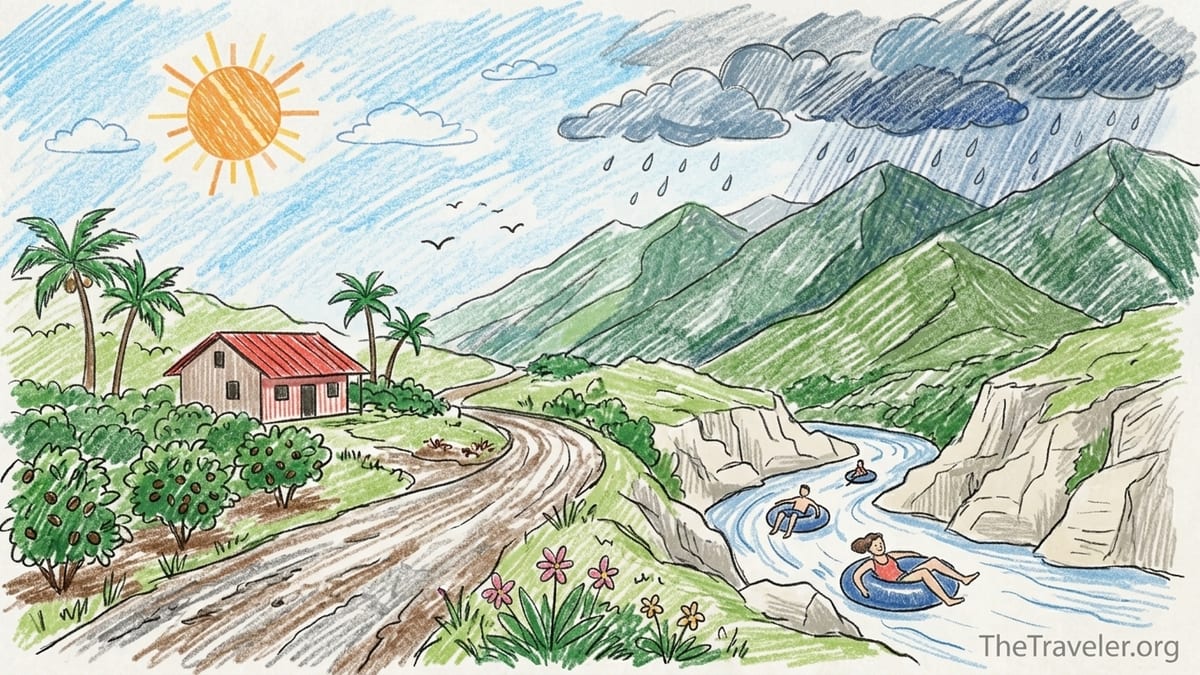
Understanding Utuado’s Mountain Climate
Puerto Rico has a tropical climate with warm temperatures year round, but the central Cordillera Central mountains create sharp differences between coastal cities like San Juan and interior towns such as Utuado. Studies of the island’s climate show that interior mountain areas are noticeably cooler than the coasts and receive much more rain because moist trade winds are forced up over the terrain, forming clouds and frequent showers in the highlands. In practice, that means a mid-afternoon thunderstorm in Utuado on a day when San Juan only has passing showers.
Rainfall in Puerto Rico is spread through the year, with a broadly drier stretch from about December to April and a wetter pattern from May through November, peaking from August to November when about half of the annual rainfall often falls. Utuado, in the north-central mountains and within the island’s karst belt, tends to be wetter than the south coast and closer in rainfall to the lush northeastern mountains than to drier areas around Ponce. Travelers who only know Puerto Rico from the San Juan waterfront are often surprised by how quickly mountain clouds build over Utuado on hot afternoons.
Because of the terrain, showers in Utuado frequently form in the afternoon even on days with decent forecasts. Official data for the northern coast mention that rain often comes as brief showers, especially in the afternoon and at night, with heavier, longer-lasting rain when tropical waves or the trailing edge of cold fronts cross the island. That pattern extends into the interior, but the orographic lift from the mountains makes showers more likely and more intense here than on many beaches. Planning early start times for long hikes or river tours is more important in Utuado than in a flat resort area.
Temperatures are warm year round, generally in the 70s and 80s Fahrenheit in the mountains, which feels cooler than the coastal heat. You are unlikely to encounter cold conditions in Utuado, but humidity can be very high, especially in ravines and forested river corridors. Even in the so-called dry season, vegetation stays lush and trails can be muddy. For visitors, the key seasonal difference is not heat versus cold but more predictable versus more changeable rainfall.
Drier Months, Wet Season and Hurricane Considerations
For trip planning, it helps to think in three broad timing windows: the relatively drier months from about December to April, the early-rain period in May and June, and the peak wet and hurricane season from roughly August through November. The drier months tend to bring more stable weather and fewer intense storms, though showers and short-lived downpours still happen. Hikers in Río Abajo State Forest and visitors to archaeological sites such as the Caguana Indigenous Ceremonial Center often find winter and early spring more comfortable for walking and photography, with slightly cooler temperatures and somewhat firmer ground underfoot.
By contrast, late summer and early fall bring the highest overall rain totals across much of Puerto Rico, as well as the Atlantic hurricane season that runs officially from June 1 to November 30. Climate assessments for Puerto Rico note that a significant share of annual rainfall comes from tropical cyclones or their remnants. That does not mean weekly hurricanes, but it does mean that late August, September and October are the months when you are most likely to see multi-day heavy rain events, tropical storm warnings, river flooding and tour cancellations in Utuado.
June and July can feel transitional. Some years they act like an early summer lull in rainfall on parts of the island, with hot, hazy days and scattered afternoon storms instead of all-day deluges. Other years, a string of tropical waves can bring more frequent downpours. For river-based activities such as Tanamá tubing, it is common for local operators to make go or no-go decisions based on current river gauges, recent rainfall and soil saturation, not just the printed forecast. Companies that work on mountain rivers in Puerto Rico describe cancelling tours when river levels exceed specific safety thresholds, even if the morning sky is partly sunny when guests arrive.
If you are scheduling Utuado during the core hurricane season, build in flexibility. For example, a family booked for a Tanamá cave and river trip with a company based near Caguana might also plan an indoor day at Arecibo’s museums or a coffee farm tour that uses more paved access roads. That way, if a tropical disturbance forces river cancellations, you can pivot without losing the entire day.
How Mountain Rain and Rivers Behave in Utuado
One of the most important differences between Utuado and a beach town is how quickly river conditions can change due to rain that falls far upstream or in side valleys you may never see. Hydrological data from the Tanamá River near Utuado, for example, are monitored by national agencies precisely because water levels can rise and fall rapidly after storm events. Local river guides in the central-west region describe using not only level readings, but also information on recent rainfall and soil saturation to judge whether conditions are safe, and they cancel trips when levels exceed conservative limits.
This means that you can drive to a Tanamá put-in under blue skies and still find that a tour company has called off trips because of upstream storms overnight. In the karst terrain around Utuado, rain funnels through sinkholes and underground channels into rivers and canyons. That water may take time to reach the main gorge where tubing and canyoning trips run, so guides often explain that “yesterday’s storm” is the real risk, not just the clouds you see at check-in. Visitors who understand this dynamic tend to be less frustrated when operators place safety above a fixed schedule.
Another key feature is how slippery and fragile the limestone can be. Karst cliffs and riverbed rocks around Utuado develop a layer of algae and fine sediment that becomes extremely slick after even moderate rainfall. Local adventure companies advise guests to wear footwear with very good grip and to be ready for scrambling and wading on uneven, wet surfaces. On rainy days in the wet season, a riverbank approach that feels like a moderate challenge for a fit adult can become unsuitable for small children or anyone with balance or knee issues.
For do-it-yourself visitors, this is not a region where you simply follow a social media pin into a narrow canyon after a week of heavy rain. Unlike some well-regulated national parks, many river spots around Utuado lack staffed rangers or formal closure gates. The combination of narrow canyons, unpredictable runoff and slippery limestone means that local knowledge and up-to-date information from guides and landowners are crucial, particularly in the wetter months.
Caguana and Archaeology: Flexible in Light Rain
The Caguana Indigenous Ceremonial Center lies in a valley near Utuado and is one of the most important archaeological sites in the Caribbean. Because it sits in more open terrain and does not require river crossings or steep trails, Caguana is more forgiving of light, passing showers than a canyoning trip. Visitors often walk between stone-lined ceremonial plazas, interpretive signs and a small museum. If you are traveling in the wetter months, a lightweight rain jacket or compact umbrella is usually enough to keep this visit comfortable even when the mountains around you are wrapped in clouds.
Seasonally, the drier months and shoulder periods from roughly December through April offer the best odds of a leisurely visit with firm ground and minimal mud. Photographers might appreciate that after rain, the grass and surrounding forest look particularly vivid, and clouds over the mountains can provide dramatic backdrops without the harsh midday sun typical of coastal areas. Unlike river tours, Caguana rarely closes solely because of typical afternoon showers, though any severe weather, such as a nearby tropical storm, can still affect opening hours.
In practical terms, Caguana works well as a “weather backup” day if heavier rainfall has raised river levels or made mountain roads less appealing. For example, a family staying in a rural guesthouse near Utuado might visit Caguana after a night of strong thunderstorms, combining the site with a meal in town and perhaps a short roadside viewpoint stop. You avoid the risks of entering swollen ravines yet still spend the day connected to the landscape and its history.
Because access to Caguana involves paved local roads rather than deeply rutted tracks, it tends to remain reachable in conditions that would make unpaved river approaches difficult. However, heavy rain can still lead to localized flooding or fallen debris on mountain roads, so it remains wise to check municipal updates or ask local hosts about any closures or detours, especially during and after major storms in the wet season.
Tanamá River Adventures: Tour Operators and Safe Conditions
Utuado is widely known for its Tanamá River adventures, which mix tubing or body rafting, caves, waterfalls and hiking along limestone ledges. Several established companies base their operations between Utuado and neighboring Arecibo, and their websites describe safety policies that include cancelling or rescheduling tours if river levels are too high, if the chance of heavy rain is elevated, or if soil saturation adds to flash flood risk. One Tanamá-focused operator, for example, explains that all cancellations made by the company are driven by live river level information, precipitation forecasts and other safety factors rather than customer preference.
Seasonally, many operators see strong demand from December through March when North American travelers seek winter sun and river levels are often moderate. In those months, days may start relatively clear with quick afternoon showers, and guides often schedule morning departures to take advantage of calmer conditions. By late spring and summer, water can feel pleasantly refreshing on hot days, but the pattern of stronger afternoon storms becomes more pronounced, and in late summer and fall, tropical waves and storms increase the odds of trips being cancelled at short notice.
When planning, it is smart to book Tanamá excursions early in your Utuado stay rather than on your final morning before a flight. That way, if river levels are too high on your chosen day, you have some flexibility to move the tour. It is also worth reading each operator’s refund and rescheduling policy carefully. One river adventure company near Caguana, for instance, offers partial refunds or credits when guests cancel several days in advance but treats same-day client cancellations as nonrefundable, while company-initiated weather cancellations may be handled differently.
Equipment and timing matter as much as the month. Good grip shoes or light boots are essential because you will be walking on wet rock and uneven terrain even in relatively dry spells. Morning tours often mean cooler temperatures and more stable river flows, while afternoon departures during the wettest months may encounter rapid water level changes if storms form upstream. Before committing to a self-guided river outing, consider whether a professional guide with a radio, first aid training and up-to-date knowledge of recent rainfall is a better fit, especially if you are visiting between August and November.
Cañón Blanco: Why Heavy Rain Changes Everything
Cañón Blanco, a striking white-walled canyon on the outskirts of Utuado’s wider region, has become increasingly visible in traveler photos. Its smooth, pale rock formations and narrow passages look inviting on a clear day, but it is absolutely not a casual destination in or after heavy rain. The same karst geology that makes it beautiful also creates a confined channel with limited escape options when water levels rise. Local outdoor groups and safety-focused operators in Puerto Rico emphasize that narrow canyons can funnel sudden surges of water after storms, even when the immediate sky looks only partly cloudy.
There have been incidents elsewhere on the island where visitors were caught by fast-rising water in canyons and riverbeds after upstream rainfall. While those events might not make international headlines, they are taken very seriously by local authorities and guides. In areas like Cañón Blanco, the rock underfoot becomes extremely slick once wet, making quick movement difficult. Even a shallow, swiftly moving flow can knock an adult off balance on polished limestone, and there are often deep potholes, undercut ledges and submerged drops that are not obvious from the surface.
Seasonally, that means Cañón Blanco is most safely approached in the relatively drier months and on days with stable forecasts and several preceding days of modest rainfall. Even then, visitors should speak with locals, avoid entering during active rain or thunderstorm forecasts and turn back at any sign of rising water or thunder upstream. During the peak wet and hurricane period from late summer into fall, it may be wiser to admire such terrain from safer vantage points and focus active days on guided experiences where professional risk assessments are built into the operation.
Access to features like Cañón Blanco often involves unpaved roads or informal parking areas. After periods of strong rain, those access tracks can turn muddy or rutted and may be impassable to small rental cars. In the dark, it becomes much harder to judge water depth at low river crossings or to spot rockfall and washouts. Planning to visit such areas only in full daylight and turning around at any uncertain crossing is a sensible, season-independent rule in Utuado’s mountain environment.
Coffee Farms: Harvest Season, Misty Mornings and Road Conditions
Utuado lies within one of Puerto Rico’s traditional coffee-growing regions, and several farms now welcome visitors for tours that explain cultivation, processing and tasting. In the central mountains, coffee trees generally flower in spring and beans are harvested in the fall and early winter, so visits between roughly September and January often coincide with visible activity such as picking, sorting and drying. That harvest period, however, overlaps with the wetter and more storm-prone months, so travelers need to balance the appeal of seeing coffee in full production with the realities of mountain rain.
On a practical level, visiting a coffee farm in November might mean driving up a steep, winding road that is slick from overnight showers. Many fincas use a mix of paved and gravel access roads. After heavy rain, short unpaved sections can develop potholes or ruts that are challenging for low-clearance rental cars. Calling ahead to confirm conditions, especially in the weeks following a tropical system, can save frustration and ensure that staff are prepared to receive visitors.
During the relatively drier months from December through March, farm roads often remain more stable, and visitors may enjoy clearer mountain views along with comfortably warm days. While harvest intensity may taper after the main picking rush, beans are usually still being processed, and educational tours and tastings continue. In these months, dawn and early morning visits can be especially pleasant, with light mist in the valleys and softer light for photography around shade-grown plots and processing buildings.
Weather also shapes the sensory experience. On misty, cool mornings in Utuado’s coffee country, the aroma of freshly roasted beans in a small on-site café feels different from drinking the same coffee at a coastal resort. Those atmospheric conditions are most common when night skies clear after rain and temperatures drop slightly, allowing fog to form in the valleys. Travelers who prioritize the romance of mountain coffee scenes may lean toward late fall and winter, building in flexibility to delay a farm visit by a day or two after any major storm.
Río Abajo Birding and Mountain Hiking
Río Abajo State Forest stretches across a karst landscape of limestone hills, sinkholes and thick forest between Utuado and Arecibo. Because it is inland and elevated, it experiences many of the same patterns as Utuado itself: warm but slightly cooler than the coasts, with frequent showers and a clear difference between a somewhat drier winter and a wetter summer and fall. Recent hiking-oriented guides to Río Abajo point out that the dry season from roughly December to April offers the most reliable trail conditions for backpacking, with firmer ground and fewer heavy downpours, while the wetter summer months highlight the forest’s dense greenery and active drainage channels.
Birders visit Río Abajo to seek endemic species and to enjoy relatively quiet trails compared with busy coastal parks. Some accounts note that bird activity and visibility can be particularly good in the dry season, when certain migratory species are present and trails are less muddy. Early mornings are generally best for both birdwatching and avoiding the heaviest heat. Rain can still arrive at any time of year, so many visitors carry a light waterproof layer and pack electronics in dry bags.
For general hikers not focused on birding, the choice of season is partly a trade-off between comfort and lushness. A February hike in Río Abajo might bring milder temperatures, easier creek crossings and less insect activity, ideal for families or those new to tropical forests. An August hike, by contrast, may involve higher humidity, muddier trails and more biting insects, but the scenery can be spectacularly green with flowing streams and waterfalls. In either season, sturdy footwear with traction is important, as tree roots and exposed limestone can be slick after even brief showers.
Because Río Abajo lies in a complex karst region, paths sometimes traverse sinkhole rims and narrow ridges. In prolonged wet periods, small landslides, fallen branches and minor washouts can affect certain routes. Before tackling longer or lesser-known trails, check with local forestry offices, outdoor clubs or recent trip reports to confirm which paths are open and recommended at the time of your visit, especially after a major storm during the hurricane season.
Daylight, Mountain Roads and Practical Planning
Daylight and road conditions are more important in Utuado than in many coastal destinations in Puerto Rico. Because the town is ringed by mountains and deep valleys, the sun can drop behind ridges earlier than the printed sunset time, leaving river valleys and narrow roads in shadow well before true night. In winter months, that can mean that an unpaved access track that felt manageable at 3 p.m. becomes tricky by 5:30 p.m., when low light makes it hard to judge pothole depth and avoid loose rock.
Unlike the relatively straight expressways that run between San Juan and the north coast, many roads around Utuado are steep, winding and bordered by drop-offs or cliffs. Afternoon showers can coat the asphalt with a thin film of water and plant debris, especially where overhanging trees drop leaves. In the wet season, small landslides and rockfall are not unusual along certain mountain roads after heavy rain. Drivers familiar with the area often try to complete long inter-town journeys in daylight and allow extra time, especially when navigating from the San Juan region into Utuado in a rental car.
Visitors planning river or canyon activities should aim to finish outings well before dusk. If a guided Tanamá trip is scheduled from mid-morning into mid-afternoon, consider what time you will realistically be back at the trailhead, changed and ready to drive. Leaving a remote parking spot at twilight in the rainy season increases your exposure to fog, wet pavement and the possibility of encountering stalled vehicles on narrow sections. For families, it can be less stressful to reserve lodging close to main roads rather than far down rough side tracks, especially during the darker, wetter months.
Because mountain weather is changeable, always check short-term forecasts and road advisories the evening before and the morning of your activities. A forecast that mentions scattered showers in San Juan can translate into much heavier localized rain in the central mountains. Talking with local hosts, guides or café owners about how the weather has behaved over the past few days will often give you better practical insight than simply reading a generic forecast for “Utuado” once at the start of your trip.
The Takeaway: Matching Seasons to Activities
There is no single perfect month that suits every traveler in Utuado. Instead, the ideal timing depends on what you want to do and how much weather risk you are willing to accept. The relatively drier period from about December through April offers the most reliable conditions overall for road travel, hiking and family-friendly exploration, while the wetter months from May through November bring lusher scenery but more frequent heavy rain, storm systems and tour cancellations.
For river adventure on the Tanamá and in other canyons, aim for stretches when no major storms have passed in the previous days and current river levels are moderate, regardless of month. Many travelers find that late winter and early spring often provide a good balance of warm air, refreshing water and fewer intense rain events, though day-to-day conditions still vary. Always rely on local operators’ judgment about safety; a sunny sky is not a guarantee that river levels are appropriate.
Archaeology and history, including Caguana and Utuado’s small museums, remain viable in more varied weather, making them strong choices for shoulder and wet-season trips. Coffee enthusiasts may prefer the late fall through early winter harvest window, accepting the higher chance of rain in exchange for seeing farms in full activity. Hikers and birders in Río Abajo frequently favor the December to April period for more predictable trail conditions, though serious birders may plan around specific migratory windows.
For family travel, especially with younger children or nervous drivers, the drier months are usually more forgiving for mountain roads and outdoor logistics. Photographers may enjoy any season, but many appreciate the combination of crisp air, dramatic cloudscapes and softer light in the winter and early spring shoulder. Whatever your priority, build flexibility into your plans and always check the latest forecasts, river warnings, road updates and any operator cancellations immediately before committing to outdoor activities in and around Utuado.
FAQ
Q1. Is there a bad time of year to visit Utuado?
There is no single “bad” time, but late August through October brings the highest risk of heavy rain, tropical storms and river tour cancellations, so travelers in that window should build maximum flexibility into plans.
Q2. Are Utuado’s rivers safe for swimming year round?
Water temperatures remain warm, but safety depends on current levels, recent rainfall and operator guidance, not just the calendar. Rivers can rise quickly after storms, especially in narrow canyons and karst gorges.
Q3. When is the most reliable time for Tanamá River tubing or canyoning?
Many visitors find late winter and early spring offer a good mix of warm weather and fewer intense storms, but the best window is always when several days have passed without heavy rain and local guides confirm safe river levels.
Q4. Does Caguana close when it rains?
Light to moderate showers usually do not close the Caguana Indigenous Ceremonial Center, though very severe weather or tropical systems can affect opening hours. It is more resilient to rain than river activities but still worth checking conditions before driving out.
Q5. What is the best season to visit Utuado’s coffee farms?
Fall into early winter, roughly September through January, often coincides with coffee harvest and processing, offering more activity to observe. Roads may be wetter then, so dry-season months like December to March can balance comfort and farm interest.
Q6. When are hiking and birding in Río Abajo most comfortable?
Conditions are often most comfortable from about December to April, with somewhat drier trails, milder temperatures and good bird activity. Early mornings in any season help avoid heat and afternoon showers.
Q7. Is mountain driving around Utuado difficult at night?
Yes, driving can be challenging after dark because of narrow, winding roads, limited lighting, fog and occasional debris after rain. Many visitors prefer to plan longer drives during daylight, especially in the wet season.
Q8. Should I rent a special vehicle for Utuado’s roads?
A standard rental car can handle main paved roads in normal conditions, but a vehicle with slightly higher clearance is helpful if you plan to visit remote coffee farms or river access points, particularly after heavy rain.
Q9. How far in advance should I book river and cave tours?
In the busy winter months, booking at least several weeks ahead is wise, especially for weekends. Even with a reservation, tours may be rescheduled or cancelled close to departure if river conditions are unsafe.
Q10. How should I check conditions before outdoor activities in Utuado?
Use a trusted weather forecast, look for any government warnings about storms or flooding, review river level updates when available, and contact your tour operator, lodging host or local authorities on the same day to confirm that conditions remain suitable.