


Jökulsárgljúfur is the dramatic canyon carved by the glacial river Jökulsá á Fjöllum between thundering Dettifoss and the horseshoe cliffs of Ásbyrgi, now part of Vatnajökull National Park in North Iceland. Beyond quick roadside views, this section of the park offers marked trails that range from short, spray-soaked waterfall walks to a challenging multi day canyon trek. All route lengths, hiking times and difficulty levels in this article are based on current Vatnajökull National Park information as checked in November 2026, and hikers should always verify details again on the park’s official maps or with rangers before setting out.
Get the latest updates straight to your inbox!
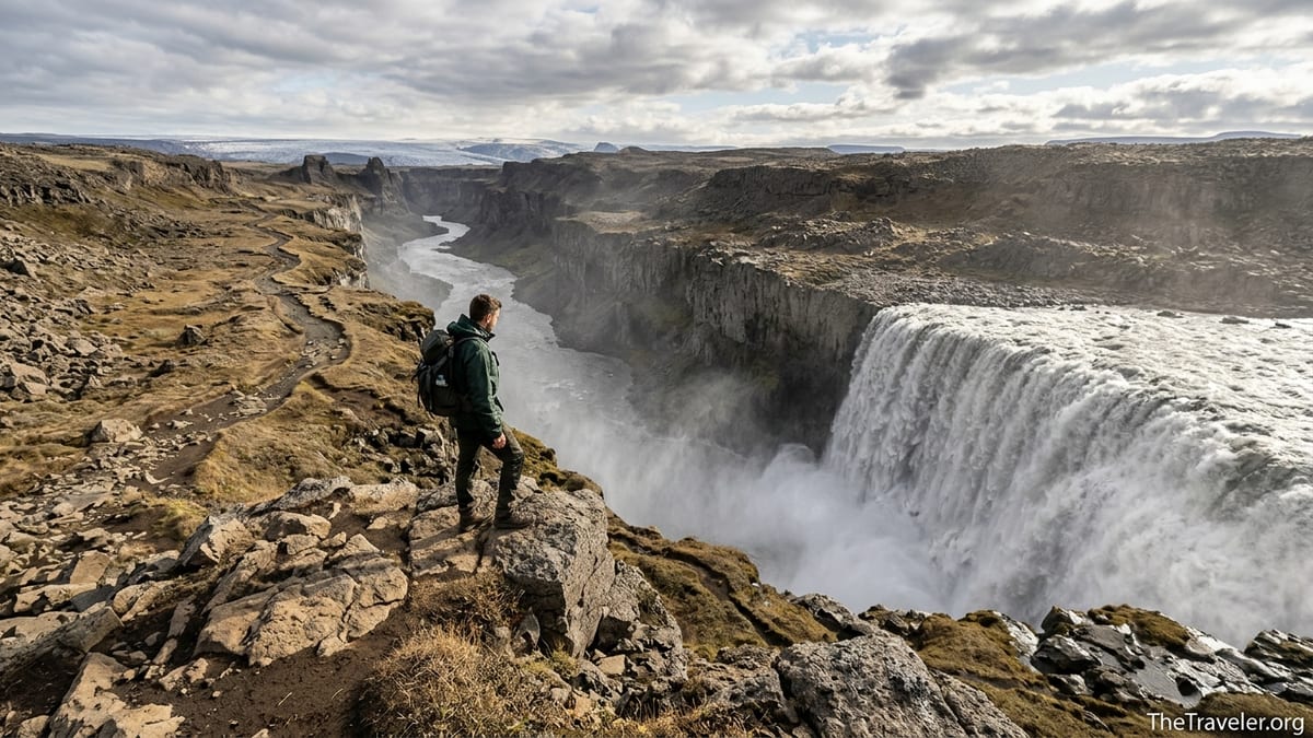
Understanding Jökulsárgljúfur and How the Area Is Laid Out
Jökulsárgljúfur stretches roughly between Dettifoss in the south and Ásbyrgi in the north, following the west side of the Jökulsá á Fjöllum river through a deep, lava lined canyon. The area is managed as part of Vatnajökull National Park, with Gljúfrastofa visitor centre at Ásbyrgi acting as the main information hub for hiking trails, current conditions and regulations. The park provides detailed hiking and 3D maps for Jökulsárgljúfur and Ásbyrgi that are the primary reference for official trail distances, estimated times and difficulty grades.
Access for Dettifoss and the canyon is from separate west and east side roads, with several signed car parks. Key trailheads for hikers interested in Dettifoss based routes include Dettifoss west and Dettifoss east parking areas, the Hafragilsfoss car park south of Ásbyrgi, the Hljóðaklettar and Vesturdalur area, and Ásbyrgi itself. Because most trails follow the canyon rim or river for long stretches, many longer walks are one way, so hikers often combine vehicles, use informal local transport or plan out and back routes based on the official park maps.
The park divides the main canyon trail between Ásbyrgi and Dettifoss into sections with coded labels and an overall rating of "challenging," with an approximate total distance of 32 kilometres usually walked over two days. Shorter trails around Ásbyrgi and Hljóðaklettar have easier grades, while the riverside and canyon edge paths south toward Dettifoss are generally classified as more demanding. Regardless of grade, all routes share some common traits: largely unprotected cliff edges in places, uneven rocky ground and exposure to rapidly changing weather.
Because the canyon has few services and no mountain huts, practical preparation matters just as much as choosing the right distance. Campgrounds at Ásbyrgi, Vesturdalur and the Dettifoss area, together with basic facilities at some parking areas, form the backbone of hiker logistics. Outside these designated camping areas, overnight stays are not allowed in Jökulsárgljúfur, and visitors should factor that into their route plans.
Short Waterfall Walks Around Dettifoss and Selfoss
The most accessible hikes in the area are the marked paths from the Dettifoss car parks to viewpoints over Dettifoss and upstream to Selfoss. Both the west and east riverbanks have established routes, though conditions and facilities differ slightly. On the west side, reached via the paved access road, a relatively short, often busy path leads from the Dettifoss west parking area to several fenced viewpoints above the falls. The distance from the car park to the main Dettifoss viewpoints is typically in the range of a few hundred metres each way, with the park classing the walk as short but on uneven, rocky ground that can be slippery in spray or rain.
From the same western car park, a marked path continues upstream to Selfoss, usually described by the park as an easy to moderate walk of roughly 1.5 kilometres each way, depending on the specific route taken. The terrain is mostly flat but can be very rocky, with sections of lava and loose stones. Hikers can expect to spend around 45 minutes to 1.5 hours for a combined Dettifoss and Selfoss outing from the west side, allowing extra time for photographs and moving carefully near the unfenced canyon edge areas beyond the formal viewing platforms.
On the east side of the river, accessed by a gravel road that can be rough early or late in the season, another marked path links Dettifoss east parking with open viewpoints at the top of the falls and with Selfoss upstream. The overall distances are similar to the west side, but the experience is more rugged and exposed, with fewer railings and a greater sense of closeness to the canyon rim. The park rates the east side routes as more demanding than the easiest walks at Ásbyrgi, mainly due to rough footing, potential wind exposure and the need to watch footing near drops.
For planning purposes, hikers should treat any Dettifoss and Selfoss combination as a minimum of one to two hours of active walking plus time to enjoy the scenery, even if the raw distances seem short. Waterproof layers, sturdy shoes or boots, and wind protection are essential, since spray from Dettifoss can soak clothing even in calm conditions and the open plateau offers little shelter. Visitors should also confirm each season whether both west and east side paths are officially open, as snow, ice or maintenance work can lead to temporary closures.
Half Day Canyon Routes Linking Dettifoss, Selfoss and Hafragilsfoss
For active travelers who want more than a short out and back, the most rewarding half day options in Jökulsárgljúfur connect Dettifoss and Selfoss with Hafragilsfoss and the canyon edges. The park’s hiking maps show marked routes between the Dettifoss area and Hafragilsfoss viewpoints, mostly on the west side of the canyon. These paths typically follow the canyon rim over rough lava fields and low vegetation, with frequent views down to the Jökulsá á Fjöllum and its waterfalls.
One common strategy is to park at Dettifoss west, visit the Dettifoss and Selfoss viewpoints, then continue on foot along the marked route toward Hafragilsfoss for a longer circuit-style outing. The walking time for a combined Dettifoss, Selfoss and Hafragilsfoss hike can easily extend to three to five hours depending on pace, photo stops and exact route choice. Because the canyon edge sections are relatively exposed and in places close to unfenced drops, the park grades these routes as moderate in difficulty, suitable for hikers with good footwear and basic experience on uneven ground.
Some hikers use a second vehicle at Hafragilsfoss car park to turn this into a one way hike along the canyon edge, allowing more time at viewpoints without needing to backtrack. Others prefer an out and back from one car park, turning around at Hafragilsfoss or at an intermediate viewpoint based on time and conditions. There is no formal shuttle service run by the park, so vehicle logistics are self arranged and subject to change, which is one reason why verifying practical information with rangers or at Gljúfrastofa is important.
The official Jökulsárgljúfur hiking maps also show connecting trails from the Dettifoss area northwards into Hljóðaklettar and Hólmatungur, where additional half day loops exist among striking basalt formations. These combinations increase total walking time and cumulative elevation feel, shifting the outing toward the upper end of the half day range. Because the network is intricate, hikers should study the latest park map before departure and carry either a printed copy or an offline version on a phone, as mobile reception in the canyon is inconsistent.
Multi Day Ásbyrgi to Dettifoss Canyon Trek
The signature long distance hike in Jökulsárgljúfur is the Ásbyrgi to Dettifoss canyon trail, or the reverse, which the national park describes as approximately 32 kilometres and generally recommended as a two day trek. The park rates this route as challenging, reflecting both its length and the nature of the terrain. Starting from the wooded bowl of Ásbyrgi, the trail heads south along the canyon, passing viewpoints and side areas such as Hljóðaklettar and Hólmatungur before reaching the more barren highland landscapes closer to Dettifoss.
Vatnajökull National Park recommends breaking the route into two stages, with an overnight camp at the Vesturdalur campground, which lies roughly midway in the canyon. The typical breakdown is Ásbyrgi to Vesturdalur on the first day and Vesturdalur to Dettifoss on the second. Exact daily distances depend on side trips and chosen viewpoints, but each stage involves several hours of walking on mostly undulating ground, with sections of steep or rough trail near the canyon rim and in lava fields.
There are no huts or cabins along the canyon trail. According to current park guidance, camping is only allowed on the official campgrounds at Ásbyrgi, Vesturdalur and the Dettifoss area for this route, and wild camping elsewhere inside Jökulsárgljúfur is not permitted. Campgrounds within the national park usually collect a per person fee and may offer basic facilities such as toilets, sinks and possibly showers at Ásbyrgi. Exact services, booking requirements and prices can change, so hikers planning the trek should check directly with Vatnajökull National Park or Gljúfrastofa for the latest details before reserving dates.
Recent park information highlights that along parts of the Ásbyrgi to Dettifoss route there are no reliable springs or streams suitable for drinking water. Hikers are advised to carry all drinking water needed between campgrounds, which significantly affects pack weight and stage planning. Because of this and the lack of shelters, the trek is best reserved for experienced hikers with appropriate gear, including a sturdy tent, full waterproof clothing, warm layers even in summer, map or GPS, and enough food and water for at least two days of walking.
Safety Considerations on Canyon Edges and Near the River
Jökulsárgljúfur’s appeal lies in steep cliffs, dramatic drops and the immense power of Jökulsá á Fjöllum, but these same features present real hazards. Many viewpoints and sections of the canyon trail are close to unfenced edges where a slip could be fatal. Rocks can be loose or undercut, especially near overhangs, and snow patches or ice early and late in the season can conceal cracks. Hikers should keep a safe distance from the edge, avoid sitting or standing on cornices, and be particularly cautious in strong wind, which is common on the plateau above the canyon.
The river itself is cold, fast and fed by glacial meltwater, making it extremely dangerous to approach too closely. Official trails keep a conservative distance from the riverbank in many places, but at waterfall viewpoints some paths briefly draw nearer. Visitors should respect barriers and stay within marked areas, especially around Dettifoss, Selfoss and Hafragilsfoss. Children need close supervision at all times, and solo hikers should ensure someone knows their route and expected return time.
Weather in North Iceland can change quickly, even in peak summer. Clear mornings can turn into windy, rainy afternoons with low cloud and poor visibility along the canyon. Temperatures drop rapidly in the evening, and wind chill can be significant near exposed rims and waterfalls. Hikers, even on short walks, should bring waterproof jackets, warm mid layers, hats and gloves outside the warmest weeks, along with sturdy footwear with good grip. On the multi day trek, a full set of warm, moisture wicking layers and a properly rated sleeping bag are essential.
There are no emergency shelters along the canyon trail, and mobile coverage is patchy, particularly between Vesturdalur and Dettifoss. This means that self reliance is important. A basic first aid kit, charged phone, power bank and, for longer routes, a personal locator beacon or similar device are sensible additions. Before starting any hike beyond the short waterfall walks, visitors should check the latest trail conditions and weather forecast at Gljúfrastofa, at other national park information points or by contacting rangers.
Park Rules on Camping, Fires, Drones and Staying on Trail
Vatnajökull National Park has clear rules that apply specifically to Jökulsárgljúfur and are intended to protect both sensitive canyon ecosystems and visitor safety. Camping is restricted to designated campgrounds such as Ásbyrgi, Vesturdalur and the Dettifoss area. Overnight stays outside these sites are not allowed within Jökulsárgljúfur, even for hikers on the Ásbyrgi to Dettifoss trek. Tent campers typically pay a nightly fee, and separate charges may apply for use of facilities; these details should be confirmed directly with the park before travel.
Open fires are generally prohibited in the national park due to the risk of wildfires in moss and low vegetation. Campers are expected to use camping stoves and to place them carefully to avoid scorching ground. All waste must be carried out or placed in bins where provided, and visitors should follow a strict leave no trace approach, particularly along the canyon trail where there are no huts or bins between campgrounds. Human waste should be managed using toilets at campgrounds and parking areas; where no toilets are available, hikers should follow recognized backcountry sanitation practices at a generous distance from watercourses.
Drone use is tightly controlled. According to current park rules, recreational drone flying is prohibited throughout Jökulsárgljúfur, including Ásbyrgi, Vesturdalur, Hljóðaklettar and Hafragilsfoss, with one limited exception near Dettifoss on the western side of the river. There, flying may be allowed at specified times of day and only over certain parts of the canyon, not over crowds or north of the main viewing platforms. Regulations change and may distinguish between recreational and commercial use, so anyone considering flying a drone must consult the latest rules from Vatnajökull National Park and the Icelandic Transport Authority and, when required, obtain permits in advance.
Staying on marked trails is strongly encouraged in all parts of Jökulsárgljúfur. The thin soils, moss and vegetation of the canyon rims are easily damaged by trampling, and informal shortcuts can quickly turn into eroded scars. Some areas are closed seasonally for bird protection, and rangers may adjust route markings or close sections after landslides or heavy rain. Hikers should obey any temporary signs and respect closures, which are typically updated first on the park’s official platforms and at Gljúfrastofa.
Facilities, Services and Trailhead Logistics
Services in and around Jökulsárgljúfur are limited compared with more developed parts of Iceland, so hikers should plan to be largely self sufficient for food and basic supplies. There are no shops or fuel stations at the main trailheads, including Dettifoss west, Dettifoss east, Hafragilsfoss, Hljóðaklettar or Vesturdalur. Ásbyrgi, at the northern end of the canyon, offers the widest range of services, including the Gljúfrastofa visitor centre, a campground and seasonal facilities that may include toilets and possibly a small service kiosk, though the exact offering varies year by year.
Toilets are present at some of the main car parks, but not all. Dettifoss west usually has toilets and basic facilities, while Dettifoss east and Hafragilsfoss may offer only limited or seasonal services. Vesturdalur and Hljóðaklettar parking areas have toilets associated with the campground or day use area, but hikers should not rely on facilities being open outside the main summer season. Mobile phone coverage is variable at all these locations, tending to be better on higher ground and weaker inside the canyon.
Parking areas can fill quickly on busy summer days, particularly at Dettifoss west. Arriving early in the morning or later in the afternoon can ease pressure, especially for those who prefer quieter trails. Roads on the west side are typically paved and suitable for most rental cars in summer conditions, while the east side access road may be gravel with potholes and, early in the season, lingering snow or soft sections. Road conditions can change quickly after rain or in shoulder seasons, so drivers should check up to date information and be prepared to adjust plans.
Because there is no park operated shuttle service within Jökulsárgljúfur at the time of writing, hikers who wish to walk one way routes must organize their own transport solutions. This can involve using two rental cars, arranging a pickup with a local operator where available, or planning loops and out and back hikes that return to the same car park. Whatever the option, a conservative time buffer is wise, as both driving and hiking can take longer than expected in this rugged area.
Quick Reference Mini Profiles of Key Hikes
For visitors looking to match routes to time and fitness, the main hikes in Jökulsárgljúfur can be summarized in broad terms. The Dettifoss west viewpoints and Selfoss from the same car park form a short route with a low elevation feel, classed by the park as easy to moderate. The typical season runs from late spring to autumn, depending on snow and ice, and the main highlights are direct views over Europe’s most powerful waterfall along with more tranquil cascades at Selfoss. Expect rocky, sometimes wet ground and heavy spray in windy conditions.
The equivalent Dettifoss east to Selfoss outing offers a similarly short distance but feels more rugged and exposed. Elevation change is modest, but uneven rock and proximity to the canyon rim give it a moderate character. It is best in snow free months and rewards hikers with open, wide angle views into the canyon, at the cost of rougher access roads and fewer facilities.
A combined Dettifoss, Selfoss and Hafragilsfoss canyon edge hike from the west side stretches into the half day category. The elevation feel is rolling rather than steep, yet the cumulative effect of walking on irregular lava and constantly undulating terrain raises the overall effort. The park generally treats these routes as moderate, suitable for reasonably fit hikers comfortable on variable ground. Highlights include multiple angles on all three major waterfalls and long reaches of the canyon seen from above.
The Ásbyrgi to Dettifoss canyon trail, or its reverse, stands as the flagship multi day hike. With an approximate total distance of 32 kilometres, a park rating of challenging, and an advised season from roughly mid summer to early autumn when conditions are most reliable, it is best reserved for well prepared parties. Elevation gain is spread across many short rises and descents along the canyon rim, and the sense of remoteness grows toward the middle sections between Ásbyrgi and Vesturdalur. Key highlights include Ásbyrgi’s towering cliffs, the basalt formations of Hljóðaklettar, more secluded reaches of the canyon and the final approach to Dettifoss.
Planning Your Day: Driving Stop or Dedicated Hiking Destination?
Many visitors first encounter Dettifoss as a brief stop on a driving day along the Ring Road, but Jökulsárgljúfur rewards those who slow down. Travelers with tight schedules can still enjoy a meaningful experience by allowing at least two to three hours at Dettifoss west or east for both falls, including walking time, photography and the flexibility to move carefully on the rocky ground. In fair weather, this approach fits into a broader day of driving between major North Iceland hubs while still respecting safety considerations.
Hikers with more time and a stronger interest in landscapes will benefit from dedicating a full day, or even two, to Jökulsárgljúfur. A full day allows for half day canyon routes linking Dettifoss, Selfoss and Hafragilsfoss, coupled with a visit to Ásbyrgi or Hljóðaklettar. With two days, it becomes realistic to attempt the full Ásbyrgi to Dettifoss trek with an overnight at Vesturdalur, conditions permitting, or to enjoy day hikes from multiple trailheads without rushing.
Whatever the plan, preparation starts with the latest information from Vatnajökull National Park. Before departing, visitors should check road and trail conditions, confirm which car parks have toilets and other basic services, and review any current restrictions on camping, fires, off trail walking and drones. Conditions in Iceland can shift from one week to the next, so treat the details in this article, based on official information as of November 2026, as a planning foundation rather than a final authority.
By matching hiking ambitions to fitness, allowing generous time margins and respecting the canyon’s rules and hazards, travelers can move beyond a quick roadside photo and experience Jökulsárgljúfur as an immersive hiking destination. The reward is a deep, memorable encounter with one of Iceland’s most powerful riverscapes, where every bend of the canyon brings new shapes in rock, water and light.