


More news on this day
Hong Kong is preparing to issue the No 8 gale or storm signal at 10.10pm on Saturday, as Typhoon Noul sweeps across the northeastern part of the South China Sea, triggering widespread disruption to flights, classes and transport services.
Get the latest news straight to your inbox!
T8 Signal Timed for Late Evening Escalation
According to publicly available bulletins from the Hong Kong Observatory, the city’s tropical cyclone warning will be upgraded to Signal No 8 at 10.10pm on July 25 as Noul edges closer to the Guangdong coast. Earlier in the day, the warning level was raised to Strong Wind Signal No 3, with forecasters indicating that winds over the territory would strengthen steadily through the evening.
Track projections show Noul moving west northwest across the northeastern sector of the South China Sea, on a path toward landfall along the coastal corridor between Huizhou and Shanwei on Sunday morning. Forecast charts indicate that the cyclone is expected to skirt roughly 100 kilometres northeast of Hong Kong at its closest point, bringing bands of intense rain and increasingly gusty conditions.
Weather advisories highlight the likelihood of frequent heavy squally showers and thunderstorms over Hong Kong tonight and into Sunday. Even though the storm’s centre is not expected to pass directly over the city, outer rainbands and a tightening pressure gradient are expected to produce gale force winds in exposed areas, meeting the criteria for the T8 signal.
Observatory updates also indicate that conditions will be reassessed between late evening and the early hours of Sunday for the possibility of higher signals, depending on Noul’s exact track, intensity changes and the wind field near the Pearl River Delta.
Transport Networks Brace for Disruptions
Transport operators across Hong Kong are adjusting services in anticipation of the T8 upgrade. Information released by airport and aviation authorities shows that flights have been cancelled or rescheduled from Saturday night through at least midday Sunday as Noul approaches, affecting both regional and long haul routes.
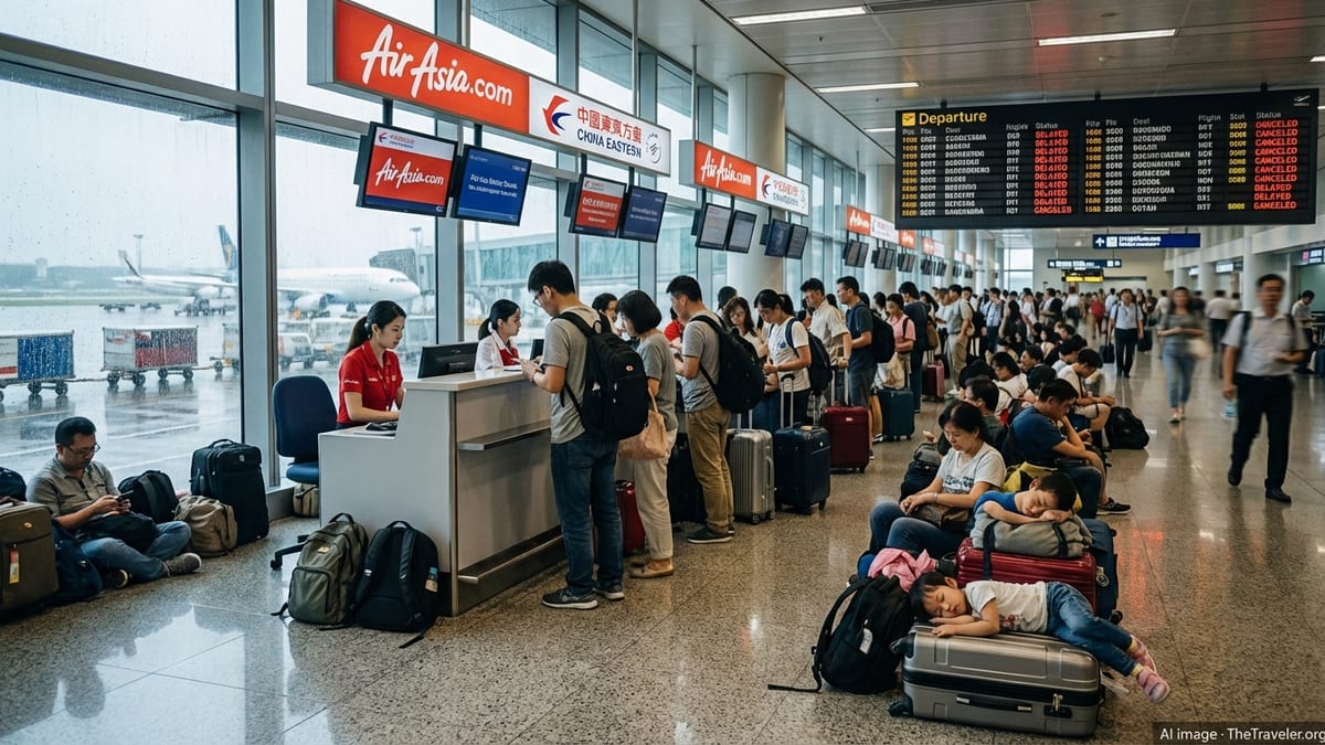
At Hong Kong International Airport, departure boards on Saturday afternoon already showed a growing list of cancellations and delays to destinations across East and Southeast Asia. Airlines have issued travel advisories urging passengers to check their flight status before heading to the airport and to expect longer processing times as operations are consolidated.
On the ground, public transport arrangements are being aligned with standard typhoon protocols. Rail operator guidance indicates that most MTR lines typically continue to operate at reduced frequency under T8, although some open air sections and feeder bus routes may be curtailed or suspended if conditions deteriorate. Harbour and outlying island ferry services are usually among the first to be halted once Signal No 8 takes effect, and operators have warned of likely suspensions overnight.
Road traffic is also expected to thin out considerably after the signal change, as residents are urged in public advisories to avoid unnecessary journeys and stay away from seafront promenades and exposed hillside roads where crosswinds and flying debris pose greater hazards.
Schools, Workplaces and City Life Affected
The escalation in warnings has had an immediate impact on daily routines in the city. Government announcements and local news coverage report that afternoon and evening classes on Saturday have been suspended as a precaution, with education authorities emphasizing the risk posed by worsening weather during dismissal hours.
For employers and workers, the move toward T8 reactivates Hong Kong’s long established typhoon work arrangements. Guidance from labour authorities and legal commentators notes that once Signal No 8 is in force, many offices, shops and construction sites close, and staff who have not yet started their shifts are generally advised to stay at home. However, essential services and certain retail and hospitality outlets may continue limited operations based on internal safety assessments.
Shopping malls and entertainment venues, which had seen a steady build up of visitors earlier in the day, are expected to shorten opening hours as the storm system draws nearer. Past typhoon seasons show that crowd levels typically drop sharply once the T8 signal is hoisted, with many businesses shuttering until warnings are lowered.
The timing of the planned 10.10pm upgrade also means many residents are adjusting evening plans, cancelling restaurant bookings and social events, and securing outdoor items on balconies and rooftops in line with long publicized safety advice.
Regional Impact Across Southern China
Beyond Hong Kong, Noul is affecting a broad swathe of southern China’s coastline. Forecast tracks compiled by regional meteorological agencies show the typhoon moving toward a landfall zone between Huizhou and Shanwei, with heavy rain expected over coastal Guangdong and neighboring provinces.
News reports from Shenzhen, Huizhou and other Pearl River Delta cities highlight preparations including temporary suspension of some coastal ferry services, checks on drainage systems and advisories for residents in low lying or landslide prone areas. Authorities in these cities are also monitoring river levels closely as the typhoon’s moisture combines with seasonal monsoon rainfall.
Airlines and rail services across the wider region are reviewing schedules in response to the storm’s projected track. Some carriers have announced fee waivers or flexible rebooking options for passengers traveling through southern Chinese hubs during the weekend, reflecting the potential for delays to ripple through broader regional networks.
Forecasters note that while Noul is not expected to reach the intensity of past super typhoons that have battered the South China coast, its combination of strong winds, high waves and heavy downpours could still produce localized flooding, fallen trees and power disruptions, particularly in areas directly exposed to onshore winds.
Travelers Urged to Monitor Conditions Closely
For visitors in Hong Kong and the surrounding region, the swift escalation in warnings underscores the importance of closely monitoring official bulletins and transport updates. International coverage, including from global news agencies, points out that typhoon related disruptions often begin hours before the strongest winds arrive, as operators seek to clear backlogs and reposition aircraft and vessels.
Travel industry advisories recommend that hotel guests in low lying waterfront districts pay particular attention to notices about possible storm surge and high tide interactions, which can briefly push water levels higher along exposed coastlines. Even as the storm’s centre tracks northeast of Hong Kong, strong onshore winds and large swells may affect popular promenades, beaches and outlying islands.
Tour organizers and attractions across the city are adjusting operations, with some venues preemptively announcing closures or modified schedules for Sunday, especially for outdoor activities such as hiking tours, boat excursions and theme parks. Visitors are being encouraged to remain flexible with their plans, allowing for last minute changes once the full effects of Noul’s passage become clearer on Sunday morning.
While forecasts suggest that weather conditions in Hong Kong may gradually improve later on Sunday after Noul moves further inland over Guangdong, residual showers, rough seas and lingering transport disruptions may persist for several hours. Travelers transiting through the city are therefore advised to build in extra time for connections and to check the latest information from airlines, rail operators and hotels before setting out.