


More news on this day
A yellow fog warning from the Met Office is in force across large parts of the UK on Monday 9 November, heightening the risk of travel disruption on key road, rail and air corridors as dense patches of fog cut visibility to under 100 metres in some areas.
Get the latest news straight to your inbox!
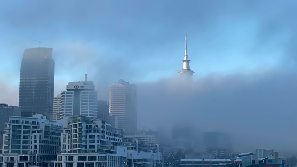
Warning covers major transport corridors and cities
According to the Met Office’s latest national severe weather warnings, yellow fog alerts remain in place through late Monday morning across swathes of England and Wales, with additional coverage for parts of Northern Ireland. The warning zone stretches from Yorkshire in the north to the South East of England, with affected areas including much of the East Midlands, eastern England, the West Midlands, and sections of north and mid Wales.
Accessible versions of the warning show that counties such as Lincolnshire, Nottinghamshire, Leicestershire, Bedfordshire, Hertfordshire and Essex are included, alongside urban areas around Greater Manchester and the West Midlands conurbation. Separate yellow alerts for fog are also in force across central and eastern parts of Northern Ireland, including County Antrim, County Down and County Armagh.
The alerts follow similar fog warnings issued late on Sunday 8 November, when thick fog settled over parts of England and Wales. National media coverage from broadcasters including Sky News, ITV News and newspapers such as the Guardian and the Independent indicates that weather conditions have created what forecasters describe as a “perfect recipe” for persistent fog across consecutive mornings.
Forecast detail from the Met Office states that fog patches formed overnight into Monday and are expected to thin gradually late in the morning. Until then, visibility could drop below 100 metres in places, with some locations seeing even denser pockets and very sharp differences in visibility over short distances.
Road and rail users urged to plan for slower journeys
The Met Office yellow warning explicitly highlights a likelihood of slower journey times on the road network, alongside the potential for delays to bus and train services. Publicly available guidance for fog conditions advises drivers to allow extra time, use fog lights where appropriate and be prepared for reduced speed limits or congestion around key junctions and interchanges.
Fog-related travel advice produced by the Met Office notes that reduced visibility can affect all major road types, from motorways and dual carriageways to rural A-roads. Where visibility drops significantly, journey speeds can fall quickly, leading to localised tailbacks near busy junctions, river crossings and approaches to major cities. Local authorities and transport operators often respond by issuing their own service updates, and travellers are being encouraged to check live information before setting out.
On the rail network, reports indicate that some operators have warned of the risk of minor delays where low visibility requires more cautious signalling or speed restrictions on certain routes. While widespread cancellations have not been reported so far, previous fog events have shown that knock-on delays can build up through the morning peak when trains run at reduced speed or when earlier services are held for safety checks.
Guidance shared through local resilience and transport planning documents emphasises that even yellow-level Met Office warnings are issued when forecasters expect at least some low-level impacts, including disruption to travel in a few places. Travellers are being advised to build flexibility into their schedules and consider later departures where possible if they are not bound to fixed appointment times.
Air passengers face risk of delays and cancellations
The current fog warning text includes a specific reference to the chance of delays or cancellations to flights, especially during the early morning when visibility can be at its lowest. Flight operations at major airports are particularly sensitive to low cloud and fog, and public-facing advice from the Met Office suggests checking with airlines and airports for the latest operational status.
In previous UK fog episodes, flight schedules at hubs such as London Heathrow, London City, Gatwick and regional airports across the Midlands and northern England have been reduced when low visibility procedures were introduced. Recent media coverage notes that Monday’s yellow warning extends over regions that are home to several of these busy airports, raising the risk of knock-on disruption for domestic and short-haul European services.
Standard safety protocols can require increased spacing between aircraft on approach and departure when visibility is reduced, which limits runway capacity even if the airport remains open. Passengers have been reminded through airline and airport communications to allow additional time for check-in and security, as early-morning queues may build if multiple departures are retimed within short windows when conditions briefly improve.
Where flights are cancelled outright, consumer information from aviation regulators points travellers toward airline rebooking policies or statutory compensation rules, but these depend on the cause of the disruption and the jurisdiction involved. With the current disruption risk driven by adverse weather, airlines typically focus on re-routing and accommodation rather than financial compensation.
How the Met Office fog warning system works
The Met Office issues weather warnings through its National Severe Weather Warning Service, using colour-coded categories to describe both the likelihood of weather impacts and their potential severity. Yellow warnings, such as those in place for fog on Monday, indicate that some impacts are likely in a few places, and that travellers should keep up to date with forecasts and be prepared for possible changes to plans.
Public information leaflets and planning documents that outline the UK alerting system explain that fog is among the hazards monitored alongside heavy rain, thunderstorms, snow, wind, ice and extreme heat. For each warning, a matrix of likelihood and impact helps local authorities, businesses and the public understand whether to expect limited disruption or more significant effects such as transport closures and risks to infrastructure.
In the case of the current fog episode, the Met Office has assigned a high likelihood but moderate impact level to the warning. That combination supports the message that dense fog is very probable in the affected regions, while the overall scale of disruption is expected to remain below the threshold associated with amber or red warnings, which are reserved for more severe conditions.
Guidance on the Met Office website stresses that weather warnings can change at short notice as new data becomes available. Travellers are encouraged to monitor updates through official forecast channels and adapt their journeys if the warning area expands, contracts or is extended in time beyond the current end point of late Monday morning.
Practical steps for travellers over the warning period
For those travelling during the fog warning period, publicly available advice from transport and safety bodies highlights several practical measures. Motorists are advised to check that fog lights and low-beam headlights are working before departure, clear all windows thoroughly and maintain greater following distances in slow-moving traffic. Highway information services also suggest avoiding sudden braking and lane changes in conditions where other drivers may have limited forward visibility.
Commuters using buses and trains are being encouraged, through operator advisories and news reports, to allow extra interchange time and to prepare for short-notice platform or stand changes if service patterns are adjusted. In some areas, early-morning services may run with minor delays while operators respond to localised visibility problems around depots, junctions or level crossings.
For longer-distance journeys that involve multiple transport modes, such as rail-to-air connections or coach links to airports, the combination of slower roads and potential flight schedule changes increases the risk of missed connections. Travel planners recommend building additional margin into itineraries during active weather warnings, particularly where tickets are tied to fixed departure times.
Looking beyond Monday morning, the Met Office warning calendar indicates that no further fog alerts are currently in force for the middle of the week. Forecasters nonetheless continue to advise that travellers check daily updates, as similar temperature and humidity setups can allow fog to redevelop on subsequent nights if conditions remain calm and clear.