
More news on this day
A powerful June storm system is bearing down on the Midwest on June 17, 2026, with forecasters warning of a significant risk of tornadoes, destructive winds, flash flooding and major air-travel disruption in and out of Chicago, Cincinnati and Indianapolis.
Get the latest news straight to your inbox!
Moderate Tornado Risk Targets Chicago and Northern Indiana
Publicly available outlooks from the Storm Prediction Center place a broad swath of the Midwest under an elevated severe weather threat on Wednesday, with a core zone of moderate risk centered on northern Illinois and northern Indiana, including the Chicago metropolitan area. The risk category, ranked four out of five on the center’s scale, reflects concern over multiple rounds of intense thunderstorms capable of producing strong tornadoes, very large hail and damaging straight-line winds.
Forecast discussions highlight a volatile environment building through the afternoon and evening as warm, humid air surges north ahead of a cold front. A midlevel disturbance sliding across the northern Plains and Great Lakes is expected to provide the lift needed for rapid storm development, with discrete supercells possible before lines of storms merge into a broader complex later in the night.
In Illinois and Indiana, recent coverage from regional outlets notes that communities are still clearing debris and repairing infrastructure after at least 17 tornadoes were confirmed in storms that swept through the region last week. That earlier outbreak left hundreds of thousands without power and underscored how quickly June conditions can flip from summer heat to life-threatening weather. Today’s setup is being described in meteorological briefings as another high-impact event, with the potential to affect many of the same counties.
Although the most intense risk is centered on the Chicago to northern Indiana corridor, the broader threat zone stretches from Iowa and Missouri east through parts of Ohio, placing a long list of interstates, rail corridors and air routes under the potential for sudden, dangerous weather changes.
Air Travel Disruptions Spread from Chicago to Cincinnati and Indianapolis
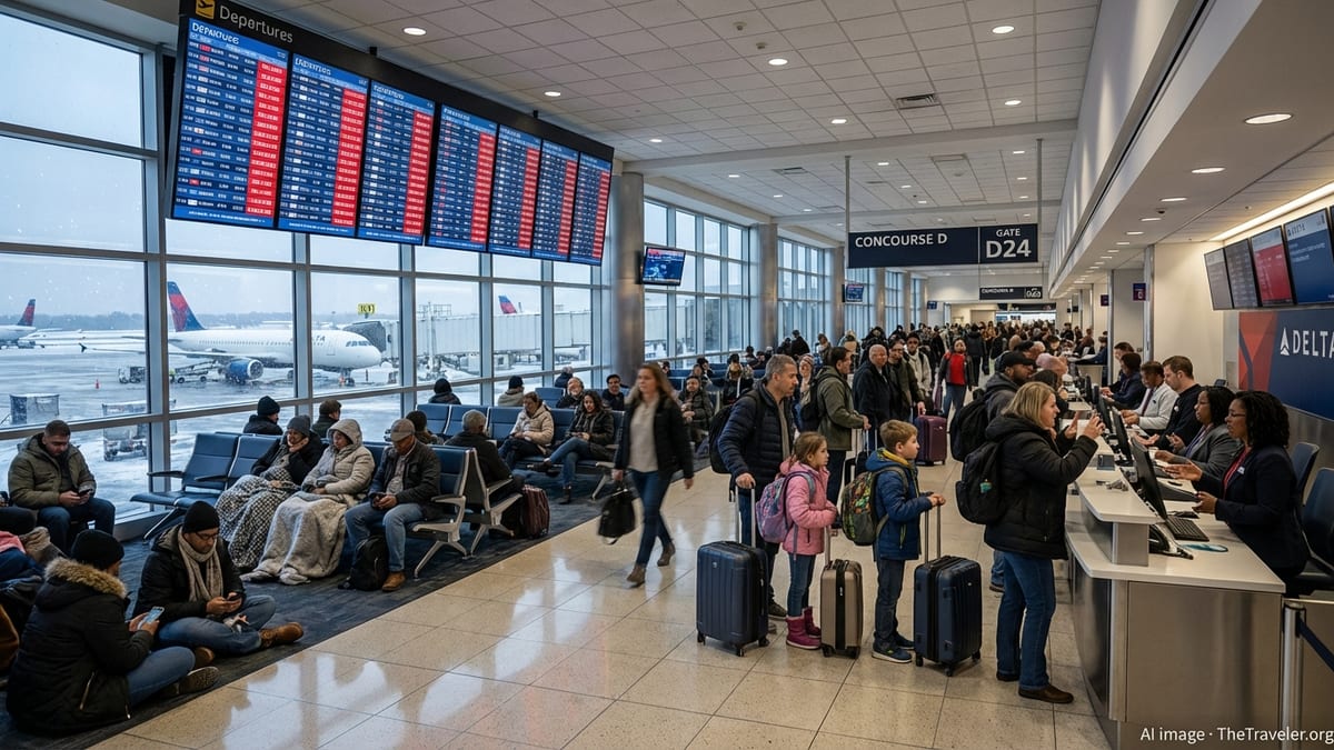
The severe weather threat is already rippling through Midwest air travel plans. After damaging storms last week caused more than a thousand delays and cancellations at Chicago’s O’Hare and Midway airports, airlines and travelers are bracing for another difficult day in the skies. Industry-focused coverage and airline advisories describe a pattern of rolling delays as thunderstorms force temporary ground stops and rerouting around the most active storm cells.
Chicago’s role as a major hub means even localized storms can quickly snarl connections across the country. With another round of severe storms expected to fire near peak afternoon departure times, travel analysts warn that ripple effects may extend far beyond the Midwest as aircraft and crews fall out of regular position. Passengers connecting through O’Hare or Midway to other destinations, including Cincinnati and Indianapolis, may face missed connections or last-minute rebookings.
On social media and aviation forums, travelers are sharing notices of new or extended weather waivers from major carriers covering Midwest cities including Chicago and Indianapolis for much of the week. These waivers generally allow flyers with affected tickets to switch to alternate dates or routes without change fees, provided they travel within a specified window and remain on the same airline.
In Cincinnati, where the primary airport serves as a regional link between major hubs, forecasts indicate that storms will likely arrive later in the day and into the overnight hours. Thunderstorms tracking east from Illinois and Indiana could move across southern Indiana and northern Kentucky, raising the prospect of holding patterns, diversions and further knock-on delays for flights arriving from or departing to Chicago and other Midwest hubs.
Flooding, Power Outages and Ground Transport Concerns
Beyond the tornado and wind risk, forecasters are emphasizing the potential for torrential rainfall, particularly around the Chicago area and into northwest Indiana. Local meteorological briefings point to highly efficient storms capable of producing rainfall rates of one to two inches per hour, with some scenarios showing localized totals of three inches or more on already saturated ground.
Recent days have already seen flood advisories and warnings for portions of Cook County and other northern Illinois jurisdictions as rivers, creeks and urban drainage systems strain under repeated downpours. With additional storms in the forecast today, travel observers note an elevated risk of flash flooding on highways, low-lying underpasses and airport access roads, especially during the evening rush hour and overnight hours when visibility is reduced.
Past Midwest storm events this month have knocked out power to hundreds of thousands of customers, as documented in national business and energy coverage after a recent line of severe storms swept from Illinois into neighboring states. Those outages, driven by high winds toppling trees and power lines, disrupted commuter rail services, halted some light-rail routes and forced detours around downed infrastructure. A similar pattern is possible with today’s storms, particularly in neighborhoods with older tree canopies and above-ground utility lines.
Travelers moving by car, bus or train through the Chicago, Indianapolis and Cincinnati corridors are being encouraged by transportation agencies and weather services to monitor real-time conditions, with some routes at risk of temporary closure due to debris, localized flooding or lightning damage. Intercity bus operators and rail providers may also adjust schedules or issue weather-related advisories if the worst-case storm scenarios develop.
How the Pattern Is Shaping the June Travel Landscape
Climatologists and long-term forecasters note that mid-May through late June is historically one of the most volatile weather periods in the Midwest, but this year’s pattern has been particularly active. Public commentary from weather enthusiasts and professional forecasters alike describes a season of “rounds and rounds” of severe storms, from Wisconsin through Illinois and into Indiana and Ohio.
For leisure and business travelers, this environment is reshaping expectations for early-summer itineraries. Travel publishers and booking platforms report increased interest in flexible tickets, refundable hotel rates and itineraries that build in extra time between connections, especially when routing through storm-prone hubs like Chicago. Some passengers are choosing early-morning departures, which have statistically lower disruption risk before daytime heating fuels the most vigorous storms.
In cities like Indianapolis and Cincinnati, which often sit on the southern or eastern edge of the most intense Midwest storm corridors, residents are becoming more accustomed to late-day watches and overnight warnings. The current outlook places Indianapolis within the expanded moderate risk zone, highlighting that significant storms may track well beyond the immediate Chicago region and into central Indiana and western Ohio as the evening progresses.
As the June 17 system unfolds, travel professionals are watching closely for signs of whether the storm track will remain concentrated over northern Illinois and Indiana or sag farther south into the Ohio Valley. That distinction will determine which highways, airports and rail lines see the greatest disruption as the severe weather sweeps east.
Practical Guidance for Travelers Caught in the Path
While specific conditions will vary by hour and by location, publicly available travel and safety guidance offers several consistent recommendations for those moving through the Chicago, Cincinnati and Indianapolis areas today. Air travelers are advised to check their flight status frequently, enable alerts in airline apps and build extra time into connections, particularly if their itinerary depends on a tight layover at a Midwest hub.
For those driving, forecasters recommend planning alternate routes that avoid flood-prone underpasses and low-lying roads. Motorists are urged to avoid driving through water-covered pavement, as even shallow flooding can conceal severe damage or fast-moving currents. During severe thunderstorm or tornado warnings, transportation safety campaigns emphasize the importance of seeking substantial shelter rather than attempting to outrun storms in a vehicle.
Rail and intercity bus passengers may find that operators adjust departure times or temporarily suspend service on certain segments if high winds, lightning or debris threaten tracks and overhead power systems. Monitoring carrier alerts and local news bulletins can provide early notice of such changes, allowing travelers to rearrange plans before reaching the station or terminal.
With another intense storm day unfolding so soon after earlier June outbreaks, the Midwest’s air and ground networks are once again being tested by a combination of tornado risk, damaging winds, flash flooding and complex logistics. For visitors and residents alike, staying weather-aware and flexible remains essential to navigating Chicago, Cincinnati and Indianapolis as the June 17 severe weather episode plays out.