


More news on this day
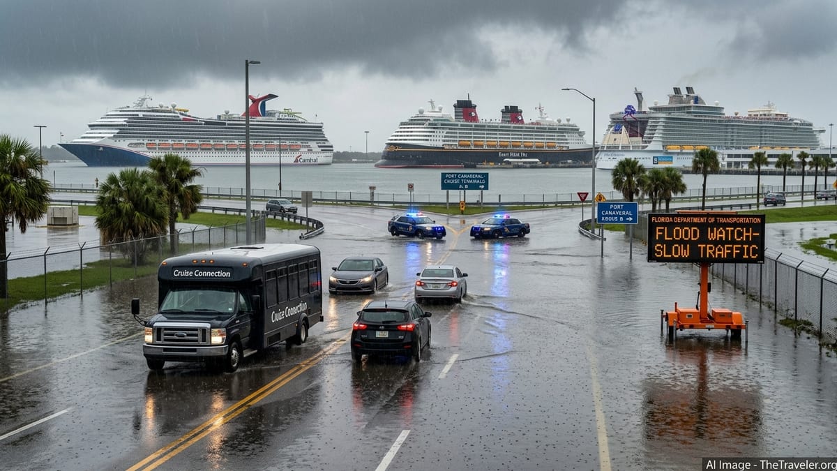
Port Canaveral is keeping cruise ships sailing under an active National Weather Service Flood Watch through Friday evening, but officials are warning passengers that heavy rain, localized flooding and poor visibility are already slowing road traffic and could delay terminal arrivals and departures.
Get the latest news straight to your inbox!
Flood Watch in effect through November 20
The National Weather Service has a Flood Watch in place for Cape Canaveral and northern Brevard County from Tuesday November 17 at 5:00 p.m. to Friday November 20 at 7:00 p.m. Eastern, covering Port Canaveral and nearby coastal communities. Alongside the watch, the agency has issued a series of short‑fuse flood advisories and warnings for parts of Brevard County as downpours have repeatedly pushed drainage systems to their limits.
Forecast discussions highlight periods of intense rain and embedded thunderstorms, with the potential for rapid ponding on roads, reduced visibility and brief flash flooding in low‑lying and urban areas around the port. State situation reports from the Florida Division of Emergency Management describe the mid‑November event as part of a multi‑day, widespread flooding pattern along Florida’s east coast, rather than an isolated shower cluster confined to one city block.
Earlier in the month, the governor’s emergency order addressing “2026 fall flooding” cited flood threats in several east‑central Florida counties, including Brevard, reinforcing that the current Flood Watch sits within a wetter‑than‑normal stretch that has already stressed some transportation links and required localized evacuations elsewhere in the region.
Port stays open but warns of slower cruise‑day movements
Against this backdrop, Port Canaveral has issued a prominent Cruise Operations Advisory confirming that the port remains open and operational for all scheduled ships. The advisory, updated November 19 and still active on November 20, states that the Flood Watch is producing localized flooding, standing water on roadways, reduced visibility and slower traffic conditions across the port district.
According to the port, the main impacts are on ground movements rather than marine operations. Access roads, parking lots and curbside drop‑off areas are seeing patches of standing water, and periods of heavy rain and gusty onshore winds are complicating traffic management around cruise terminals. As of the morning of November 20, there were no port‑wide cruise cancellations or confirmed ship diversions directly attributed to the Flood Watch.
A published master schedule shows major cruise lines, including Carnival, Royal Caribbean, Disney Cruise Line, MSC Cruises and Norwegian Cruise Line, with turnarounds or calls at Port Canaveral between November 17 and 20. The port’s advisory stresses that these calls are proceeding but that passengers should treat the weather as a realistic source of delay when planning arrival times.
Local officials urge extra time for arrivals and transfers
Local television coverage from Orlando’s WFTV on November 19 echoes the port’s message, quoting Port Canaveral officials who ask passengers to allow extra time to reach their terminals and to expect congestion on surrounding highways and causeways. Reporters describe a combination of heavy rain, gusty winds and standing water near key junctions that is forcing some shuttles and private vehicles to slow significantly during peak embarkation and debarkation windows.
The most acute risks are for travelers relying on tight same‑day connections, such as those flying into Orlando International Airport on the morning of their cruise or organizing their own ride‑share or rental‑car transfers. In these cases, an accident or temporary lane closure on a flooded stretch of State Road 528 or State Road 520 could lengthen what is normally a one‑hour journey and threaten check‑in cutoffs set by individual cruise lines.
Within the port itself, heavier bursts of rain can temporarily lengthen security and baggage‑drop queues as staff move passengers under cover and adjust lane layouts to keep people out of deeper puddles. While terminal operations are continuing, local broadcasts caution that travelers might experience slower curbside handovers, longer waits for elevators in parking garages and brief pauses in boarding while lightning or extreme downpours pass over the immediate area.
Broader pattern along the Atlantic coast
Port Canaveral’s advisory comes as multiple Atlantic coastal areas contend with flood‑related alerts in mid‑November. National Weather Service offices along Florida’s east coast and farther north have issued overlapping flood watches, coastal flood advisories and wind statements this week as a moist, slow‑moving weather system feeds repeated bands of heavy rain into urban corridors.
In Florida, emergency managers have warned that saturated ground and high water tables after earlier November flooding are increasing the sensitivity of roads and drainage canals to additional downpours. Situation reports note impacts to transport infrastructure beyond cruise terminals, with low‑lying arterials and some neighborhood streets experiencing recurrent closures or restrictions when storms move through at high tide.
For cruise passengers, this broader pattern means that disruption risk is not limited to the final few miles around Port Canaveral. Travelers driving from South Florida, Jacksonville or the Gulf Coast, or connecting from other airports along the Atlantic seaboard, may also pass through counties operating under their own flood advisories, where speed reductions, surface‑street detours and heavier congestion can add unplanned time to the journey.
What cruise travelers should do next
Given that ships are sailing but ground access is strained, the most practical step for anyone embarking or disembarking at Port Canaveral through at least Friday evening is to build a substantial timing buffer into every leg of the trip. That includes booking earlier flights, leaving hotels ahead of the usual schedule and allowing extra time to return rental cars or move luggage between park‑and‑cruise facilities and the terminal.
Passengers should monitor both the port’s official alerts page and the latest National Weather Service products for Cape Canaveral on the day of travel, as specific warnings and advisories can change quickly within the overall Flood Watch window. Cruise lines may also issue terminal‑specific guidance, such as adjusted arrival recommendations or staggered check‑in times, which can help spread crowds and reduce bottlenecks in bad weather.
Looking ahead, state emergency managers indicate that the present stretch of unsettled weather is expected to ease after the current watch period, but they continue to flag a heightened sensitivity to heavy rain events along Florida’s east coast over the short term. Until conditions stabilize and flood products are cleared, travelers using Port Canaveral and other affected coastal gateways should treat weather‑related ground delays as a realistic planning factor rather than an outlier.