
More news on this day
Potential Tropical Storm Arthur is taking shape in the northwestern Gulf of Mexico, and forecasters warn that its slow movement and tropical moisture could stall travel plans across Texas, New Orleans, and other Gulf Coast hubs through late week.
Get the latest news straight to your inbox!
Storm System Organizes Off Texas as First Named Threat of 2026 Season
National Hurricane Center advisories describe a broad and slow moving disturbance near the Texas coast, officially labeled Potential Tropical Cyclone One, with forecasts indicating it is likely to strengthen into Tropical Storm Arthur as it tracks northeast toward the Texas Louisiana border. Reports indicate the center was located not far offshore from Corpus Christi on Tuesday, drifting at only a few miles per hour over very warm Gulf waters.
Published coverage from national and regional weather outlets notes that this would be the first named storm of the 2026 Atlantic hurricane season, arriving barely two weeks after the official June 1 start. While maximum sustained winds have remained below tropical storm strength so far, forecasters emphasize that the system’s slow pace and deep tropical moisture are the primary concerns.
Forecast discussions point to a track that brings the system inland somewhere along the upper Texas or southwest Louisiana coast by midweek, then arcs it slowly east or northeast across the Deep South. Even modest strengthening before landfall could extend tropical storm conditions hundreds of miles along the shoreline, keeping seas rough and winds gusty for much of the week.
Meteorologists also highlight that similar early season Gulf systems in past years have been prolific rain makers rather than classic wind driven hurricanes. That pattern appears to be repeating, with Arthur’s main threat expected to be widespread, long lasting downpours over heavily populated corridors.
Flooding Rains Target Houston, Galveston, New Orleans, and Key Transit Corridors
Forecast totals from the Weather Prediction Center and other publicly available guidance show a broad swath of 4 to 8 inches of rain from the middle and upper Texas coast across southern Louisiana, with localized pockets potentially reaching 10 to 12 inches where bands repeatedly train over the same areas. Urban centers including Houston, Galveston, Beaumont Port Arthur, Lake Charles, Baton Rouge, and New Orleans all lie within the zone of greatest concern.
Major roadways that knit together the Gulf Coast travel network, including long stretches of Interstate 10, U.S. 59 and 69, and approach roads to coastal bridges and causeways, are at elevated risk for flash flooding. Low lying underpasses, bayfront parkways, and frontage roads near bayous and drainage canals frequently flood in heavy summer thunderstorms and could become impassable if tropical rain bands stall.
In New Orleans and surrounding parishes, recent guidance from local weather offices points to several inches of rain through Saturday, with isolated higher amounts where persistent bands set up. Given the region’s history of drainage challenges, even a slow moving tropical storm that never reaches hurricane strength can bring enough water to disrupt day to day movement across the metro.
Farther inland, smaller regional airports and general aviation fields scattered across eastern Texas, central and southern Mississippi, and western Alabama may also contend with saturated runways, low visibility, and training thunderstorms as the moisture plume lifts north and east after landfall.
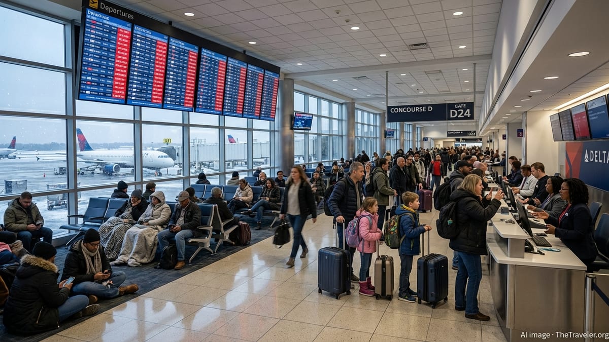
Flight Disruptions Likely at Major Hubs and Regional Airports
Air travel across the western and central Gulf Coast is already feeling early effects from increasing showers and storms around the developing system. Aviation forecasts compiled by meteorological services show periods of heavy rain, low cloud ceilings, and gusty crosswinds developing along the approach paths into major hubs such as Houston’s George Bush Intercontinental and William P. Hobby airports, as well as Louis Armstrong New Orleans International.
Even if terminals remain open and runways fully operational, airlines often slow operations when thunderstorms repeatedly move through, spacing out arrivals and departures to maintain safety in poor visibility and turbulent air. That can quickly ripple outward across national networks, meaning passengers with connections through Houston or New Orleans this week could see delays even if their origin and final destination remain dry.
Regional airports along the Texas coast from Brownsville and Harlingen up through Corpus Christi and into the Galveston Bay area face additional challenges from strong onshore flow. Short bouts of coastal flooding on access roads and parking facilities, combined with frequent lightning and downpours, could force temporary ground stops or extended taxi times.
Travel industry analysts regularly note that early season tropical systems, while often weaker than peak season hurricanes, can be more disruptive than their wind speeds suggest because they arrive when airlines are already operating near summer capacity. With little slack in schedules, even brief shutdowns at a Gulf hub can cascade into missed connections and rebookings well beyond the storm’s footprint.
Driving, Cruising, and Beach Travel Plans Confront Changing Conditions
For road travelers heading to or from the Gulf Coast this week, publicly available forecast maps show a patchwork of flood watches along the Texas and Louisiana shoreline and extending into parts of Mississippi and Alabama. Drivers planning overnight hauls along Interstate 10, Interstate 45, or U.S. 90 may encounter bands of torrential rain that abruptly reduce visibility and cause ponding on pavement, especially near coastal marshes and river crossings.
Given the system’s expected slow movement, travel conditions are likely to vary significantly over relatively short distances. Some stretches of highway could see only intermittent showers and manageable winds, while adjacent coastal counties experience hours of heavy rain and standing water. This variability makes it important for travelers to check updated radar and forecast information close to departure times rather than relying solely on multi day outlooks.
Tropical moisture and rough seas are also affecting cruise and ferry itineraries in and out of Texas and Louisiana ports. Industry tracking sites indicate that vessels departing Galveston, New Orleans, and other Gulf embarkation points may alter routes to avoid the heaviest squalls or delay departures if port authorities reduce traffic due to strong onshore winds and limited visibility in ship channels.
Beach bound visitors from within Texas and neighboring states should anticipate red flag swim conditions, with strong rip currents and high surf warnings already highlighted by coastal forecast offices for portions of the northwestern Gulf shoreline. Even where skies temporarily brighten between bands, lifeguards and local officials typically discourage entering the water when long period swells from a nearby tropical system are impacting the coast.
What Travelers Can Expect Through Late Week
Forecasts compiled on Tuesday indicate that the heaviest impacts from Potential Tropical Storm Arthur will likely unfold from midweek into Friday, as the system strengthens, makes landfall, and then slowly tracks inland across the lower Mississippi Valley. While details about exact landfall location and eventual intensity remain subject to change, confidence is high that a broad area of the western and central Gulf Coast will experience at least several days of unsettled, travel unfriendly weather.
Air travelers with itineraries through Houston, New Orleans, and nearby regional airports this week should budget extra time for security and boarding, prepare for gate changes and rolling delays, and monitor real time updates from their carriers. Flexible travelers may find it worthwhile to explore alternative routings through inland hubs if connections through the Gulf region appear especially vulnerable on specific days.
Those driving long distances along the coast or across the Deep South are likely to face episodes of heavy rain, ponding water, and sporadic road closures around flood prone areas. Publicly available highway advisories often update quickly as bands move through, so checking state transportation alerts and local media reports before setting out each morning can help avoid the worst bottlenecks.
For travelers still in the planning stage, the evolving guidance around Potential Tropical Storm Arthur underscores the value of flexible bookings and refundable rates during the heart of hurricane season. With the first named storm of 2026 poised to test early summer travel across Texas, New Orleans, and the wider Gulf Coast, staying informed and adaptable will be key to keeping trips on track.