
More news on this day
Major summer travel routes across the central and eastern United States are bracing for another round of intense thunderstorms and flash flooding today, with Colorado, Wyoming, Nebraska and surrounding states facing disruptive weather conditions capable of delaying road traffic and air travel at the height of the June getaway season.
Get the latest news straight to your inbox!
Storm System Targets Central Plains and High Plains
Forecast discussions and national outlooks indicate that an active storm corridor is once again setting up from the central Rockies into the central Plains, focusing severe weather threats on Colorado, Wyoming and Nebraska. A vigorous disturbance aloft interacting with warm, humid air at the surface is expected to fuel strong to severe thunderstorms over the High Plains before they track east into the Plains through the evening and overnight hours.
Meteorologists tracking the pattern describe an environment supportive of large hail, damaging wind gusts and torrential downpours, particularly across western and central Nebraska and adjacent areas of Kansas, as storm clusters consolidate and intensify. Parts of eastern Colorado and southeast Wyoming also sit within a higher risk zone for robust late-day storms, where rapid thunderstorm development along boundaries could lead to locally intense rainfall and lightning.
These storms are unfolding against the backdrop of an already unsettled early summer across the Plains, with recent days bringing repeated thunderstorm rounds and pockets of flash flooding from the Dakotas into Wyoming and Nebraska. The latest outlooks suggest that today’s activity will continue that pattern, with the potential for new problem spots to emerge on key cross-country travel routes.
Flash Flooding Concerns Along Key Travel Corridors
Flood watches and localized warnings are being highlighted along portions of the central United States where soils are already saturated and drainage systems are vulnerable. Forecast guidance points to swaths of Nebraska and Kansas as particularly susceptible to excessive rainfall rates, where slow-moving or training thunderstorms could quickly overwhelm creeks, low-lying roads and urban drainage.
Publicly available information from hydrologic and weather briefings also underscores concerns in parts of the central and lower Mississippi Valley and the interior South, where recent heavy rain has primed the landscape for renewed flooding. In these regions, any additional intense downpours today and into the start of the new week could lead to rapid rises in small streams and ponding on highways, especially near underpasses and poorly drained interchanges.
Travelers planning long-distance drives through the central corridor are being urged in public advisories to monitor local forecasts frequently and be prepared for rapidly changing road conditions. Low visibility in sheets of rain, hydroplaning risks at highway speeds and sudden closures of flood-prone stretches can all materialize within minutes when thunderstorms repeatedly track over the same area.
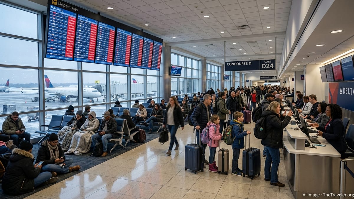
Air Travel Disruptions Around Denver and Regional Hubs
The volatile storm pattern poses particular challenges for aviation hubs embedded in the storm corridor, notably Denver, a major connecting gateway for transcontinental and mountain-west flights. Case studies and operational analyses of past thunderstorm events over the Denver airspace highlight how rapidly developing storms along the Front Range can force abrupt changes to arrival and departure flows, trigger ground stops and produce significant knock-on delays across the national network.
Late afternoon and evening hours are typically the most sensitive period, when the busiest departure banks coincide with peak thunderstorm intensity east of the Rockies. Strong and shifting winds, heavy rain cores near approach paths and lightning in the vicinity of ramps can slow or temporarily halt ground operations. Even when storms remain just outside the immediate airport perimeter, air traffic controllers may need to reroute traffic around convective cells, adding time to already full schedules and disrupting connections.
Secondary airports across the High Plains and Midwest, from Cheyenne and Scottsbluff to hubs in Nebraska and Kansas, may also experience delays, diversions or cancellations when lines of storms sweep through. Travelers connecting through these smaller facilities can be affected even if skies at their final destination remain relatively calm, as aircraft and crews become entangled in delays upstream.
Ripple Effects for Rail and Highway Summer Travel
Beyond aviation, today’s severe weather threat reaches into nearly every mode of surface transportation that supports the busy summer holiday period. Long-haul interstate routes such as I-25 through Colorado and Wyoming, I-76 and I-80 across Nebraska and neighboring states, and additional east-west corridors further downstream are all susceptible to sudden slowdowns as storms move across the Plains into the Midwest.
Heavy rainfall can quickly reduce visibility, and strong crosswinds in open country make driving high-profile vehicles challenging, especially on elevated stretches and exposed overpasses. Public transportation bulletins across multiple states have recently highlighted the need for drivers to budget additional time, avoid flooded roadways and be prepared for detours where law enforcement or transportation agencies temporarily close low-lying segments.
Rail freight and passenger services can also encounter weather-related delays when intense thunderstorms produce localized flooding on tracks, washouts along rights-of-way or debris blown onto lines. In past events, rail operators in the central United States have been forced to reduce speeds or briefly suspend service over vulnerable sections until inspections confirm that tracks remain safe, creating further ripple effects for supply chains and long-distance travelers.
What Travelers Across Central and Eastern States Should Expect Next
Looking beyond today, medium-range outlooks from national forecasting centers point to a continuation of an active pattern for much of the central and eastern United States. While the exact placement of the strongest storms will shift from day to day, the broader corridor from the central Rockies through the Plains and into portions of the Midwest and interior East is expected to see recurring rounds of showers and thunderstorms into the early part of the week.
For travelers, this means that disruptions may not be confined to a single afternoon of rough weather. Those heading out by car or plane over the next several days across Colorado, Wyoming, Nebraska and neighboring states should monitor updated forecasts, airline notices and state transportation alerts, especially when itineraries involve tight connections or overnight drives.
Summer storms of this kind can be highly localized, but their impact on travel is often widespread. Even where conditions remain manageable at ground level, upstream weather along connecting routes can send delays cascading across regions. A flexible mindset, contingency plans and extra time built into schedules can all help mitigate the impact of what is shaping up to be a stormy stretch for the heart of the United States at the height of the June travel season.