


More news on this day
Summer thunderstorms sweeping across the Mid-Atlantic on July 21 prompted the Federal Aviation Administration to implement ground stops at Ronald Reagan Washington National, Washington Dulles International and Baltimore/Washington International Thurgood Marshall airports, leading to cascading delays and cancellations for travelers moving through the Washington region.
Get the latest news straight to your inbox!
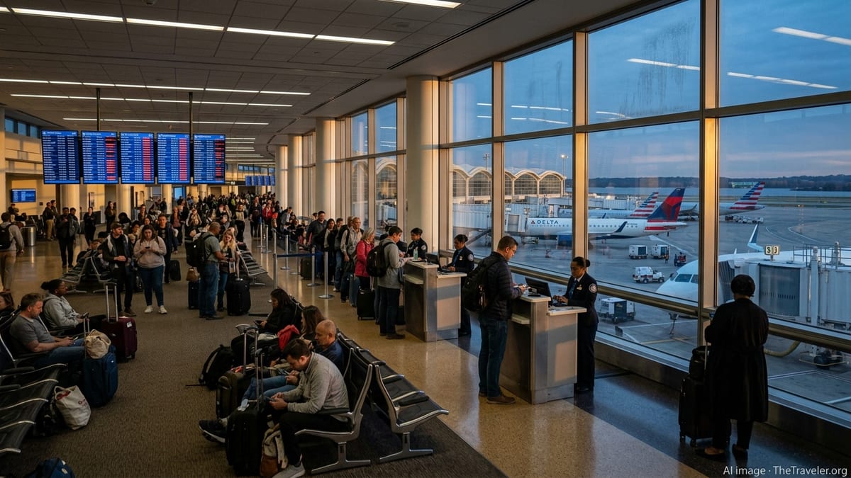
Severe Storms Collide With Peak Summer Travel
The weather-related ground stops came as strong thunderstorms built over the Washington metropolitan area during one of the busiest travel periods of the summer. Publicly available information from the National Weather Service indicated a severe thunderstorm watch in effect for the region through the evening hours, with the potential for damaging winds, lightning and torrential rain reducing visibility around the three major airports.
FAA operational status pages for Reagan National, Dulles and BWI showed traffic management programs tied to thunderstorms, with periods when arrivals were held at their departure points and departures were restricted. These measures are designed to keep aircraft out of congested and potentially hazardous airspace when storm cells move directly across approach and departure corridors.
The combination of convective weather and already full flight schedules meant that even relatively short ground stops quickly translated into wider disruptions. Flights inbound to the capital region were forced to hold, divert or wait on the ground at origin airports, while passengers at Washington area terminals watched as departure times slid further into the evening.
Reports from airline tracking tools and consumer forums suggested that some flights experienced extended delays as storm intensity varied across the region, with brief windows of improved conditions allowing limited operations before new cells moved through.
Ground Stops Ripple Across Airline Networks
The ground stops at the three Washington area hubs affected a range of domestic and international routes, given the role of DCA, IAD and BWI as key connecting points along the busy Northeast and Mid-Atlantic corridors. According to published coverage and airline advisories, carriers implemented flexible rebooking policies for travelers whose trips touched any of the affected airports during the storm window.
Because many aircraft operate multiple segments in a single day, delays in Washington quickly reverberated through airline networks. Aircraft arriving late into the region were often scheduled to continue on to other cities, spreading knock-on delays as crews and equipment became misaligned with planned timetables.
Airlines appeared to prioritize recovering mainline operations once conditions improved, rerouting aircraft and adjusting later departures to accommodate stranded passengers. However, limited gate space at Reagan National and heavy evening traffic at Dulles and BWI constrained how quickly normal flows could resume.
Observers noted that some carriers proactively trimmed schedules or combined lightly booked flights in anticipation of storms, a strategy that can reduce the number of last-minute cancellations but still leaves many passengers arriving hours behind schedule.
How FAA Ground Stops Work During Thunderstorms
Ground stops are one of the FAA’s more restrictive air traffic management tools, used when it becomes unsafe or impractical to continue sending additional flights into an airport’s airspace. In the case of fast-moving thunderstorms, the primary concerns include lightning, sudden wind shifts, low ceilings and reduced visibility along arrival and departure paths.
Public FAA guidance explains that during a ground stop, flights destined for an affected airport are held at their origin until conditions improve or until air traffic managers can safely meter arrivals using other programs. Unlike simple delays, a ground stop can temporarily halt nearly all inbound traffic, leaving only a small number of exceptions such as certain diversions or already airborne aircraft that can be safely accommodated.
At busy airports like Reagan National, Dulles and BWI, thunderstorms can severely limit the number of usable runways and constrain radar coverage as controllers work around active storm cells. When this happens, the rate of arrivals and departures that can be handled safely drops, and a ground stop can be the most efficient way to prevent airborne congestion and minimize time spent holding in turbulent conditions.
Once the most intense weather passes, traffic managers typically transition from full ground stops to arrival and departure delay programs, gradually increasing throughput as radar, runway and taxiway conditions allow. The shift from complete stoppage to reduced-rate operations can still leave significant backlogs, particularly during the evening rush.
Traveler Impact and Advice for the Hours Ahead
For travelers, the thunderstorms and associated ground stops brought familiar scenes at Washington area airports. According to airline apps and flight-tracking services, passengers faced long lines at rebooking counters, crowded gate areas and challenges securing same-day alternatives as already busy flights filled with displaced customers.
Publicly available guidance from airlines and travel advisers consistently recommends that passengers flying through weather-prone hubs monitor their flight status closely, enable mobile alerts and arrive at the airport earlier than usual when storms are in the forecast. During events like the July 21 disruptions, same-day changes through airline apps or customer service channels are often processed more quickly than in-person requests at crowded counters.
Travelers with tight connections at DCA, IAD or BWI were especially vulnerable to missed onward flights as the evening schedule compressed. Some carriers encouraged customers with flexible plans to voluntarily move their trips to earlier or later days, easing the strain on peak-hour operations once thunderstorms subsided.
Rail and road alternatives between Washington, Baltimore and nearby East Coast cities provided backup options for some passengers, although heavy rain and localized flooding risks also affected surface travel times around the region.
Stormy Pattern Highlights Ongoing Vulnerability
The latest round of thunderstorm-induced ground stops underscores how sensitive the Washington region’s air travel system remains to summer weather. The three airports serve overlapping catchment areas and share portions of the same controlled airspace, meaning that a single severe storm complex can disrupt all of them at once.
Recent FAA planning documents and construction impact reports have highlighted ongoing efforts to bolster resilience, including runway and taxiway projects at BWI and procedural updates around Reagan National and Dulles. While these initiatives can improve capacity and safety, convective weather remains an operational constraint that cannot be engineered away.
According to historical data summarized in public reports, the Mid-Atlantic frequently experiences clusters of stormy days in July and August, producing repeated bouts of delays across major hubs. The July 21 event fits that broader pattern, arriving on the heels of other weather and traffic management disruptions in the same airspace earlier in the summer travel season.
For airlines and passengers alike, the experience serves as another reminder that flexibility, real-time information and contingency planning are essential when navigating peak-season travel in one of the nation’s most complex and weather-sensitive airspace regions.