


More news on this day
Travelers moving through Houston’s George Bush Intercontinental Airport faced widespread disruption as Tropical Depression Edouard pushed ashore, sending bands of heavy rain and gusty winds across southeast Texas and rippling through one of the nation’s busiest aviation hubs.
Get the latest news straight to your inbox!
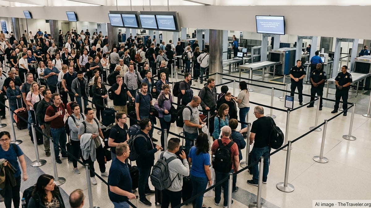
Storm-Driven Disruptions Ripple Through a Major U.S. Hub
Publicly available tracking data and airline status boards on September 1 and 2 show hundreds of flights into and out of George Bush Intercontinental Airport (IAH) affected by Tropical Depression Edouard, which came ashore after strengthening over the warm waters of the northwest Gulf of Mexico. As the system’s outer bands moved over the Houston region, operations shifted into a prolonged period of weather-related delays, rolling schedule changes and scattered cancellations.
According to national air traffic planning information, Houston’s airports were flagged for potential slowdowns as thunderstorms and tropical rain bands built over Texas and Louisiana, tightening usable airspace and complicating arrival and departure flows. While real-time Federal Aviation Administration tools indicated only modest airborne arrival delays at times, the cumulative impact on airlines’ tightly sequenced bank structures resulted in backups that stretched across much of the day.
Airport guidance for disrupted travelers emphasizes that passengers whose flights are canceled or substantially delayed must work directly with their airlines for rebooking or refunds, and refers travelers to U.S. Department of Transportation resources on passenger rights during weather events. The Houston Airport System also points affected passengers toward carrier-specific apps and alerts, which often update faster than terminal display boards during fast-changing storms.
Edouard’s Track Brings Heavy Rain and Hazardous Conditions
National Hurricane Center advisories show that Edouard strengthened from a Gulf disturbance into a tropical storm on August 31 before nearing the northwest Gulf Coast, with forecasters highlighting a compact but intense core and the potential for further intensification before landfall. Subsequent forecast discussions and outlooks from federal meteorological agencies described a quick transition to a tropical depression over land, but warned that the primary impacts for Texas and western Louisiana would be flooding rain, strong gusts and pockets of coastal surge.
Area forecast discussions for the Houston region noted tropical storm warnings along parts of the upper Texas coast and stressed that aviation conditions at Bush Intercontinental would be heavily influenced by passing rain bands and low ceilings associated with Edouard. Even as the cyclone weakened inland, saturated ground, poor drainage in low-lying areas and training showers posed ongoing challenges for ground transportation to and from the airport, including the regional highway corridors that feed IAH.
Elsewhere in Texas, reports compiled by national and local outlets described flash flooding, downed trees and power interruptions as Edouard’s remnants swept inland. Those conditions can indirectly affect airport staffing, ground logistics and passenger access, adding further friction to flight operations even when runways and taxiways remain open.
Traffic Management Measures and Diversion Tools Activated
In the days leading up to Edouard’s landfall, the Air Traffic Control System Command Center issued an advisory activating a diversion recovery tool for Houston Intercontinental, signaling that planners expected significant numbers of flights to be rerouted away from the airport during periods of strongest impact. Such tools are designed to help sequence returning traffic and manage constrained airspace once weather begins to improve, but they also underscore the scale of operational stress that a tropical system can impose on a single hub.
National daily air traffic reports around the time of the storm highlighted Houston alongside other Gulf and Southeast airports as locations where thunderstorms and tropical moisture were likely to slow flights. These planning bulletins offer airlines an early framework for adjusting schedules, rerouting aircraft and repositioning crews, though the precise number of delays and cancellations ultimately depends on rapidly evolving radar trends and ceiling and visibility measurements at the field.
Operational research compiled after previous Gulf storms, such as Hurricane Harvey and later systems, shows that Houston’s dual-airport system is particularly vulnerable to multi-day disruption when tropical weather stalls over the metro area. Analysts have documented patterns of near-total shutdown during extreme flooding events, followed by gradual recoveries as runways are inspected, road access is restored and aircraft and crews are cycled back into position. While Edouard arrived as a weaker system, the same fundamental dynamics influence how quickly schedules can normalize.
Passengers Confront Long Waits and Tight Connections
For travelers on the ground at IAH, Edouard’s timing translated into familiar scenes of crowded gate areas, long customer service queues and mounting concerns over missed connections. Hub-and-spoke bank structures mean that when early-morning or midday inbound banks are significantly delayed, outbound connections are pushed back or canceled outright, often cascading into later flights across the network.
Travel guidance from airport and federal sources consistently urges passengers to build in additional time when tropical systems threaten, particularly for itineraries involving tight connections or international transfers. Same-day rebooking options, standby lists and rolling delays can create confusion when different information appears on airline apps, airport display boards and third-party trackers, but carrier-controlled channels typically provide the most up-to-date status for a specific reservation.
Edouard’s heavy rain and gusty winds also heightened the possibility of ground holds and temporary pauses in ramp activity when lightning or strong crosswinds moved across the airfield. Even relatively short stoppages for safety can quickly magnify departure queues, as aircraft require pushback clearance, deicing or additional inspections before takeoff.
Ongoing Monitoring as Remnants Move Inland
By early September 2, outlooks from national weather centers indicated that Edouard had fully weakened into a tropical depression over the interior of Texas, with responsibility for detailed rainfall and flooding forecasts shifting to domestic prediction centers. Although wind speeds continued to diminish, forecasters still pointed to the risk of flash flooding in saturated basins and urban areas, including parts of the greater Houston region.
Real-time federal aviation dashboards showed improving airborne arrival metrics for Bush Intercontinental at times, suggesting a gradual easing of the most acute weather constraints aloft. However, schedule recovery often lags the meteorological clearing, as airlines work through aircraft positioning, crew duty limits and backlogged passenger reaccommodations.
Travelers with bookings through Houston over the next day or more are advised by airlines and airport outreach materials to monitor their flights closely, use mobile check-in and alerts, and expect residual delays or equipment swaps even after the heaviest rain bands exit the region. With the Atlantic and Gulf still in the climatological peak of hurricane season, carriers and airport authorities are likely to maintain heightened readiness for additional tropical disturbances in the weeks ahead.
National Hurricane Center: Tropical Depression Edouard archive
Federal Aviation Administration: Daily Air Traffic Report
Houston Airports: George Bush Intercontinental Airport flight information