


More news on this day
Airlines across Europe, the Middle East and Asia are increasingly modifying flight paths to skirt conflict flashpoints and invisible navigation hazards, quietly adding time and cost to journeys as the map of perceived risk in global aviation shifts.
Get the latest news straight to your inbox!
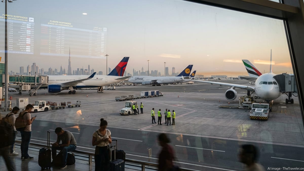
Middle East Tensions Reshape Global Flight Corridors
Recent conflicts involving Iran and Israel have turned parts of the Middle East into some of the most closely watched skies in commercial aviation, with carriers adjusting routings on a scale not seen since the pandemic disruptions. Publicly available flight-tracking data from April 2024 onward shows long haul services between Europe, the Gulf and Asia bending south and west to avoid Iranian and neighboring airspace during periods of heightened tension.
Reports indicate that after Iranian missile and drone attacks targeting Israel in April 2024, followed by retaliatory strikes, multiple countries temporarily closed sections of their airspace. Airlines serving hubs such as Doha, Dubai and Abu Dhabi routed around these closures, extending flight times and creating congestion along alternative corridors over Saudi Arabia, Egypt and the eastern Mediterranean.
Analysis published by industry outlets since 2024 describes how some Europe to Australia and Southeast Asia routes have periodically added 30 to 90 minutes of flying time by detouring around high risk flight information regions. These shifts often happen overnight, with aircraft departing on older routings early in the day and later rotations tracing visibly altered paths to skirt emerging danger zones.
New economic research released in early 2026 estimates that war-related airspace disruptions in the broader Middle East have become a major driver of operating costs. Longer routes increase fuel burn, crew hours and maintenance exposure, raising the baseline expense of connecting Europe and Asia even when airports themselves remain open and schedules appear normal to travelers.
From Conflict Zones to Navigation ‘Dark Spots’
While conflict has long shaped where airlines choose to fly, the list of risk zones is expanding beyond conventional war areas. Guidance from international aviation bodies stresses that operators now weigh a mix of missile threats, drone activity, cyber risks and interference with satellite navigation when planning routes. This broader threat picture has created a patchwork of areas that airlines prefer to avoid at certain altitudes, times of day or phases of flight.
Over Ukraine and parts of neighboring airspace, European regulators maintain strict overflight prohibitions that have been in place since the downing of Malaysia Airlines flight MH17 and reinforced after Russia’s full scale invasion in 2022. Similar caution applies over parts of Sudan, Afghanistan and Somalia, where official notices and advisories underscore the risk of conflict reaching cruising altitudes or threatening airports on the ground.
At the same time, aviation safety specialists have documented a sharp rise in GPS jamming and spoofing incidents, particularly in the eastern Mediterranean, Black Sea region and around parts of the Middle East and Baltic area. Case studies compiled in 2024 and 2025 describe hundreds of daily instances in which aircraft systems briefly receive false position data, creating what some analysts label “navigation dark spots” along otherwise routine air corridors.
In one widely cited example, a cluster of flights near Beirut and the surrounding sea area reported false GPS positions that appeared to place aircraft on the airport apron despite being miles away. Industry assessments note that such interference does not resemble a traditional conflict zone, yet it has prompted airlines and air navigation providers to adjust flight planning, add backup procedures and, in some cases, shift routings around the most persistent interference hotspots.
Quiet Detours, Visible Costs for Airlines and Travelers
These reroutings are often quiet in the sense that they come with little fanfare or public explanation, appearing instead as subtle bends in the flight track or slightly longer block times in schedules. But the financial effect is significant. Consultancy estimates released in early 2026 suggest that each additional hour of flying for a widebody aircraft can add several thousand dollars in fuel and operating costs, magnified across fleets and entire seasons.
Industry analyses of airspace disruptions linked to Middle East tensions and the war in Iran describe airlines facing a difficult trade off between safety margins and profitability. Some carriers have responded by trimming frequencies on the most affected city pairs, tweaking departure times to accommodate longer routings, or nudging fares higher on specific corridors where alternatives are limited and detours are unavoidable.
For passengers, the impact typically surfaces as a combination of slightly lengthened journey times and occasional missed connections when reroutes coincide with congestion or unexpected airspace closures. Travel advisories and airport announcements during major flare ups have urged customers to check their flight status closer to departure, as routings can change rapidly in response to new notices to air missions and evolving security assessments.
Environmental advocates are also drawing attention to the emissions implications of longer routings. Research comparing pre conflict and post conflict patterns through the Middle East and around closed portions of Russian and Ukrainian airspace indicates higher aggregate fuel burn on many Europe to Asia and Europe to Middle East flows, complicating airlines’ decarbonization plans even as they invest in more efficient aircraft.
Data Driven Risk Mapping Behind the Scenes
Behind every detour sits an expanding ecosystem of data and risk analysis. International agencies such as the International Civil Aviation Organization have issued updated guidance since 2023 on how states and operators should assess conflict zones, including new considerations for drones and evolving weapons systems. National regulators, including the Federal Aviation Administration in the United States, publish advisories and restrictions for their carriers operating near global hotspots, supported by crisis response teams and intelligence sharing frameworks.
Airlines layer on their own internal assessments, drawing from commercial security intelligence providers, satellite tracking, and real time monitoring of navigation interference. Case studies from aviation risk firms describe dashboards that color code flight information regions by threat level, incorporating everything from missile tests and drone launches to new patterns of GPS jamming and spoofing activity.
This data driven approach has shifted route planning from occasional, high profile changes to a more continuous process of micro adjustments. Instead of a single blanket decision to avoid one country’s airspace indefinitely, many carriers now fine tune routings by altitude bands, time windows or specific waypoints, seeking to preserve efficiency while staying ahead of emerging threats.
Publicly available information suggests that airlines with more sophisticated risk intelligence capabilities are able to pivot faster when new hazards arise, restoring near optimal routings sooner than peers that rely primarily on formal notices. That speed can translate into meaningful savings when conflict related closures last weeks or months, reinforcing the value of investing in quieter, behind the scenes safety infrastructure.
What Travelers Can Expect as Risk Zones Multiply
For most passengers, the changing risk map remains largely invisible, masked by familiar route numbers and airport codes. Yet the steady accumulation of conflict zones, navigation interference areas and restricted corridors is reshaping how the world connects, especially between Europe, the Gulf and Asia where alternative paths are limited and heavily trafficked.
Travel industry observers expect airlines to continue building extra time into schedules on vulnerable corridors, both to accommodate longer base routings and to leave margin for sudden reroutes around new closures. Some carriers have begun communicating more broadly about airspace disruptions through travel advisories and operational updates, describing rerouting decisions as precautionary steps even when there is no immediate incident.
In the near term, analysts anticipate that higher operating costs linked to detours will remain a background factor in fares, particularly on long haul journeys that already operate close to fuel and crew time limits. If tensions ease in key regions, airlines may be able to gradually restore more direct tracks, but the growing prominence of non kinetic threats such as GPS interference suggests that absolute reversions to pre conflict patterns are unlikely.
As a result, the world’s airways are entering a new phase in which geopolitical risk and invisible electronic disruptions shape routes as much as geography and demand. The detours may be quiet, but their imprint on airline networks, costs and the traveler experience is becoming steadily more pronounced.