


Guayama sits on Puerto Rico’s south coast where dry lowlands, mangrove-fringed bays and cooler interior hills all meet within a short drive. That variety makes it an appealing year-round destination, but it also means the “best” time to visit depends on whether you are walking the historic center, lingering along the coast and Jobos Bay, or escaping uphill into the Carite area. This guide looks at seasons, heat, rain, hurricanes and daylight so you can match your timing to the kind of Guayama experience you want, without assuming perfect weather in any month.
Get the latest updates straight to your inbox!
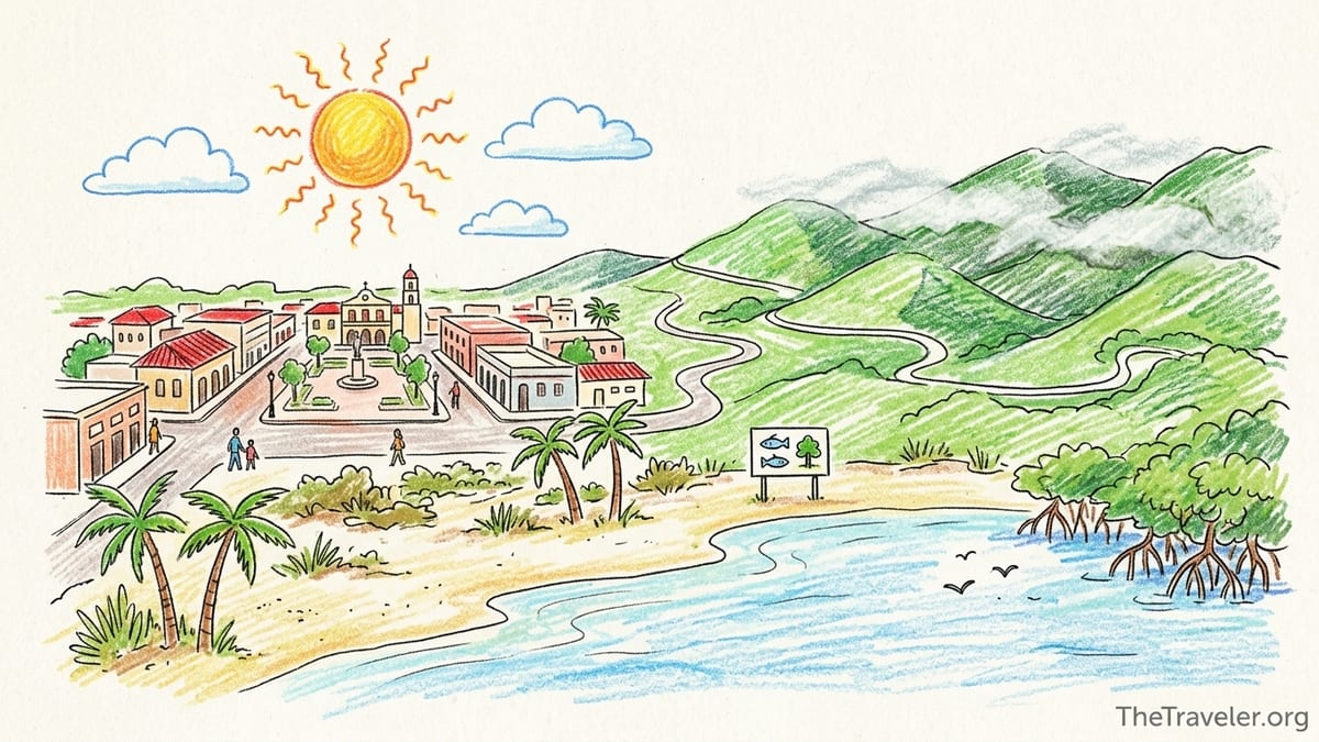
Understanding Guayama’s South Coast Climate
Guayama lies on Puerto Rico’s drier south and southeast coast, facing the Caribbean Sea rather than the open Atlantic. Climate data for Guayama and nearby stations indicate warm conditions throughout the year, with average temperatures around the low 80s Fahrenheit and annual rainfall of roughly four feet, noticeably less than many northern and interior areas of the island. The region falls in what scientists describe as a subtropical dry forest zone, especially around Jobos Bay, with mangroves and coastal scrub adapted to long sunny spells and bursts of heavier rain later in the wet season.
Seasons here are defined less by big temperature swings and more by shifts in humidity, rainfall and the risk of tropical storms. The broadly drier months run from about January to April, when skies are often clearer and showers shorter. From May into November, humidity rises, passing showers become more frequent, and September and October can bring the most intense rain along with peak hurricane risk. Even in the driest weeks, though, clouds can build quickly and a sunny morning can turn stormy by mid-afternoon, so flexibility is essential.
Daytime highs typically sit somewhere in the upper 80s to low 90s Fahrenheit near sea level, which can feel hotter on Guayama’s concrete streets or the exposed coastal plain. Nights on the coast usually cool only into the mid to upper 70s, which many visitors find comfortable for an evening paseo through the plaza or a late dinner on the Ruta Gastronómica de la Costa. In the hills toward Carite, temperatures trend a few degrees lower and evenings can feel distinctly fresher, especially after rain.
Wind also shapes how the weather feels. Trade winds tend to arrive from the east, sometimes funneled along the south coast. On the historic streets and in the central plaza, breezes can help late-afternoon heat feel more tolerable. Along beaches and the mangrove channels of Jobos Bay, the same winds can bring welcome relief but may also kick up choppy water on certain days. In the Carite area, mist and low clouds can ride in on humid days, shifting conditions from bright sunshine to cool overcast in minutes.
Historic Center: Heat, Rain and Urban Walking Conditions
Guayama’s compact historic center, anchored around its plaza and church, rewards travelers who like to explore on foot. The challenge is timing your visit around midday heat and sudden showers. From roughly March through October, the sun is very strong between late morning and mid-afternoon. Pavement, pastel-walled buildings and limited tree cover on some streets amplify the heat, so a walking itinerary is more comfortable if you focus your longest strolls between about 8:00 and 10:30 in the morning or after 4:30 in the afternoon.
In practice, a visitor arriving in February might plan to grab a coffee and breakfast sandwich at a local bakery, then spend a couple of hours seeing the plaza, nearby streets and any open historic buildings before the sun climbs higher. By 11:00, heat and light can already feel intense, even in winter, which is why many locals retreat indoors for lunch or errands. After a break, you could return around sunset for a paseo when the square is livelier and temperatures have eased.
Rain patterns influence urban walking in different ways depending on month. During the relatively drier period from January to April, showers around town are often brief and can even feel cooling, though drainage may be uneven on older streets. As you move into May and June, afternoon cloud buildups become more common, and by late summer short, heavy downpours can flood intersections for a time. Puddled streets, slick sidewalks and frequent lightning in the wider region make it wise to have indoor alternatives such as cafes, small museums or shops in mind whenever storms appear in the forecast.
Daylight length is fairly stable year-round, with the sun generally rising between about 6:00 and 7:00 in the morning and setting between roughly 6:00 and 7:00 in the evening. That consistency allows you to keep similar walking hours in every season, but the character of the light changes. Winter sun angles are a touch lower and marginally gentler, while midsummer brings a higher, more overhead sun. In high-sun months, even a short unsheltered walk at midday can feel draining, so visitors sensitive to heat often treat central Guayama like a city in the tropics: errands and sightseeing early and late, air-conditioned downtime at noon.
Along the Coast and Jobos Bay: Sun, Mangroves and Tropical Weather
Guayama’s coastal zone, including stretches of the Caribbean shoreline and the mangroves around Jobos Bay, experiences some of the hottest and sunniest conditions in the municipality. Scientific work in the Jobos Bay National Estuarine Research Reserve describes the bay’s surroundings as part of a dry southern coastal ecosystem, with limited annual rainfall compared to Puerto Rico’s interior, but a pronounced rainy peak around September. That means long sunny spells are common in winter and spring, while late summer and early autumn can bring sequences of unsettled days.
Visits to beaches, boardwalks or mangrove lookouts are especially exposed to direct sun. Wooden decks or sand reflect light, and breezes sometimes mask how quickly skin can burn. From roughly February through September, ultraviolet levels are usually high enough that a couple of hours on the water without sun protection can lead to serious sunburn for fair-skinned visitors. Light, long-sleeved clothing, hats that stay put in the wind, and reef-safe sunscreen are good ideas in every season. On calm, hot days, the mangrove channels can feel like a steam bath, so some birders and kayakers prefer starting at or shortly after sunrise to enjoy cooler air and more active wildlife.
Insects are another seasonal detail that shapes coastal outings. Mangrove edges and sheltered lagoons around Jobos Bay can host biting insects year-round, but numbers often feel higher after heavy rains or in very still, humid weather. During the drier early months, breezier days on the coast may keep most insects at bay except at dawn and dusk. When humidity rises and rain leaves behind standing water, you may encounter more mosquitoes in sheltered pockets, particularly at sunrise or in late afternoon shade. Lightweight long pants and effective repellent can make the difference between a relaxed birding session and a hurried retreat.
Tropical waves and storms have a direct effect on coastal plans. From June through November, and especially from August into early October, disturbances moving across the Caribbean can bring large swells, strong winds or days of on-and-off rain even if the center of a storm passes far away. That can mean murkier water, floating debris or sargassum on some beaches, and authorities may temporarily close certain coastal access points or advise caution. For any coastal or boating activity near Guayama, it is important to review the latest marine forecasts and tropical outlooks before you set out, rather than relying on general seasonal expectations.
Carite and the Interior Hills: Cooler Air and Changing Skies
North of Guayama, roads climb toward the Carite area and the spine of Puerto Rico’s Cordillera Central. Elevations rise to well over 2,000 feet in nearby Carite State Forest, and even lower slopes accessible from the Guayama side feel noticeably cooler than the coastal plain. The air here is more humid and the landscape greener, a contrast to the drier lowlands you pass leaving town. Climate descriptions for Carite refer to a humid, cool forest environment, with the wettest conditions often between about May and October, aligning with the island’s broader wet season.
For visitors, that translates into more comfortable mid-day temperatures for hiking or scenic drives, but also a higher chance of cloud, drizzle or fog, particularly in the afternoons. A summer morning might begin with blue sky around the ridges before clouds billow up toward midday. By early afternoon, light rain or a short thunderstorm could sweep in, only to clear again before sunset. Trails can become muddy quickly, so footwear with grip is useful even on short walks to roadside viewpoints.
Compared with Jobos Bay, insects in the hills are often less tied to mangrove and saltmarsh habitats, but you may still encounter mosquitoes around wet spots and streams, especially after rain. Cooler air can lull travelers into forgetting sun exposure at these elevations; even under thin cloud, you can burn during a long walk on an open ridge or road shoulder. Packing a light layer or rain shell is wise too. When tropical systems affect Puerto Rico, upland areas can receive heavy rainfall, leading to slick roads, roadside rockfall and swollen streams, so routes in and out of the Carite area should be planned with weather updates in mind.
Because the hills sit close to Guayama, it is realistic to start a day with a walk in the historic center, drive up toward the Carite area for a cooler early afternoon, and be back on the coast for an evening meal. The catch is that conditions can differ sharply between zones. A hot, cloudless midday in town may coincide with mist or showers in the uplands, or the reverse. Checking the forecast for both Guayama and an inland reference point, then watching live radar or satellite imagery before you commit to the drive, gives you a better chance of picking the most pleasant microclimate on any given day.
Weekends, the Coastal Gastronomy Trail and Crowds
Guayama’s “Ruta Gastronómica de la Costa,” or Coastal Gastronomy Trail, is one of the town’s main draws for both residents and visitors. Official tourism descriptions portray this coastal route as a favorite with locals, lined with restaurants specializing in fresh seafood and other Puerto Rican dishes. Many of these spots cluster along the south-coast highway between the urban area and neighboring municipalities, with sea views, open-air seating and music that make them natural weekend gathering places.
On Saturdays and Sundays, especially around midday and late afternoon, you can expect heavier traffic along the route, longer waits for a table and livelier, sometimes louder, atmospheres. Families may arrive from surrounding towns, and groups of friends make a full day of moving from one coastal restaurant to another. This energy is part of the appeal for travelers who enjoy people-watching and local ambiance, but it does change the experience compared with a quieter weekday lunch. Parking near popular stops can be tight on Sunday afternoons, just when the sun is strongest and shade is scarce along the roadside.
Weather interacts with this weekend pattern. A dry, sunny Sunday in February may bring especially large crowds, as southern residents escape cooler, wetter conditions elsewhere on the island. On such days, consider having an early seaside lunch before the midday rush, then shifting inland or back to town during the hottest hours. During late summer and the peak of hurricane season, unsettled forecasts might thin crowds slightly, but sudden downpours can quickly fill any covered tables and make outdoor seating less comfortable. A traveler arriving in late August, for example, will benefit from calling ahead where possible and having a flexible timeframe for coastal meals in case a storm cell passes over.
If you want to combine the Coastal Gastronomy Trail with other activities, weekday visits can make logistics easier. Arriving for a late lunch on a Tuesday in March, pairs or small groups are more likely to find shaded seaside tables without a wait, then still have time for a gentle stroll by the water or a short drive to a nearby lookout before sunset. Weekends, by contrast, suit those who prioritize atmosphere over ease of movement and do not mind heat, lines or more limited quiet corners.
Hurricane Season, Rainy Months and Daylight Considerations
Guayama, like the rest of Puerto Rico, lies in the Atlantic hurricane basin. The official hurricane season runs from June 1 to November 30, with statistical peaks in activity from late August through early October. During this broad window, tropical waves, depressions and storms can affect weather even if a storm does not make landfall on the island itself. For travelers, that means any trip in these months should build in more flexibility, include refundable bookings when possible, and rely on live tropical updates in the days before and during the visit.
Rainfall patterns shift along with hurricane risk. Even in the drier south, May often marks an uptick in showers, and by September the combination of very warm sea surface temperatures, high humidity and passing disturbances can deliver some of the heaviest rains of the year. On the coast and around Jobos Bay, this may translate into swollen lagoons, muddier access tracks and hazier views across the mangroves. In the Carite hills, streams and waterfalls can run stronger, but trails may be slippery and some unpaved secondary roads can deteriorate quickly. Urban Guayama can see temporary street flooding or power interruptions during stronger storms.
Outside of hurricane season, roughly December through April tend to bring somewhat more stable weather, though strong cold fronts over the Atlantic can still send bands of showers and increased surf onto the south coast. In these months you are more likely to experience runs of bright, breezy days ideal for walking the historic center or spending a few hours by the sea, but there is never a guarantee of clear skies. A January week could still include gray, showery days, and an April trip might catch an early-season downpour.
Daylight hours do not swing widely at Guayama’s latitude, but even the modest variation matters for planning. A December visit offers slightly longer pre-heat morning windows for walking and birding, as the sun angle climbs slower and evenings often feel fresh enough for an early dinner outside. By June and July, the combination of high sun, very warm sea temperatures and muggy air may push many travelers to reserve the midday block strictly for shaded or indoor pursuits. Whatever the month, aligning your main outdoor efforts with the first and last third of the day improves comfort and helps avoid the harshest conditions.
Seasonal Pros and Cons by Activity Type
For history lovers focused on Guayama’s urban core, the relatively cooler, somewhat drier stretch from January through early April is often appealing. Daytime highs are still warm, but humidity can feel modestly lower than in late summer, and the chances of direct hurricane impacts are reduced outside the June to November season. Planning walking tours early and late in the day, with a long lunch and museum stop at midday, works in any month, but may be most comfortable in this winter-to-early-spring window. That said, travelers who can only visit in, say, July should not rule out the historic center; they simply need to be more disciplined about starting early, hydrating and taking shade breaks.
If food is the priority, including time on the Coastal Gastronomy Trail, you have options year-round, with nuances. Winter weekends showcase the social energy of local families on coastal outings, while midweek visits from late January to March often offer a balance of activity and ease. Summer brings longer evenings and the possibility of lingering by the water after a late sunset meal, but also higher humidity, more intense sun on outdoor terraces and the growing need to watch storm forecasts. Whenever you come, reserving or at least phoning popular spots during local holidays and long weekends can help avoid long waits in the heat.
Birders and nature-focused travelers might look to the shoulders of the wettest period, such as late February to April and again in November or early December. Around Jobos Bay, these windows can offer active birdlife in mangroves and mudflats without the most oppressive summer humidity. In the Carite area, the early wet season months may cloak the hillsides in lush green while still keeping trail conditions manageable. However, bird migration, breeding patterns and specific wildlife highlights vary from year to year, so consulting local naturalist groups or the staff of protected areas for recent observations before your visit is as important as reading long-term climate summaries.
Golfers using regional courses along the south coast, reachable by car from Guayama, will find that early tee times are valuable in every season. From December through March, you might enjoy more consistent breezy mornings and slightly cooler fairways, while June through September can mean a heavy, humid feel already by mid-morning and a higher likelihood of afternoon thunderstorms. Packing extra water, a towel and sun gear and watching early radar helps you adjust your tee time and avoid being caught on an exposed hole during a sudden storm.
Designing a One-Day Combined Visit
Many visitors fold Guayama into a broader circuit of southern Puerto Rico, perhaps driving from San Juan through the interior and down to the coast. For a single full day focused on Guayama, timing matters. In a relatively dry-season month like February, you might begin around 8:00 in the historic center, walking the plaza area while temperatures are still mild. By 10:30 or 11:00, shifting to an air-conditioned cafe or an indoor cultural stop lets you avoid the sharpest midday sun on the streets.
From late morning into early afternoon, you could drive toward the Carite area for cooler air and short scenic stops. On a spring day, you might find low clouds drifting over the ridges and a light shower passing through, while temperatures remain comfortable enough for brief walks at viewpoints or roadside picnic areas. Rain gear and a change of footwear stored in the car help you adapt if showers linger.
Later in the afternoon, especially outside the rainiest late summer weeks, you could circle back to the coast and join the Coastal Gastronomy Trail for an early dinner. Arriving at seaside restaurants around 4:30 or 5:00 gives you a better chance at shaded seating before peak weekend crowds, and it keeps you from standing in line during the hottest part of the day. After your meal, a short stroll by the water or a drive to a coastal overlook lets you enjoy the softer light of early evening before returning inland or onward to your next stop on the island.
During hurricane season or on days when forecasts show strong storms building by afternoon, you might invert this plan: start with a very early coastal walk and breakfast by the sea, move into the historic center while conditions remain stable, then retreat inland or back to your accommodation once radar shows storms approaching. Building backup options, such as indoor cultural visits in Ponce or Caguas, into your broader itinerary gives you more resilience if Guayama’s local weather turns unsettled.
The Takeaway
There is no single “best month” to visit Guayama, and no time of year guarantees the kind of weather you might hope for. Instead, the town offers different strengths in different seasons: somewhat drier, more stable conditions for city walking and food outings in winter; greener hills and livelier mangrove ecosystems in parts of the wet season; lingering summer evenings for coastal dining; and the always-cooler refuge of the Carite area within a short drive.
Thinking of Guayama not as one destination but as three overlapping zones helps you choose well. The historic center is at its most comfortable early and late each day, particularly from January to April. The Jobos Bay and coastal strip promise strong sun, beautiful light and active birdlife mixed with insects and, in some months, tropical-weather uncertainty. The interior hills add a nearly year-round escape from coastal heat but can be cloudier and wetter, especially from May through October.
Whichever season you choose, two habits matter more than any long-term climate average: checking up-to-date, localized forecasts for both Guayama and nearby upland areas, and monitoring tropical weather outlooks closely before and during travel between June and November. If you combine that information with flexible planning and realistic expectations about heat, rain and crowds, you can align your visit with your priorities, whether that is history, food, birds, golf or a compact one-day sampler of all three landscapes around “la ciudad bruja.”
FAQ
Q1. What is the most comfortable time of year for walking Guayama’s historic center?
The period from about January through early April often brings slightly lower humidity and somewhat fewer heavy showers, making early-morning and late-afternoon walks in the center more comfortable than in late summer. Even then, midday sun can be intense, so it is better to avoid long walks in the hours around noon.
Q2. When are coastal conditions around Jobos Bay usually sunniest?
Winter and early spring, roughly from January to April, often bring strings of sunny days around Guayama’s coast, with fewer prolonged rain events than late summer. However, even in these months clouds and showers can develop, so checking the short-term marine and weather forecasts close to your visit remains important.
Q3. Are the Carite hills significantly cooler than Guayama’s coast?
Yes, the higher elevations toward Carite typically feel a few degrees cooler than the coastal plain and more humid, especially from May through October. Visitors often notice the difference most in the middle of the day and in the evening, when a light layer can be welcome after a hot morning in town or by the sea.
Q4. How does hurricane season affect travel plans in Guayama?
Hurricane season, from June through November, brings a higher risk of tropical storms, heavy rain, rough seas and occasional infrastructure disruptions. Travelers visiting in this period should monitor tropical outlooks closely, choose flexible bookings where possible, and be prepared to adjust or cancel coastal and mountain plans if official advisories or local conditions warrant.
Q5. Are weekends a good time to try the Coastal Gastronomy Trail?
Weekends are very popular along the Coastal Gastronomy Trail and can be ideal if you enjoy lively atmospheres, music and people-watching. Expect heavier traffic, limited parking and longer waits at well-known restaurants on sunny Saturdays and Sundays, especially in the middle of the day, and plan hydration and sun protection accordingly.
Q6. What should I pack for nature outings in the mangroves and along the coast?
For coastal and mangrove excursions, it is wise to bring sun-protective clothing, a hat that stays on in the wind, reef-safe sunscreen, insect repellent, plenty of water and footwear that can handle wet, sometimes muddy ground. These items help you cope with strong sun, reflective surfaces, biting insects and sudden showers that are possible in any month.
Q7. Do insects pose a big problem for visitors in Jobos Bay or the Carite area?
Insects such as mosquitoes can be noticeable around mangroves, lagoons and wet forest areas, especially after rain and during very humid, still conditions. They are usually not a barrier to visiting if you wear light long sleeves and pants where appropriate and apply effective insect repellent, but sensitive travelers should plan ahead for dawn and dusk, when biting insects may be more active.
Q8. Is it safe to plan golf or other open-air sports in the wet season?
Golf and similar open-air sports can still be enjoyable during the wet season, provided you book early tee times, prepare for higher humidity and remain alert to storm development. Watching radar and forecasts on the day of play is important so that you can adjust start times or cut a round short if thunderstorms or heavy rain approach.
Q9. Can I comfortably combine the historic center, hills and coast in one day?
Yes, many travelers design a day that starts with an early walk in the historic center, continues with a midday drive and short walks in the cooler hills, and finishes with an early evening meal on the Coastal Gastronomy Trail. The key is to align each activity with the most favorable time of day for heat and rain, and to be ready with indoor or alternate plans if weather conditions change.
Q10. Should I rely on climate averages when planning a trip to Guayama?
Climate averages are helpful for understanding general patterns, like which months tend to be wetter or drier, but they do not guarantee specific conditions for your dates. Always pair long-term information with live weather forecasts, radar and, in hurricane season, storm updates in the days leading up to and during your trip to make informed decisions.