


More news on this day
Air travelers across the United States face a heightened risk of flight delays today as a combination of late-summer thunderstorms, extreme heat and ongoing airport construction converges on some of the country’s busiest hubs, according to federal air traffic planning updates and national forecast guidance.
Get the latest news straight to your inbox!
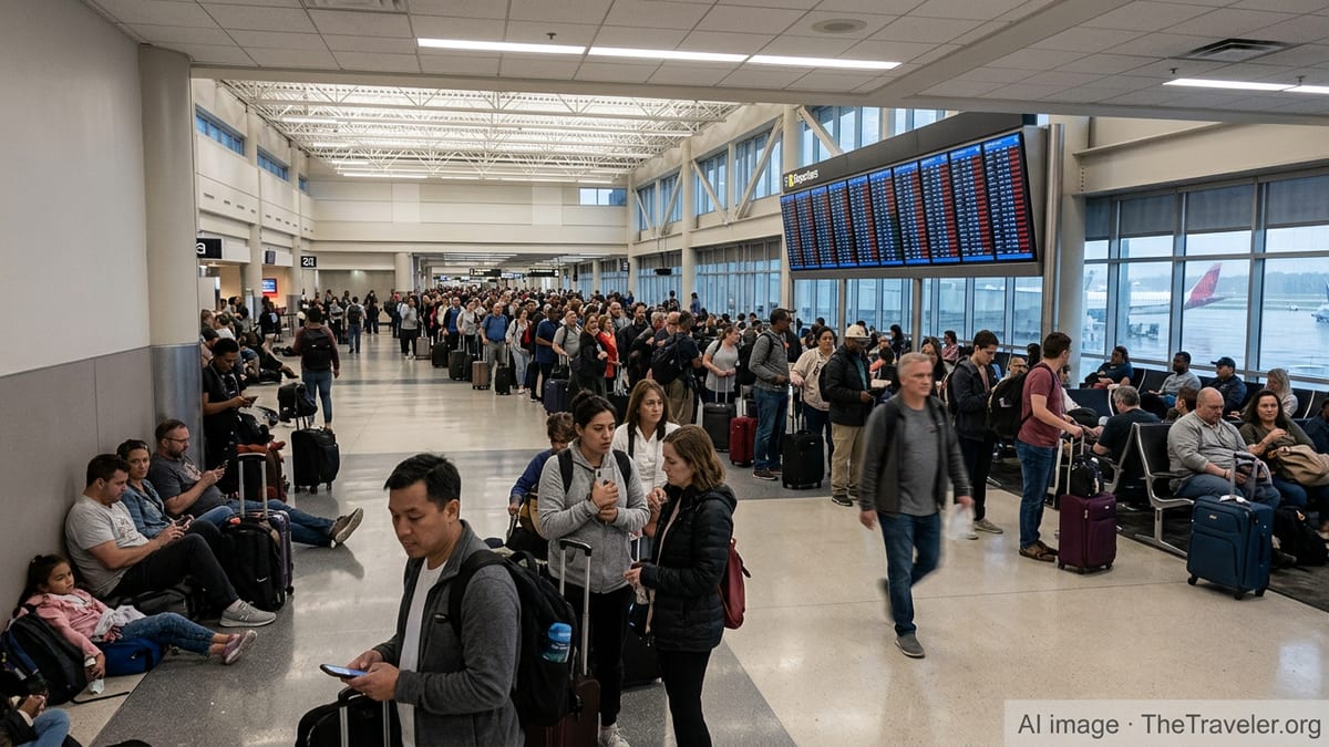
Storms threaten on-time departures at key hubs
Thunderstorm activity is expected to affect several major airports today, particularly in Florida, the Central Plains and parts of the Rockies, which could disrupt departure and arrival banks during peak periods. The latest Federal Aviation Administration (FAA) daily air traffic report highlights the potential for weather-related slowdowns in central and south Florida, including Fort Lauderdale, Miami, Orlando and Tampa, as well as Minneapolis–St. Paul, Houston and Denver.
Convective storms near busy terminal areas can trigger spacing requirements between aircraft, lower arrival rates and temporary ground stops, all of which contribute to delays that ripple through airline networks. Forecast discussions from National Weather Service (NWS) offices in Miami and Houston describe numerous or scattered thunderstorms through midweek, with some storms capable of heavy rainfall, gusty winds and frequent lightning, conditions that can halt ramp operations and extend turnaround times.
National guidance from the Weather Prediction Center points to a corridor of organized thunderstorms from the Middle Mississippi Valley into the Great Lakes and Ohio Valley, alongside pockets of excessive rainfall risk in the Southwest and central United States. This pattern increases the chance of en route reroutes and holding, particularly for long-haul flights crossing the central part of the country during afternoon and evening hours, when storm coverage typically peaks.
Travelers connecting through weather-sensitive hubs, or flying late in the day when schedules are already compressed, are more exposed to knock-on impacts from these storm complexes even if local conditions at their departure airport appear calm.
Extreme heat adds operational strain to summer schedules
Alongside storms, persistent heat across the southern tier of the United States is adding another layer of complexity to airline operations. Area forecast discussions from NWS offices in Brownsville and Miami indicate widespread major to extreme heat risk persisting through at least the end of the week, with heat indices frequently topping 108 degrees Fahrenheit in parts of Texas and heat advisories common across Deep South Texas.
High temperatures can affect aircraft performance on departure, particularly at busy airports with fully loaded aircraft, and can lead to weight restrictions or longer takeoff rolls on shorter runways. While major jet-capable runways are designed to accommodate operations under a broad range of weather conditions, prolonged heat can still interact with heavy schedules, runway work and occasional wind shifts to slow the pace of departures.
The national hazards outlook from the Weather Prediction Center continues to flag an extended late-summer heat wave over the southern Plains and Gulf Coast region. This pattern keeps demand for travel elevated while also increasing the likelihood of localized ground delays as crews manage heat safety protocols on the ramp and in terminal areas, where additional time may be needed to rotate staff and handle equipment.
For passengers, the combination of heat and thunderstorms can create a stop-and-go operating environment at large hubs, where even short disruptions quickly translate into longer taxi times and missed connection windows.
Construction and capacity limits increase delay risk at major hubs
Beyond daily weather, ongoing airfield construction and temporary runway closures are also contributing to possible delays at several of the country’s busiest airports. The most recent advisory from the FAA’s Air Traffic Control System Command Center lists extended runway and taxiway work at San Francisco, Seattle, Houston, Dallas–Fort Worth and other large facilities, with some projects continuing into mid-November and beyond.
At San Francisco International Airport, for example, construction affecting Runway 01R/19L and associated taxiways has already required a ground delay program, with recent planning bulletins citing expected scheduling delays in the 45 to 60 minute range during peak periods. Similar notices highlight reduced runway availability at Baltimore/Washington, Boston and Houston Hobby, where closures can compress arrival and departure flows into remaining pavement and reduce flexibility when weather or traffic demand shifts quickly.
Separately, federal notices covering summer scheduling at Chicago O’Hare describe temporary limits on the number of daily operations to reduce overscheduling and large-scale disruption during peak hours. According to published material in the Federal Register, the FAA moved to cap total operations for the Summer 2026 season at levels intended to reflect the airport’s demonstrated manageable capacity, citing data that showed roughly three-quarters of prior delays reached the 15-minute reportable threshold.
These planned constraints do not guarantee delays on any given day, but they illustrate how closely capacity is being managed at major hubs. When weather disturbances or airspace flow programs are layered onto a schedule already running near its operational ceiling, the margin to absorb disruptions becomes thin and the risk of extended delays grows.
Tropical activity and national planning keep outlook fluid
In the background, forecasters are also watching developing tropical systems that could influence flight operations in the coming days. The National Hurricane Center’s latest outlooks for the Atlantic and eastern Pacific basins describe active disturbances, including Tropical Storm Lowell in the eastern Pacific and additional areas of low pressure with high probabilities of development south of the Baja California Peninsula.
While the primary impacts from these systems currently focus on maritime interests and the central and eastern Pacific, the pattern underscores the late-season tropical risk window that typically runs through the coming weeks. Closer to the continental United States, tropical waves moving through the Caribbean and western Atlantic are being monitored for signs of organization, with clusters of showers and thunderstorms occasionally brushing portions of Florida and the Gulf Coast.
The FAA’s national operations plan, summarized in recent air traffic advisories, reflects this fluid environment by flagging the potential for additional ground delay programs and airspace flow programs when convective weather, traffic volume or spaceflight operations intersect. Advisories issued in recent days reference possible programs for Northeastern airspace during severe weather episodes, as well as ground stops at West Coast hubs when low ceilings, marine layers or runway work reduce arrival rates.
Travelers flying over the next several days may therefore see a mix of short-notice traffic management initiatives, schedule adjustments and re-routes as air traffic planners respond to evolving weather and tropical developments.
What travelers should expect and watch today
For passengers, the immediate outlook points to the highest delay risk at hubs expecting thunderstorms during busy afternoon push periods, particularly in Florida, the central United States and the Rockies. National forecast charts highlight an active frontal zone from the Great Lakes to the Central Plains, where a slight risk of excessive rainfall and severe thunderstorms could affect key north–south and east–west routes.
Publicly available information from the FAA reiterates that national planning products provide a broad picture of expected impacts rather than flight-specific status. Individual flight delays depend on factors such as airline schedules, crew and aircraft availability, and any local constraints at origin or destination airports, including temporary runway closures or taxiway work.
Given the overlapping influences of storms, heat and infrastructure projects, travelers are likely to encounter longer-than-normal taxi times and periodic gate holds in some markets, especially on afternoon and evening departures. Airports that serve as major connection points, including those in Florida, Texas, the Midwest and the West Coast, are particularly exposed to cascading disruptions if convective weather flares at the wrong time.
Passengers are encouraged, according to airline and government travel guidance, to monitor real-time flight status tools, allow extra time for connections, and be prepared for schedule changes when severe weather or national traffic management programs are in effect.