


More news on this day
Carved into a steep chasm of dark volcanic rock in western Colorado, Morrow Point Reservoir is increasingly drawing boaters and anglers who want a dramatic, fjord-like escape without the crowds common at better-known Rocky Mountain lakes.
Get the latest news straight to your inbox!
A Narrow, Cliff-Walled Reservoir in the Heart of Curecanti
Set within Curecanti National Recreation Area between Blue Mesa and Crystal reservoirs, Morrow Point Reservoir occupies one of the most canyon-like stretches of the upper Gunnison River. Publicly available information describes a long, narrow body of water hemmed in by cliffs that in places drop hundreds of feet almost directly to the shoreline, creating a profile often compared to a miniature fjord high in the Rockies.
The reservoir is impounded by Morrow Point Dam, a concrete double arch structure completed in the late 1960s as part of the Aspinall Unit of the Colorado River Storage Project. Above the dam, the Gunnison River backs up into a series of tight bends and alcoves, with the water surface typically sitting more than 7,000 feet above sea level. Recent federal operations data indicate that reservoir levels in mid-summer 2026 have supported both hydropower generation and flatwater recreation, even as storage conditions fluctuate across the Colorado River basin.
Unlike many broad Western impoundments, Morrow Point remains relatively undeveloped along its immediate shoreline. Access points, trailheads and small primitive campsites are set back from the water at intervals, while most of the corridor retains the feel of a remote gorge linked historically to the nearby Black Canyon of the Gunnison.
Hand-Carried Boats Only on a Quiet Stretch of Water
Recreation guidance from the National Park Service describes Morrow Point Reservoir as a destination for non-motorized, hand-carried craft, including kayaks, canoes and small rafts. To reach the water, visitors typically descend steep stairways or trails from canyon-rim parking areas down to simple launch points, a physical filter that helps keep overall boat traffic relatively light compared with drive-up marinas at Blue Mesa Reservoir.
Regulations summarized in state and federal materials emphasize a low-noise, low-wake environment that aligns with the reservoir’s narrow footprint. With internal combustion engines restricted and access limited to those prepared for a substantial climb in and out of the gorge, paddlers often report stretches of near solitude, broken mainly by the sound of water against rock and the occasional tour craft operating under park concession permits in peak season.
Safety advisories highlight that conditions can be markedly different from typical lake outings. The canyon walls can block sunlight for long periods, water temperatures remain cold even in mid-summer, and sudden weather changes on the surrounding plateau can send gusty winds funneling through the gorge. Public planning information recommends treating any outing as a backcountry trip, with self-reliant navigation, personal flotation devices and careful attention to changing water levels.
Fishing Regulations Reflect a Changing Coldwater Fishery
Morrow Point Reservoir and its associated reaches of the Gunnison River support a mix of coldwater species shaped by decades of reservoir management and evolving regulations. State rule summaries list kokanee salmon, various trout and several warmwater species among the principal targets, with special measures in place in nearby reaches to protect wild rainbow trout and limit the spread of nonnative predators.
Colorado’s current code of regulations for coldwater impoundments in the Gunnison basin identifies specific closures and tackle restrictions around dam structures and tributary inlets. On stretches near Morrow Point Dam, angling may be prohibited within posted distances of the structure, while some upstream or downstream segments require the use of artificial flies and lures only, with mandatory release of certain trout species. These rules are adjusted periodically in response to monitoring data on population trends and angler harvest.
For kokanee, published brochures from Colorado Parks and Wildlife indicate a focused snagging season in specified Gunnison-area waters, including portions of the Curecanti system, to manage dense spawning runs. Anglers are advised to review the most recent statewide fishing brochure and site-specific signage before targeting salmon or warmwater species in and around Morrow Point, as creel limits and allowed methods can change with updated management plans.
Signature Scenery, Trails and a Historic Railroad Landmark
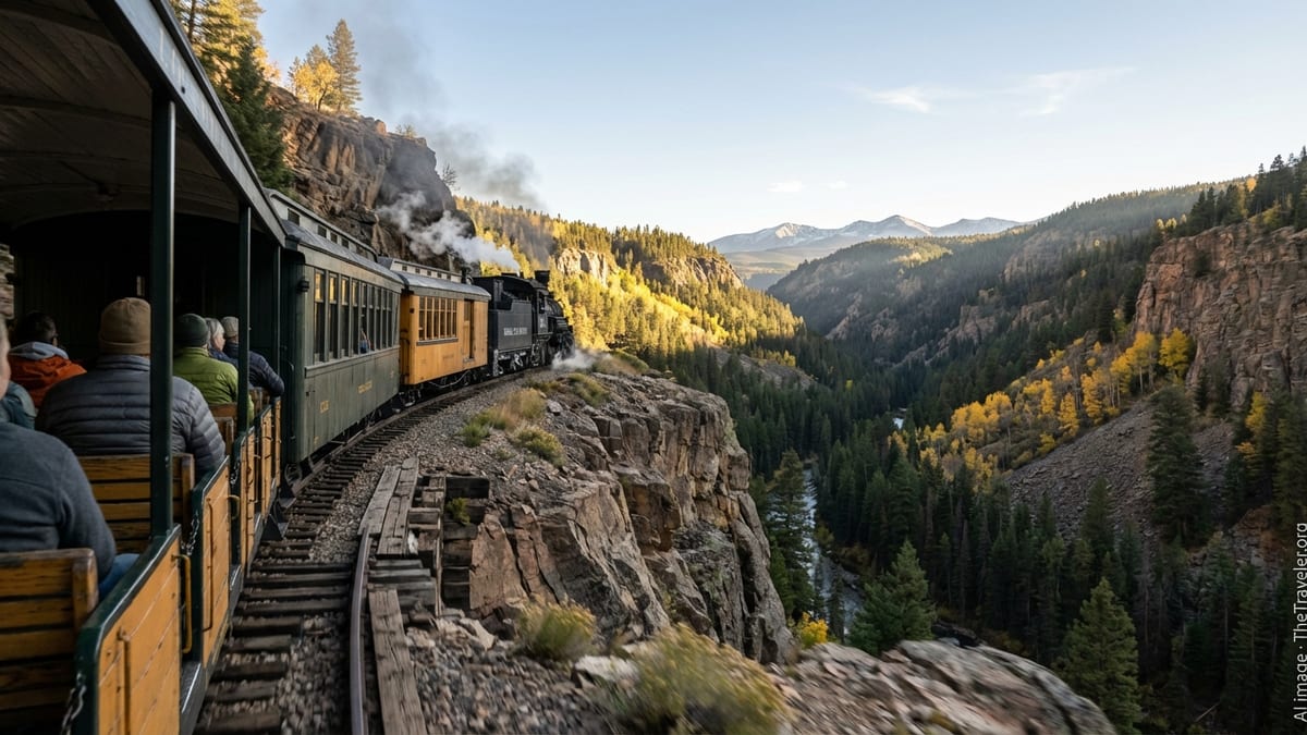
Beyond boating and fishing, the reservoir’s most widely recognized feature is the Curecanti Needle, a prominent granite spire rising an estimated 700 feet from the south shore. Historical accounts describe the formation as an early marketing icon for the Denver and Rio Grande Western Railroad, whose narrow-gauge line once clung to ledges along the river, offering passengers dramatic views of the gorge and its distinctive pinnacle.
Today, the rail line is gone, but the Needle remains a focal point for paddlers and tour boats as they navigate the central reaches of the reservoir. On calm days, the spire’s reflection can stretch across the dark water, reinforcing comparisons to Scandinavian fjords where sheer rock walls plunge straight into long, glacially carved inlets.
On the canyon rims, established overlooks such as Pioneer Point provide vantage points into the gorge and serve as gateways to challenging backcountry routes. The Curecanti Creek Trail, identified in park materials as a steep, roughly four-mile round-trip hike with about 900 feet of elevation change, descends through mixed forest to campsites and a suspension bridge near the reservoir edge. Observational data compiled in a recent National Park Service wilderness plan suggest that even in peak season, hikers on these routes encounter relatively low visitation compared with other Colorado destinations.
Access, Fire Restrictions and Trip-Planning Considerations
Travelers typically reach the Morrow Point area via U.S. Highway 50 west of Gunnison or east of Montrose, then follow signed spur roads into Curecanti National Recreation Area. While nearby Blue Mesa Reservoir has developed campgrounds and marinas that accommodate larger boats, services at Morrow Point are more limited, with an emphasis on day use, self-issue backcountry permits and basic facilities concentrated near trailheads and overlooks.
In 2026, travelers planning a trip to this section of the Gunnison corridor are being urged by public land managers and regional destination sites to check for temporary restrictions related to wildfire danger and ongoing infrastructure work. Recent notices tied to Black Canyon of the Gunnison National Park and Curecanti National Recreation Area describe staged fire restrictions that can affect campfires, smoking and other open-flame activities across both units during periods of high risk.
Water operations data published by the Bureau of Reclamation also indicate that flows and reservoir elevations may shift over short periods in response to hydropower demand, downstream obligations and regional hydrology. Boaters are advised in planning materials to anticipate changing shoreline configurations, submerged obstacles and potentially strong currents near the upper and lower ends of the reservoir, particularly close to dam structures and river inlets.
With its combination of narrow, cliff-lined waters, regulated non-motorized boating and tightly managed fisheries, Morrow Point Reservoir is emerging as a niche destination for travelers seeking a quieter, more rugged style of Rocky Mountain lake experience. For those willing to shoulder a boat down steep access routes and adapt to backcountry-style conditions, the reservoir offers a rare chance to paddle and fish in a setting that feels closer to a high mountain fjord than a typical Western reservoir.