


More news on this day
Powerful afternoon thunderstorms over the Tampa Bay region triggered a major ground delay at Tampa International Airport, forcing airlines to slow departures and absorb cascading disruptions across their networks.
Get the latest news straight to your inbox!
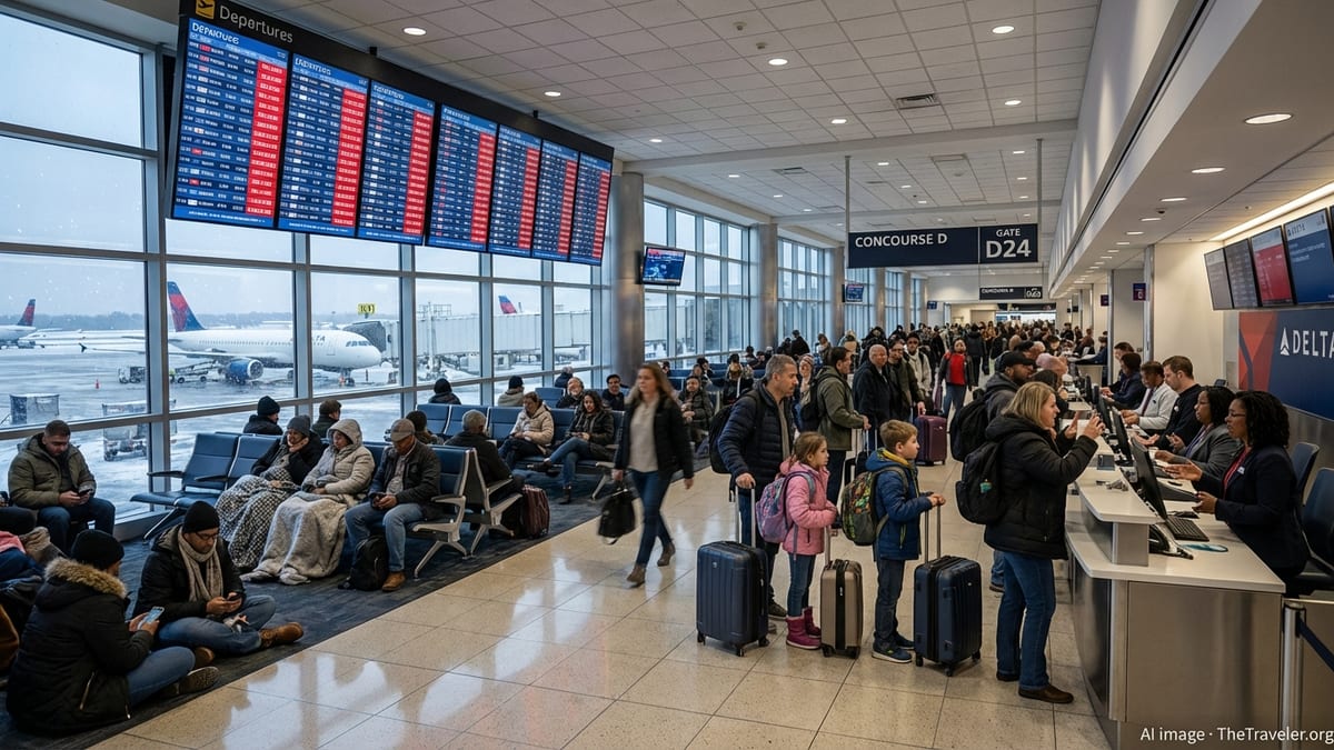
Thunderstorms stall departures and snarl connections
The latest round of severe storms formed quickly over central Florida, with heavy rain, lightning and strong wind gusts converging on Tampa International Airport during one of the day’s busiest departure windows. Publicly available flight-tracking data shows dozens of departures pushed back on the ground as storm cells moved over the airfield and surrounding approach corridors.
Ground operations at Tampa were intermittently constrained as ramp workers were moved indoors for lightning safety and visibility dropped in heavy downpours. That combination sharply reduced the rate at which aircraft could depart and arrive, leading to a buildup of aircraft waiting at gates and holding on taxiways.
The slowdown rippled into airlines’ broader networks, particularly for carriers that rely on Tampa for links to major hubs in the Northeast and Midwest. Connections through Atlanta, Charlotte and other large airports experienced additional knock-on delays as aircraft and crews arrived late from Tampa and other storm-affected Florida airports.
For passengers, the disruptions translated into extended waits in departure lounges, missed onward connections and last minute rebookings. Airline customer-service channels and airport information boards reflected rolling schedule changes as the storms evolved through the afternoon and early evening.
Ground delay programs and temporary ground stops in focus
Operational data from the Federal Aviation Administration indicates that traffic managers responded by imposing a ground delay program for Tampa-bound flights, slowing the rate at which new departures were released from other airports. These programs are commonly used when weather or other constraints reduce the number of flights an airport can safely handle in a given period.
Under such programs, flights headed for a constrained airport are held at their origin for assigned departure times, rather than being allowed to depart and then wait in airborne holding patterns. Aviation-planning materials describe this approach as a way to manage congestion more predictably, keeping aircraft on the ground where fuel burn and crew duty complications are easier to control.
According to air-traffic planning advisories, storms building over the Florida peninsula can also prompt short-term ground stops that temporarily halt certain departures or arrivals entirely while controllers assess storm movement and lightning risk in critical sectors. These pauses, which may last from several minutes to over an hour, are layered on top of broader ground delay programs when intense cells directly impact flight paths into or out of a specific airport.
In Tampa’s case, the severe weather over the region aligned with the typical summer pattern in Florida, where fast-developing afternoon storms often require rapid adjustments to traffic management plans. Aviation weather guidance for the area emphasized the potential for damaging winds, frequent lightning and sudden visibility reductions, all factors that can trigger more restrictive measures around a busy airfield.
Passengers experience rolling delays and diversions
Flight status boards for Tampa showed long strings of delayed departures during the height of the storms, with some flights pushed back repeatedly as conditions failed to improve within initial forecast windows. Publicly available airline schedules indicate that both domestic and international services felt the impact, including routes to major hubs as well as popular leisure destinations.
Some flights headed for Tampa were held on the ground at their origin airports for extended periods under assigned departure times, while others diverted to alternate Florida airports when arrival slots became uncertain. Tracking data and publicly posted flight logs for the region frequently show Tampa used as a diversion point when weather snarls operations at nearby airports, and the reverse pattern can occur when storms focus over Tampa itself.
Travelers connecting through other major hubs reported missed onward flights and unplanned overnight stays as storm-related delays in Florida cascaded into evening and next-day schedules. Social media posts and airline customer updates suggested that rebooking options became more limited as the disruption coincided with already busy summer travel loads.
Airlines generally encourage passengers flying through Florida during peak storm season to monitor their flight status closely on day of travel, as rapidly changing convective weather can alter departure and arrival times with little advance notice.
Tampa’s storm-season vulnerability and planning
Tampa International Airport sits on the Gulf Coast of Florida, a region well known for intense summer thunderstorms and a long tropical weather season. Airport planning and resilience documents highlight weather as an ongoing operational challenge, with lightning, heavy rain and strong outflow winds frequently affecting ramp work, runway use and arrival spacing.
Recent planning reports from the Hillsborough County Aviation Authority describe a broader focus on storm preparedness, including coordination with airlines and ground handlers, contingency procedures for ramp closures, and infrastructure upgrades intended to improve drainage and protect critical systems from flooding. The documents also reference experience gained from previous major storms and hurricanes that have affected the Tampa Bay region in recent years.
Industry analyses of flight performance across U.S. airports consistently rank weather as one of the leading causes of delayed operations, particularly at large coastal and Sun Belt airports exposed to frequent convective activity. For Tampa, a growing route network and high seasonal leisure demand can amplify the impact of even short-lived weather events, as tightly scheduled aircraft rotations leave limited slack in airline timetables.
Local aviation observers note that while Tampa’s airfield and terminal complex are designed to handle significant traffic efficiently, severe storms can quickly reduce usable runway configurations and narrow safe approach paths, forcing conservative spacing between aircraft and limiting throughput until conditions stabilize.
What travelers can expect in the coming days
Forecast guidance for the Tampa Bay area points to a continuation of the seasonal pattern, with hot, humid conditions and a daily risk of scattered to numerous thunderstorms. Meteorologists monitoring the region emphasize that timing and intensity can vary from day to day, but the afternoon and early evening hours often carry the greatest risk for disruptions to air travel.
Travel information distributed by airlines and airports ahead of storm-prone periods typically recommends that passengers build extra time into their itineraries, particularly when connecting through another hub on the same day. Early departures are sometimes less vulnerable to thunderstorm-related delays, although morning operations can still be affected by residual impacts from the previous evening’s weather.
Publicly available guidance from consumer travel and aviation resources suggests that passengers flying through Tampa or other Florida airports during active storm periods should enroll in flight-status alerts, keep airline mobile apps updated and remain prepared for gate changes, rolling delays and occasional diversions. Flexible ticket policies, when available, can provide additional options if forecasts indicate a high likelihood of significant disruptions.
As the summer storm season continues, Tampa International Airport and airlines serving the region are expected to adjust daily operating plans in response to evolving forecasts, with ground delay programs and short-term ground stops remaining among the primary tools for managing safety and congestion during severe weather events.