
More news on this day
Fresh lines of severe thunderstorms sweeping across the Chicago region late Wednesday into Thursday are delivering new damage and power outages on the city’s South Side and across northwest Indiana, compounding a turbulent June that has already seen multiple tornadoes and weeks of storm cleanup.
Get the latest news straight to your inbox!
New storms trigger fresh power cuts and debris
Publicly available outage maps on Thursday show thousands of customers without electricity across portions of Chicago’s South Side and nearby Cook County suburbs after another night of severe weather. Strong winds and intense lightning brought down branches and power lines, particularly in neighborhoods lined with mature trees that were already stressed by earlier storms.
Reports indicate that the latest round of storms developed late Wednesday and persisted into the early hours of Thursday, June 25, tracking from the western suburbs through the city and into northwest Indiana. Hail, torrential rain and frequent cloud-to-ground lightning were observed across the metro area as the line of storms moved east.
Localized street flooding has also been reported where heavy downpours overwhelmed storm drains. Travel across key commuter routes on the South Side was slowed by standing water, downed limbs and non-functioning traffic signals in pockets where power service remained disrupted on Thursday morning.
Utility crews are working through a saturated, debris-strewn landscape that makes restoration more complex and time consuming. Public updates from utilities stress that damage assessments continue and that restoration times may shift as crews uncover additional broken poles, damaged transformers and downed lines in backyards and alleys.
Northwest Indiana still recovering from earlier tornadoes
The latest outages arrive as communities in northwest Indiana are still rebuilding from tornadoes that struck in mid-June. Published coverage from the region documents an EF-2 tornado that swept through parts of Merrillville and nearby towns, toppling power poles, tearing roofs and siding from homes and scattering debris across residential streets and commercial corridors.
In that earlier event, thousands of customers served by regional utilities were left without power for days. Some neighborhoods experienced extended outages as crews replaced long runs of damaged distribution lines and removed splintered poles from roadsides and backyards. Vegetation cleanup has continued in many of those same communities even as new storms have arrived.
Public information from utilities and local emergency updates shows that, as of late June, scattered customers in northwest Indiana remain in a cycle of restoration and renewed outages as each new storm line passes through. Fresh damage from the latest severe weather is adding to the workload, particularly in areas where infrastructure was temporarily repaired after the tornadoes and is now facing additional stress.
Residents who just completed basic repairs to homes and vehicles are now contending with repeat wind damage, water intrusion from heavy rain and another round of spoiled food and disrupted routines caused by power loss. For many households, the compounding nature of the storms has become as significant a challenge as any single event.
South Side neighborhoods hit repeatedly this month
On Chicago’s South Side, social media posts and local reports describe blocks where branches and entire limbs from century-old trees now line the curb following multiple squall lines this June. Residents have documented trees falling into alleys, onto parked cars and across side streets in neighborhoods that were spared direct tornado damage but have endured several rounds of severe thunderstorms.
The repeated impacts are especially visible in areas with dense tree canopies and older overhead power infrastructure. According to outage dashboards, some of the same pockets that went dark during storms earlier in the month again lost service with the latest line of severe weather, highlighting how vulnerable certain circuits remain when wind gusts exceed typical summer levels.
Chicago’s southern lakefront and nearby communities have also faced intermittent beach closures and parks disruptions as storms roll through. Lightning, strong rip currents and high waves have prompted repeated advisories, limiting outdoor recreation even between major storm episodes and underscoring how unsettled the pattern has been for residents and visitors.
While most outages have been restored within hours, the repeated flickers and brief losses of power are affecting small businesses as well as households. Refrigerated goods, point-of-sale systems and security equipment are all sensitive to interruptions, and some business owners have reported turning to portable generators or closing early when storms are in the forecast.
Forecast: lingering storm chances and heat
Forecasts from the National Weather Service and regional broadcast meteorologists indicate that the stormy pattern is not yet over for the Chicago area. Outlooks for late week call for a continued chance of scattered strong to severe thunderstorms, particularly during the warmest part of the afternoon and into the evening as temperatures climb back toward the upper 80s and near 90.
Recent forecast discussions highlight the potential for damaging straight-line winds, large hail and brief tornado spin-ups in any stronger cells that develop south of the city and across northwest Indiana. Even areas that avoid the most intense storms may see heavy downpours, frequent lightning and additional localized flooding in low-lying spots.
With saturated soils and weakened trees across much of the region, even moderate wind gusts could be enough to bring down additional limbs and cause renewed outages. Residents on the South Side and in northwest Indiana are being urged through public messaging campaigns to keep mobile devices charged when storms are expected, secure loose outdoor items and avoid driving through flooded underpasses.
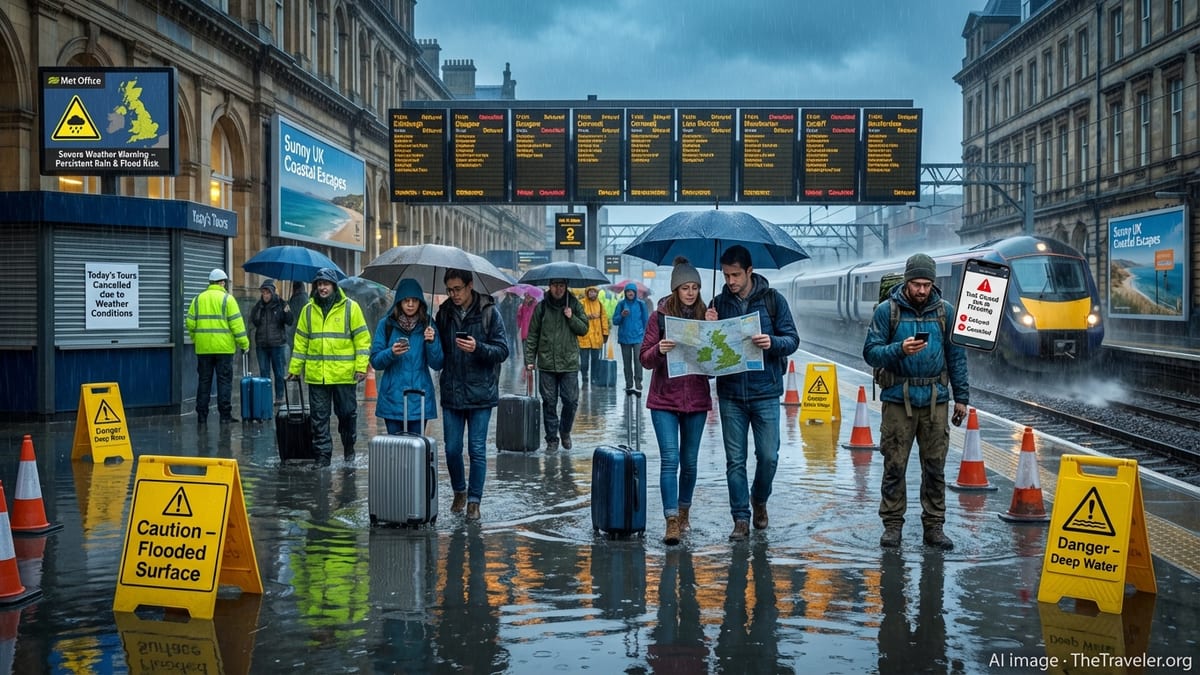
Travelers passing through the region should also be prepared for possible delays on major highways and rail corridors if strong storms coincide with peak commuting hours. Aviation forecasters have noted that rapid changes in visibility and low cloud ceilings with passing storms can temporarily slow air traffic into and out of Chicago’s major airports.
Travel and safety considerations for visitors
For travelers planning visits to Chicago and nearby lakefront communities in Indiana, the evolving weather pattern warrants close attention to short-term forecasts and real-time updates. While the city’s core attractions remain open, intermittent severe weather can affect outdoor activities, lakefront events and transportation in and out of the metro area.
Travel advisories published by transportation agencies note that strong storms can briefly disrupt commuter rail service, as seen with recent power-related interruptions along corridors running through northwest Indiana. Downed trees or localized flooding may temporarily close smaller roads that feed into expressways on the South Side, especially during overnight storms when visibility is limited.
Travel news outlets and local media recommend that visitors build flexibility into itineraries on storm days, allow extra time when connecting between airports, rail stations and downtown, and identify indoor alternatives to outdoor sightseeing if severe weather watches are issued. Many museums, theaters and cultural institutions remain reliable options when lightning and heavy rain push people off the lakefront and out of parks.
As June turns toward the heart of summer, the Chicago region is confronting how a succession of storms and tornadoes can reshape travel plans as well as daily life. For now, the forecast points to more unsettled days ahead for the South Side and northwest Indiana, with communities balancing cleanup from the last round of damage against preparations for the next.