


More news on this day
A burst of summer thunderstorms sweeping across the Puget Sound region on Thursday, July 16, led to widespread flight delays at Seattle’s SEA Airport, as aviation data and local media reports pointed to a mid-morning ground stop and a rapidly growing backlog of disrupted departures and arrivals.
Get the latest news straight to your inbox!
Ground stop ripples across morning schedule
Publicly available information from flight-tracking services and national airspace advisories indicates that a ground stop affecting flights bound for Seattle-Tacoma International Airport was put in place late Thursday morning as lightning and heavy rain moved over the airfield. The hold forced inbound aircraft to wait at origin airports and slowed the flow of departures from SEA’s congested runway system.
Local broadcast coverage described bands of showers and embedded thunderstorms pushing north across western Washington, coinciding with reports of rapidly lengthening queues on SEA’s departure boards. By late morning, data from commercial tracking platforms showed well over one hundred flights delayed, with average departure holdups approaching three quarters of an hour on some routes.
The Federal Aviation Administration’s traffic management updates for the region pointed to weather as the primary constraint, with storm cells intermittently passing close enough to the airport to trigger additional spacing between aircraft. While the most intense convection was relatively short-lived, the resulting imbalance between arriving and departing traffic left airlines working through residual congestion for much of the afternoon.
Shortly after the main line of storms moved north of Puget Sound, ground restrictions began to ease. However, the combination of displaced aircraft and out-of-position flight crews meant recovery was gradual rather than immediate, prolonging the disruption for travelers booked on midday and early afternoon departures.
Passengers face cascading delays and missed connections
For travelers, the storm’s impact was most visible in extended waits in concourses and on aircraft queued at gates and taxiways. Real-time delay boards for SEA showed clusters of flights leaving 30 to 90 minutes behind schedule, with some later services pushed into multi-hour holds as operators prioritized earlier departures and reassembled crew rotations.
Connections through Seattle, a major hub for both domestic and transpacific traffic, were particularly vulnerable. Publicly available itineraries from major airlines showed tight layovers blown out by the morning disruptions, prompting same-day rebookings, overnight stays, and, in some cases, full itinerary changes for travelers heading to destinations across the United States and Asia.
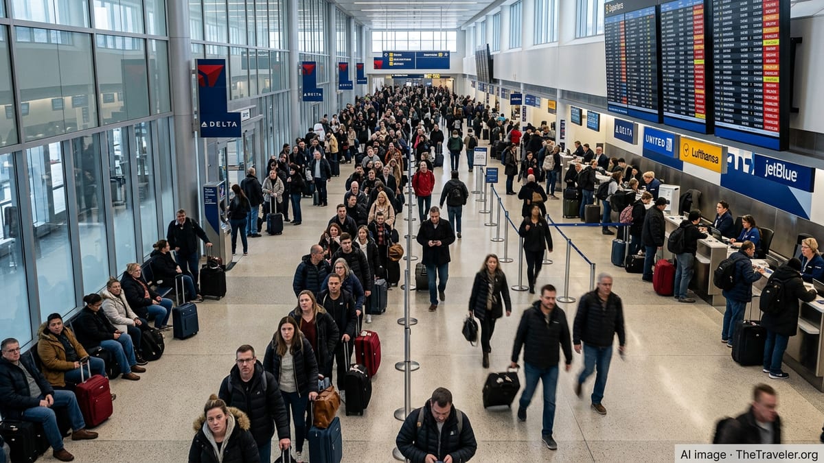
Social media posts and user-generated travel forums captured snapshots of the scene, including long lines at service desks and crowded seating areas near heavily delayed gates. While many flights ultimately operated, even relatively modest schedule changes created knock-on effects for people with time-sensitive plans, from cruises departing from downtown Seattle to onward train journeys and evening business meetings.
Despite the challenging conditions, there were no widely reported long-duration tarmac holds at SEA on Thursday, and operations continued on a reduced but steady basis once lightning moved farther from the field. Boarding and deplaning remained slower than usual at peak times as staff worked around active weather cells and intermittent ramp closures.
Storms cap a turbulent summer for U.S. air travel
The episode at SEA fits into a broader pattern of weather-related volatility that has shaped U.S. air travel this summer. Aviation performance analyses and airline operations reports have repeatedly cited convective storms as a leading cause of delays, particularly at hub airports where high traffic volumes amplify the effect of even short disruptions.
Seattle has long been accustomed to low clouds, drizzle, and occasional winter windstorms, but intense summertime convection capable of triggering ground stops and lightning-related ramp closures has featured more prominently in recent seasons. Climate and weather specialists have pointed to warmer, more humid air masses over the Pacific Northwest as a factor in recent episodes of strong thunderstorms and heavier localized rainfall.
Industry studies on airport on-time performance note that thunderstorm activity is among the most disruptive types of weather for aviation, affecting not only takeoffs and landings but also ground handling, fueling, and baggage loading. Even when radar shows only scattered cells, lightning within a certain radius of ramp areas can require ramp workers to seek shelter, temporarily halting aircraft servicing and further slowing the flow of departures.
For airlines operating through SEA, the timing of Thursday’s storm was particularly unhelpful, coinciding with a busy mid-morning departure bank aimed at eastbound domestic cities and early afternoon services to international hubs. Once those blocks are significantly delayed, it often takes several schedule waves before operations fully normalize.
What travelers can expect in the hours after the storm
By late afternoon on Thursday, publicly available airport condition dashboards showed delay levels gradually decreasing at SEA, with some carriers reporting improved departure times as the weather stabilized over central Puget Sound. Nonetheless, a residual layer of disruption remained visible on evening schedules, including sporadic cancellations and rerouted flights.
Air travel analysts note that after an event like a morning ground stop, passengers should anticipate a multi-hour recovery window, especially at hub airports that feed secondary markets. Aircraft and crews that arrive late into Seattle often leave late as well, creating rolling delays that can persist into the late-night departure bank.
Travel planning resources recommend that passengers booked on same-day flights to or from SEA monitor airline apps closely for gate changes and new departure times, even after the worst of the storm has passed. For those connecting through Seattle, longer layovers and flexible tickets tend to offer better protection against missed onward flights during the summer thunderstorm season.
Ground transportation and nearby lodging can also become tight around extended weather events. With SEA located adjacent to the city of SeaTac and connected to downtown by light rail, many travelers faced decisions about whether to remain at the airport or seek hotels along the corridor while waiting for rebooked flights.
SEA’s weather resilience under continued scrutiny
The latest summer storm has added to ongoing public discussion about SEA’s resilience to weather shocks at a time when passenger volumes continue to grow. Recent planning and policy documents from the Port of Seattle have highlighted both the airport’s role as a critical transportation hub and the need for infrastructure that can withstand more frequent climate-related disruptions.
Operational plans available on the airport’s website outline procedures for managing tarmac delays, coordinating with airlines during irregular operations, and communicating schedule changes to the traveling public. While these frameworks are designed to minimize passenger hardship during events like Thursday’s thunderstorms, real-world performance often depends on variables such as staffing levels, gate availability, and the specific track of each storm system.
Researchers studying airport surface operations have pointed to technologies like enhanced surface surveillance, improved runway throughput management, and more precise demand forecasting as potential tools to soften the impact of convective weather on hub performance. Some of these concepts have been tested or modeled at airports similar in scale to SEA, with studies suggesting modest but meaningful reductions in taxi times and departure queues during congested periods.
For now, Thursday’s storm serves as a reminder that even a relatively brief burst of severe summer weather can send ripples through flight schedules in the Pacific Northwest and beyond. With more unsettled conditions in the seasonal outlook, travelers using SEA in the coming weeks are likely to keep one eye on the forecast as they plan their journeys.