
More news on this day
Burleson County in southeast Texas has issued an urgent travel alert as rounds of heavy rain and thunderstorms sweep across the region on Monday, June 15, raising the risk of flash flooding and hazardous road conditions for residents and through-travelers.
Get the latest news straight to your inbox!
Flood watch covers Burleson County and wider Southeast Texas
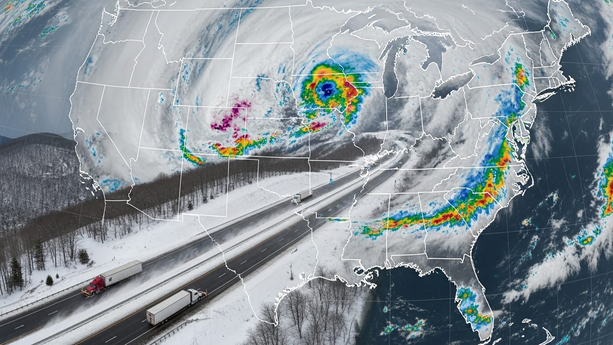
Publicly available weather bulletins show that Burleson County is included in a regional flood watch that extends across portions of south central and southeast Texas. The alert, based on National Weather Service guidance, indicates that flooding caused by excessive rainfall is possible from late Sunday through at least Wednesday morning.
Forecast discussions describe a moist, tropical air mass feeding repeated rounds of showers and thunderstorms over the area. Rainfall totals through midweek are projected to reach 2 to 4 inches across many communities, with localized pockets potentially receiving 6 to 8 inches in a relatively short period of time.
The flood watch area spans a broad stretch of the state, but Burleson County sits within a corridor highlighted for enhanced runoff risk. Weather outlets note that excessive rainfall may overwhelm drainage systems and lead to rapid rises on creeks, low-water crossings, and small rivers that are common along key travel routes in the county.
Travelers using regional connectors toward Bryan–College Station, Austin, or the Houston area are being advised through public alerts to account for periods of intense rainfall, poor visibility, and water over roadways, particularly after dark.
Travel alert warns of water-covered roads and low-water crossings
The Burleson County travel alert emphasizes that road impacts may develop quickly as storms train across the same locations. Low-lying areas, underpasses, and rural low-water crossings are singled out in statewide safety messaging as points where drivers are most likely to encounter water over the road.
Recent flooding reports from other parts of Texas, including instances of standing water on interstates and feeder roads, demonstrate how quickly travel can be disrupted when several inches of rain fall within a few hours. Regional coverage from central and north Texas over the weekend described vehicles stalled on inundated lanes and neighborhoods temporarily cut off by rising water.
County-level alerts echo long-standing state safety campaigns that warn drivers not to attempt to cross flooded roadways. Even shallow moving water can be strong enough to disable or sweep away vehicles, and visibility is often limited during the heaviest downpours, increasing the risk of misjudging depth at a crossing or dip in the road.
With additional storms expected, transportation planners and emergency managers across the region are urging anyone with nonessential trips through Burleson County to reconsider or delay travel during periods of intense rainfall, especially overnight when hazards are more difficult to see.
Air and road travel across Texas face weather-related disruptions
The conditions affecting Burleson County are part of a broader storm pattern that has delivered widespread heavy rain to large areas of Texas since late last week. Weather services and regional broadcasters have pointed to a busy multi-day outbreak of severe weather, including strong storms and flooding episodes across central, north, and southeast Texas.
In central Texas, recent coverage has highlighted flash flooding on major highways and city streets, leading to closures and detours. In north Texas, weekend forecasts warned that rounds of storms could interfere with outdoor events and driving, contributing to longer travel times and sporadic delays on heavily traveled corridors.
National travel outlooks from private weather providers note that the combination of tropical moisture and slow-moving storm systems can have cascading impacts on air travel as well. Thunderstorms near major hubs may trigger ground stops, slowdowns, or reroutes, which can ripple outward to connecting flights used by travelers to and from regional airports serving Burleson County and neighboring communities.
For motorists, the larger pattern means that those heading into or out of Burleson County may encounter pockets of intense weather both before and after they reach the county line. Trip planners are being encouraged to monitor updated forecasts along their entire route rather than relying solely on starting-point conditions.
What travelers through Burleson County should expect
Through at least midweek, travelers can expect periods of heavy rain, embedded thunderstorms, and intermittent lulls in activity across Burleson County. Weather outlooks stress that the most dangerous conditions often occur when a nearly stationary storm repeatedly passes over the same stretch of road, quickly turning a routine drive into a high-risk situation.
Short-term forecasts call for rainfall rates that may reach 2 to 4 inches per hour within the strongest cells. Under those conditions, drainage ditches, roadside culverts, and small creeks can overflow in a matter of minutes, creating unexpected ponding or swift, shallow currents across intersections and farm-to-market roads.
Public advisories recommend that anyone who must drive carry extra time in their schedule for delays, avoid cruise control on wet roads, and pay careful attention to warning signs, barricades, and electronic message boards. Travelers are also being encouraged to keep fuel tanks topped up and mobile devices charged in case re-routing becomes necessary due to sudden closures.
Those staying in hotels, campgrounds, or short-term rentals in rural parts of the county are urged, through state and local preparedness materials, to identify alternate routes to higher ground and to be aware of nearby creeks or low-water crossings that could become impassable after dark.
Monitoring conditions as the severe weather pattern evolves
Weather specialists caution that while models provide an overall picture of the threat, the exact placement of the heaviest rainfall can shift over time. This makes real-time monitoring of radar, updated advisories, and local broadcast coverage especially important for people moving through Burleson County.
Travel-focused services note that alerts may be updated or expanded as additional storms develop, particularly if rainfall totals begin to exceed early projections. A localized band of storms over a single drainage basin can prompt rapid changes in flood potential, even if nearby areas see lighter amounts.
Regional emergency management reports compiled over the past several months point to a persistently active severe weather season across Texas, with multiple episodes of heavy rain, hail, and high winds affecting different parts of the state. The current setup over Burleson County fits into that broader pattern, adding another round of disruptions for residents, commuters, and visitors.
As the week progresses, travelers are being advised, through widely shared public information, to maintain flexibility in their plans and remain prepared for the possibility of continued warnings or new advisories. Until the flood watch is lifted and the broader storm system moves on, the message for anyone driving in or near Burleson County is to stay weather-aware and prioritize safety over speed.