


More news on this day
Two powerful weather systems bearing down on the Northeast and the Gulf Coast are disrupting air travel across the United States today, with major carriers issuing travel waivers as thunderstorms and Tropical Storm Edouard trigger hundreds of delays and cancellations.
Get the latest news straight to your inbox!
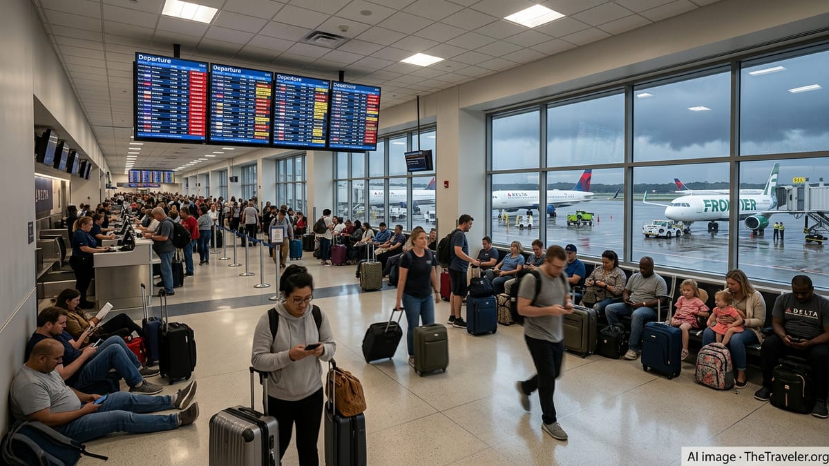
Storm Systems Target Northeast Hubs and Gulf Coast Gateways
Travelers flying on Tuesday, September 1, 2026, face a one-two punch of weather trouble as a line of strong thunderstorms sweeps across the Northeast while Tropical Storm Edouard brings heavy rain, strong winds and coastal flooding concerns to the upper Texas and southwest Louisiana coasts. Public forecasts from the National Weather Service and Weather Prediction Center highlight the potential for torrential downpours and localized flooding from the Great Lakes into the Northeast, as well as tropical storm conditions along the Gulf Coast as Edouard moves inland near the Texas Louisiana border.
The National Hurricane Center reports that Edouard made landfall near the Texas Louisiana state line with maximum sustained winds around 60 miles per hour, intensifying slightly before coming ashore and pushing bands of heavy rain well inland. Along the central Gulf Coast, forecasters are calling for several inches of rainfall in a short period, raising the risk of flash flooding in low lying and coastal communities. That combination of wind, rain and possible storm surge is particularly disruptive for airports serving the Houston region and nearby Gulf gateways, where ground operations can slow or halt when lightning and strong crosswinds are present.
Farther north, the Weather Prediction Center highlights a corridor from Pennsylvania into parts of New York and New England where slow moving thunderstorms could drop one to two inches of rain in a short window, with localized higher totals. Those conditions tend to create knock on effects for the busiest airports in the country, including New York City area hubs John F. Kennedy, LaGuardia and Newark, as well as major connection points like Boston and Philadelphia. Historic data from the Federal Aviation Administration shows that these Northeast hubs already account for a disproportionate share of national delay minutes, and days with organized thunderstorms often push the system to its limits.
While the most intense weather is concentrated in these two regions, ripple effects are being felt nationwide as airlines preemptively trim schedules, reroute aircraft and build extra time into their operations. Even travelers not flying into or out of the Northeast or Gulf Coast may encounter rolling delays as aircraft and crews arrive late from storm affected cities, tightening connection windows and increasing the chance of missed flights later in the day.
Airlines Roll Out Flexible Waivers for Affected Routes
In anticipation of weather related disruption, several major carriers have activated travel waivers for itineraries touching the hardest hit areas. Publicly available alerts show that at least one large U.S. airline has issued a severe weather waiver for the Northeast that covers customers scheduled to travel on September 1, allowing them to rebook between September 1 and 3 without paying a change fee or fare difference, provided they keep the same origin and destination. Another waiver, tied specifically to Tropical Storm Edouard, applies to Gulf Coast airports over a two day window, typically September 1 and 2, as the storm moves inland and gradually weakens.
Major carriers with hubs in the New York area and along the Gulf Coast are also flagging waivers through their travel alert pages and mobile apps. Some are allowing customers to move trips earlier or later by several days, while others are offering the option to change to alternate airports within the same region when space is available. These policies are designed to keep passengers away from peak storm impacts, reduce the number of travelers stranded in terminals and give operations teams more flexibility to recover once conditions improve.
Travelers should be aware that waiver eligibility is often restricted to specific airports, dates and fare types. Basic economy tickets, for example, may have more limited options, and any changes that involve a different origin or destination typically price as a new ticket rather than a free rebooking. Given these nuances, airlines are urging passengers to verify that their flight number and travel date fall within the listed waiver window before making changes. In many cases, modifying a reservation online or in the airline app is faster than calling, especially during major disruptions when call center hold times can lengthen dramatically.
At some Gulf Coast and Texas airports, including Houston’s Bush Intercontinental and Hobby, local airport communications have also highlighted that airlines are offering waivers tied to Edouard. Airport social media channels and websites are reminding passengers to confirm flight status and review any flexibility options before heading to the terminal, noting that the combination of heavy rain, gusty winds and lightning can force temporary ground stops that cascade into broader regional disruptions.
Where Disruptions Are Most Likely Today
Based on current weather guidance and airline advisories, the greatest risk for delays and cancellations today is concentrated at large Northeast hubs and Gulf Coast airports within the projected path of Tropical Storm Edouard. In the Northeast, thunderstorms can trigger volume and spacing programs managed by the Federal Aviation Administration, which slow the rate of arrivals and departures at high traffic airports such as Newark, LaGuardia, JFK, Boston and Philadelphia. Those restrictions tend to build long queues of aircraft both on the ground and in the air, particularly during peak morning and late afternoon bank periods.
Real time tracking services indicate that by late morning on the East Coast, more than a thousand U.S. flights had already been delayed, with several hundred cancellations systemwide. The bulk of the disruptions were tied to weather sensitive hubs, including New York area airports and major connecting complexes in the Mid Atlantic and upper Midwest that sit under the broader storm track. As the day progresses and thunderstorms redevelop, additional waves of delays are likely, especially if lightning forces ramp closures that temporarily halt boarding and baggage loading.
Along the Gulf Coast, the main operational challenges relate to Edouard’s rain bands and wind field, which are sweeping across coastal Texas and Louisiana and into parts of the lower Mississippi Valley. Airports in the Houston region are experiencing intermittent ground stops and reduced arrival rates as the tropical system comes ashore and moves inland. Secondary airports along the coast, including smaller regional fields, may see longer closures if flooding affects access roads, runways or lighting systems.
Travelers connecting through inland hubs such as Atlanta, Dallas Fort Worth, Charlotte and Chicago may experience knock on effects even if local weather is relatively calm. When aircraft and crews are delayed leaving storm affected airports, they often arrive late into these connecting complexes, compressing turn times and shrinking buffers throughout the schedule. That can produce rolling delays that persist into the evening, well after the worst of the thunderstorms or tropical downpours have passed.
How Flyers Can Navigate a Storm Disruption Day
On a volatile day like today, one of the most important steps for travelers is to monitor flight status early and often. Airline apps and websites frequently update departure times, gate assignments and aircraft changes before those adjustments appear on airport monitors, and many carriers are pushing proactive notifications when a flight falls under a travel waiver or is at risk of delay. Some airlines have added tools that automatically search for alternative options during a disruption, letting customers join standby lists for earlier or later flights without visiting an agent in person.
Passengers who see that their flight is covered by a weather waiver may want to consider rebooking before conditions deteriorate further. Moving to an early morning departure, for example, can sometimes avoid the most severe afternoon thunderstorms, while shifting a trip to a different day can sidestep widespread cancellations and full rebooked flights. For those who must travel today, leaving extra time for security lines, potential gate changes and tight connections is essential, particularly when flying through known chokepoints in the Northeast.
At the airport, travelers should be prepared for crowded gate areas, longer lines at customer service counters and a shortage of same day alternatives on heavily booked routes. When disruptions are widespread, airlines often prioritize rebooking for passengers whose flights have been canceled outright before accommodating those with long delays. Self service channels, including kiosks, apps and websites, can sometimes surface options that are not immediately visible to agents juggling multiple queues, so checking both digital and in person resources can be helpful.
Travel insurance and premium credit card benefits may also provide additional protection on a day like today, although coverage terms vary widely. Some policies reimburse for meals and hotels when delays exceed a certain threshold, while others focus primarily on nonrefundable trip costs. Because severe weather is a common exclusion, passengers are encouraged to review benefit guides and policy documents carefully and keep receipts for any out of pocket expenses incurred during an extended disruption.
What to Watch in the Hours Ahead
Looking ahead to the rest of Tuesday, the pace of disruptions will depend largely on how quickly thunderstorms clear the Northeast corridor and how rapidly Tropical Storm Edouard weakens as it tracks inland. Forecast discussions from federal meteorological agencies suggest that heavy rain and embedded storms will continue across parts of the Northeast through the evening, while the core of Edouard gradually winds down over eastern Texas and western Louisiana. Even after lightning diminishes and winds ease at individual airports, it can take several hours for airlines to reposition aircraft and crews and for the FAA to lift traffic management initiatives.
Evening flights are often particularly vulnerable on days like this because many aircraft are making their final segments after a full day of weather related delays. If early afternoon connections misalign, later departures may operate with lengthy delays or cancel altogether if crews time out under federal work rule limits. Travelers with flexibility may wish to move to early morning flights on Wednesday, when residual delays are more likely to show up as minor schedule adjustments rather than wholesale cancellations.
For those who must fly tonight, close monitoring of both weather radar and airline communications will be key. Storm cells that redevelop over the same airspace can prompt new ground stops with little warning, while sudden improvements can allow airports to temporarily increase arrival and departure rates. Having a backup plan, such as alternate routings or the option to overnight in a connecting city, can reduce stress in case conditions fail to improve as quickly as forecast.
As the Atlantic hurricane season progresses, today’s disruptions also serve as a reminder that weather risks can extend far beyond coastal regions. Tropical remnants frequently interact with frontal systems over the interior United States, producing days of unsettled weather and repeated air travel slowdowns. Travelers planning trips over the coming weeks may benefit from building extra buffer time into itineraries, favoring nonstop flights when possible and staying informed about both tropical and mid latitude storm patterns that could affect their routes.
Forbes coverage of airline waivers and delays today
American Airlines travel alerts and waiver details
NOAA Weather Prediction Center latest storm discussions
National Weather Service national forecast and tropical updates