


I first knew El Yunque from the famous north-side drive in Río Grande, squeezing into crowded pullouts for La Coca Falls and Juan Diego. It took a second trip and a deliberate decision to approach from Naguabo for me to understand that the forest feels like a different place on its south flank. This time I came in on PR‑191 South to the Río Sabana Recreation Area, using the Forest Service map and current alerts to be sure the access was open. What I found was the same national forest, but with another personality entirely: quieter, more physical and much less structured than the curated experience on the north side.
Get the latest updates straight to your inbox!
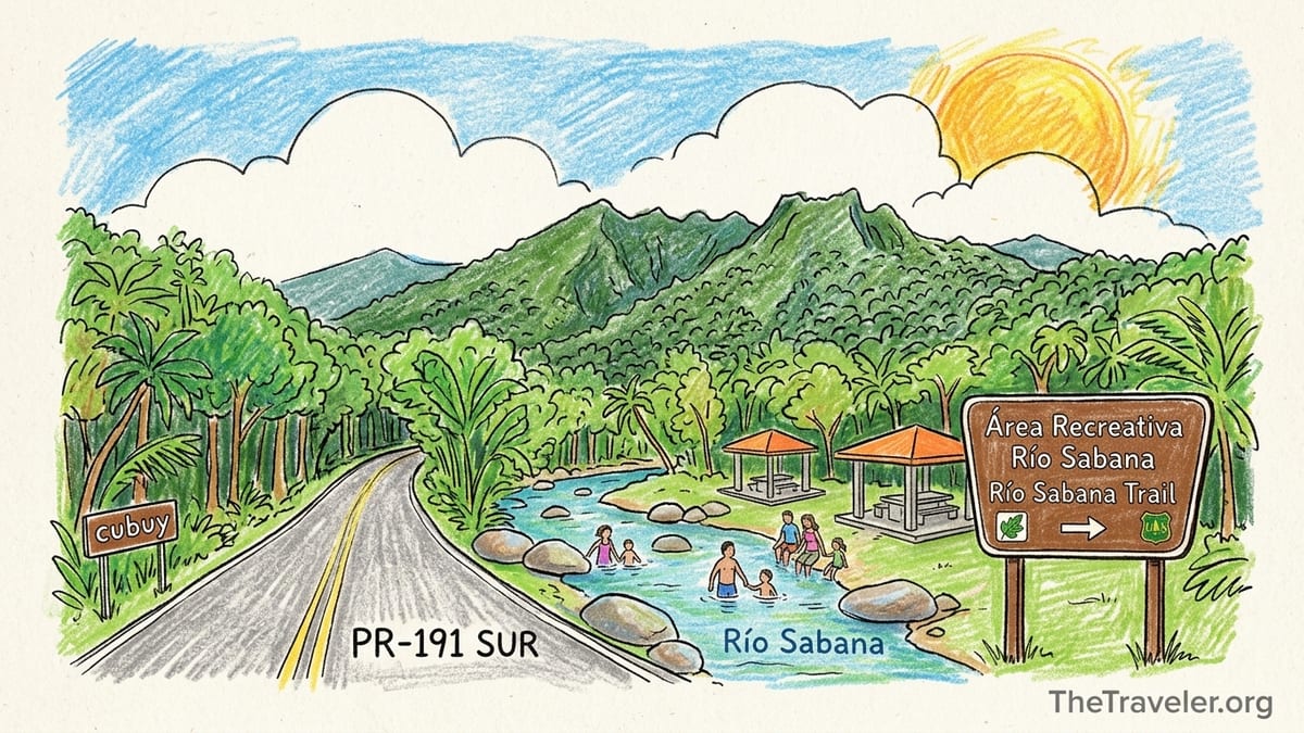
Confirming That El Yunque Really Reaches Naguabo
Before planning anything, I needed to be sure I was not just visiting a random riverside park that happened to sit near the forest boundary. The U.S. Forest Service’s own recreation map for PR‑191 South shows El Yunque National Forest extending down into the municipality of Naguabo, with the Río Sabana Recreation Area, the Río Sabana Trail, Tradewinds Trail and access to El Toro Trail clearly marked, along with icons for parking, picnic areas and restrooms. That map, updated in 2025, is the document that convinced me this was not a side show to the “real” El Yunque but an officially recognized part of the same forest.
Once I had the map, I checked the Forest Service alerts and the forest-wide trail status information for October 2026. I wanted to verify that PR‑191 South up to Río Sabana, and the main trails from that trailhead, were not under temporary closure after heavy rain or hurricane repairs. At the time of my visit the agency listed no reservations or entry fees for Río Sabana, but it did flag that conditions could change quickly and that some sections of Tradewinds and El Toro could be muddy or partially washed out after storms. That shaped my decision to focus on Río Sabana Trail itself and only venture a short way toward the Tradewinds junction.
I also cross-checked Naguabo-specific information. Local initiatives like Destino 191 and the Cubuy community material describe PR‑191 South as the southern access to El Yunque’s recreation sites, ending in the Río Sabana area inside the national forest, beyond the rural communities of Río Blanco and Cubuy. That matched what I saw on the ground: national forest boundary signs, bilingual trail boards and the familiar El Yunque leaf logo on facilities, just as on the north side.
This background matters because many people are told that El Yunque is “the road in Río Grande” and nothing more. In reality, you can stand at the picnic tables beside Río Sabana, look up toward the ridgeline of El Toro and still be firmly inside El Yunque National Forest, even though every direction sign on the way up lists Naguabo, not Río Grande.
Getting There: The Exact Route into Río Sabana
On my south-side day I approached from the east coast, joining the PR‑53 expressway and taking the exit for PR‑31 toward Naguabo’s interior. From there, I followed PR‑31 inland along the Río Blanco valley. About 20 minutes later, just after crossing the river on a concrete bridge, a junction on the right led me onto PR‑191 South, signposted for Río Blanco, Cubuy and the national forest. This is the same numbered highway as the famous road in Río Grande, but the two sections no longer meet due to a landslide in the central mountains that permanently severed the alignment.
PR‑191 South began as a two-lane rural road serving farms and small guesthouses along the river. As I climbed, the houses began to thin out and the forest thickened. The pavement here was in decent condition: patched in places, with a few shallow potholes near the edges, but entirely passable in a compact rental car without high clearance. The curves tightened as the road climbed, so I drove slowly, similar to the cautious speeds people keep on the blind corners of PR‑191 North.
Shortly before the national forest boundary, I passed a cluster of small lodgings and local kiosks, then reached a metal gate. On the day I visited, the gate was open during daylight; based on traveler reports and Forest Service notices, it is sometimes closed outside hours or during weather-related closures. There is space to park outside the gate if needed and walk in, but when the gate is open you can continue by car along the narrow paved section into the designated recreation area.
The last stretch to Río Sabana Recreation Area narrowed to essentially a one-lane road with informal passing pullouts. The pavement was intact but patched. I crawled at 10 to 15 miles an hour, both to avoid oncoming cars around blind bends and to enjoy the views up the river gorge. Unlike the north side, there were no large tour buses here, only a few local cars and one pickup truck loaded with coolers headed for the river.
Road Condition, Parking and Facilities on the South Side
The first clear sign that I had reached the official recreation zone was a brown Forest Service sign pointing to “Área Recreativa Río Sabana,” followed by a speed bump and the sound of the river growing louder. Parking consists of a simple paved loop and a gravel extension, not a huge lot, but on my weekday visit in the late morning there were only six vehicles. Even on busier weekends, local sources suggest the area fills but does not reach the gridlock sometimes seen on the north side waterfalls.
The pavement in the parking loop itself was serviceable, with some standing water in low spots after overnight rain. I did not see any deep potholes that would threaten a rental car. Spaces are not painted; people park head-in along the outer edge, then angle in wherever there is room. There was no attendant, no fee booth and no indication of a cash charge for day use when I visited, which matched the Forest Service information that there is currently no entrance or parking fee at Río Sabana.
Facilities are basic but adequate. Near the trailhead signboard there were concrete picnic shelters with tables, grills and a few open-air tables right above the riverbank. At the upper edge of the loop I found a small restroom building with flush toilets and running water. The building was clean but clearly weathered, with doors that did not close quite flush and some peeling paint after years of humid conditions. Soap and toilet paper were present, although I was glad I had brought my own just in case, since service levels can fluctuate with budgets and storms.
From the parking area, access to the river is direct and easy via short informal paths between rocks. Families had set up folding chairs in the shallows, and the water level on that day was mellow, around ankle to knee depth where people were wading. That said, the Forest Service and local signage both emphasize that river levels here can rise quickly after heavy rain, and there are no lifeguards. Anyone visiting after big storms should be much more cautious than the calm scene I experienced.
Trail Signage, Closures and Walking-Only Sections
The main hiking route beginning at Río Sabana is the Río Sabana Trail, with connections farther up to the El Toro and Tradewinds Trails. At the edge of the parking loop a large bilingual signboard displayed a simplified map: a bold line for Río Sabana, dotted connections for Tradewinds and El Toro reaching up into the El Toro Wilderness. Distances and estimated hiking times were listed in both English and Spanish. A smaller metal plaque confirmed that this was U.S. Forest Service trail infrastructure, co-managed with the municipality of Naguabo.
Before traveling I had checked the forest’s online alerts page, which at that time noted that Río Sabana Trail was open for hiking but could be “difficult to follow” in upper sections after heavy rainfall and that portions of Tradewinds and El Toro could have fallen trees. On arrival, a laminated paper notice stapled near the trailhead repeated that warning and urged hikers to turn around if they lost the path. There were no physical closure barriers on the day of my hike, which matched the online status.
The first stretch of Río Sabana Trail uses what feels like an old road grade, wide enough that two people can walk side by side, though it is clearly closed to vehicles. It begins as a firm dirt and gravel surface before narrowing into a more typical single-track path deeper into the forest. Walkers share the initial section with people in sandals and children heading just far enough to find deeper swimming holes along the river.
Beyond the casual swimming area, the trail turns resolutely into a hiking route. Painted blazes on trees, occasional wooden arrows and the tread itself guided me uphill. Compared with the north side’s heavily engineered falls trails, the signage here is sparse but present when you need it. Junctions with unofficial side paths down to the water are usually unmarked, while the main trail continues straight and gradually gains altitude. There are no paved segments and no guardrails or steps cut into bedrock; this is a walk-only experience shaped more by the terrain than by construction crews.
Weather, River Crossings and Physical Effort
On my visit in early October, the weather on the south side felt steamier than I remembered from higher elevations near El Yunque Peak on the north side. At the Río Sabana trailhead I recorded a mid-morning temperature in the low 80s Fahrenheit with very high humidity, and the river valley was almost windless. Within ten minutes of hiking my shirt was soaked, less from exertion than from the warm, still air trapped under the canopy.
The Río Sabana Trail does not immediately demand big river fords, but it does flirt constantly with the water. Several side paths lead to boulder gardens where people were swimming or picnicking. On the main trail I had to cross small side streams, the kind you can step over in one or two hops using rocks or exposed roots. After several days of average rain these crossings were ankle deep at most. I could see, however, from driftwood lodged higher on the banks that in heavy rain events these tiny channels can swell and muddy the trail.
In terms of physical effort, Río Sabana felt more like a true backcountry hike than most of the classic north-side walks. The grade is steady and sometimes steep, with stretches of slippery mud, exposed rock and tree roots. I gained several hundred meters of elevation in the first couple of kilometers and found myself breathing hard more often than on the short, mostly paved jaunts to La Mina Falls or Yokahú Tower. It is not technical, but the footing demands attention, especially when wet leaves cover the mud.
Because this side sits in the rain shadow of the central spine, showers tend to be shorter but intense. About an hour into my climb a quick downpour passed overhead, turning the trail into a shallow stream for a few minutes before draining away. I was grateful for proper hiking shoes with good grip and for lightweight rain gear. Anyone arriving in flip-flops or unsupportive sandals, which I saw on a couple of visitors near the river, would be wise not to go far beyond the first swimming holes.
How Quiet Is the South Side Compared with Río Grande?
What struck me most was not the difference in infrastructure but the difference in sound. On the north side, traffic along PR‑191 is a constant backdrop: tour vans braking at La Coca Falls, engines revving up steep grades, doors slamming at every overlook. At Río Sabana, once I stepped past the first bend in the trail, the main noises were the river and a faint chorus of coquí frogs, even in daylight. I passed only three other small groups in four hours of walking, two of them local families from Naguabo carrying coolers for a riverside cookout and one pair of hikers with trekking poles headed up toward the higher junctions.
This relative quiet changed the way the forest felt. There were no vendors, no reservation checkpoints, no lines to take photos at a viewpoint. Picnic tables were in use near the parking loop, but there were no amplified speakers or generators. The atmosphere was of a local river park that happens to sit inside a U.S. national forest, rather than a heavily promoted attraction on the main visitor circuit.
Of course, quiet is relative. On sunny weekends and holidays, Naguabo families treat Río Sabana as a traditional swimming and picnic area, and parking can fill up by late morning. Even then, the number of people spreads out along the rocks and bends of the river, so you are unlikely to feel pinned in by crowds the way you might at Juan Diego Falls on a busy afternoon. The absence of tour buses and large vans, which favor the better-known north side with its predictable timing and paved sites, keeps overall numbers lower.
For me, the south side’s calm came with a trade-off: less immediate assistance if something goes wrong. On the north side you are never far from a ranger, an information booth or a line of passing cars. At Río Sabana, particularly higher up on the trail, you carry more responsibility for your own route-finding, pace and weather judgment. That solitude is a gift for some and an uncomfortable risk for others.
What Worked, What Was Frustrating
Several aspects of approaching El Yunque from Naguabo worked extremely well. Access was straightforward with a regular rental car, and there was no need to navigate online reservations or timed-entry systems, which have periodically affected the north corridor in recent years. Parking was free and close to the river, and the combination of paved road approach, simple facilities and immediate forest immersion made it easy to transition from driver to hiker in a matter of minutes.
The character of the hike was another positive. I wanted to feel the forest as a living, changing place rather than as a curated sequence of overlooks. On the Río Sabana Trail I experienced patches of old hurricane damage where sunlight poured in through gaps in the canopy, stretches of dense, dripping understory and glimpses down to the river and out toward Naguabo and Humacao when the vegetation opened. It felt less like sightseeing and more like being let into the working interior of the Sierra de Luquillo.
The frustrations tended to mirror those strengths. Signage, while present, was limited; someone expecting the wayfinding density of the north side might feel uneasy once the trail narrowed and junction markers thinned out. The Forest Service’s warnings about conditions changing rapidly were not just boilerplate. After the short downpour during my hike, several sections became slick, and one steep pitch turned into a mud slide that required hands as well as feet. I also found that cell reception, which had been intermittent but workable on the drive up, faded to nearly nothing beyond the first kilometer of trail.
Another minor frustration was the uncertainty about the gate schedule. Although it stood open during my daylight visit, online traveler reports describe arriving to find it closed and having to park outside and walk the roughly one-kilometer paved section downhill to the recreation area. That is an easy enough walk, but it adds time and might confuse first-time visitors who assume they have somehow missed the correct turn. When I planned my day I simply assumed that I might need to walk that section and made sure my timing and water supplies reflected that possibility.
Is the South Side Right for First-Time Visitors?
After visiting both the north and south corridors, I would be cautious about recommending Río Sabana as the only El Yunque experience for a first-time visitor with limited time. The north side from Río Grande still offers the clearest introduction to the forest: El Portal visitor center for exhibits and orientation, well-marked short trails, staffed facilities and the iconic waterfalls that appear in every tourism ad. A newcomer who wants quick, photogenic highlights and easy walking will almost certainly feel more comfortable starting on PR‑191 North.
By contrast, the south side from Naguabo suits travelers who either have already seen the north or who intentionally want to avoid crowds even at the cost of a rougher experience. If you have already stood at Yokahú Tower and hiked a portion of the El Yunque or Mount Britton trails, Río Sabana offers a way to deepen your relationship with the forest: longer, steeper walking, more local flavor and a stronger sense of El Yunque as a landscape rather than a sequence of viewpoints.
The south approach is also well suited to visitors staying nearby along the east coast or in Naguabo itself who can make multiple short visits. Spending a morning exploring the riverbank and lower trail, then returning another day to push higher up toward the Tradewinds junction, can be more rewarding than trying to do everything at once. Without the pressure of a timed-entry slot, you can pick your weather window more flexibly, avoiding days of very heavy rain that would make both the road and trail less pleasant.
For families with small children or anyone with mobility limitations, I would treat Río Sabana as a gentle river park experience rather than a hiking destination. The lower picnic and swimming areas are easily accessible from the parking loop on mostly level ground, whereas the hiking beyond them quickly demands good footwear, balance and stamina. If your goal is a stroller-friendly boardwalk or a paved overlook, the north side remains the better choice.
The Takeaway
Exploring El Yunque from Naguabo does not replicate the north-side experience; it complements it. The drive up PR‑191 South from PR‑31, the modest parking loop at Río Sabana, the lightly signed trails and the quieter riverbanks all speak to a different relationship between the forest and the communities at its edge. Here, El Yunque feels less like a day trip attraction and more like a backyard mountain range that locals have been visiting long before reservation systems and tour brochures.
To make the most of this side you need to accept its quirks: a gate whose status you might have to confirm the morning of your visit, trails that can turn muddy without warning and the knowledge that help is farther away than at the main corridor. In exchange, you get a rainforest that speaks in softer voices, with more room to listen. For travelers who already know the postcard scenes of Río Grande, that trade-off can make the south side one of the most rewarding ways to see another face of El Yunque.
If you are planning a trip, think of Naguabo not as a substitute for the main corridor but as an advanced chapter in the same story. See the waterfalls, towers and crowded overlooks first if they call to you. Then, when you are ready for a slower, steeper, less supervised encounter with Puerto Rico’s most famous forest, follow the river inland from Naguabo, climb past the last houses and follow PR‑191 South until the asphalt runs out and the sound of the Río Sabana takes over.
FAQ
Q1. Does El Yunque National Forest officially extend into Naguabo?
Yes. U.S. Forest Service maps and planning documents show El Yunque’s boundary including land in Naguabo, with the PR‑191 South corridor and the Río Sabana Recreation Area inside the national forest.
Q2. What exact road do I take from Naguabo into the forest?
From the PR‑53 expressway you join PR‑31 toward Naguabo’s interior, then turn onto PR‑191 South along the Río Blanco valley. This road climbs through rural communities and enters El Yunque, ending at the Río Sabana Recreation Area.
Q3. What is the condition of PR‑191 South and do I need a 4x4 vehicle?
PR‑191 South is paved all the way to the recreation area. It is narrow and curvy with some patched sections and shallow potholes, but under current conditions a standard rental car is sufficient if you drive slowly and carefully.
Q4. Is any part of the access road walk-only?
The official access is by car when the gate at the forest boundary is open. If the gate is closed, you can park outside and walk the remaining paved section, roughly a kilometer, down to the Río Sabana Recreation Area on foot.
Q5. What parking and facilities are available at Río Sabana?
There is a small paved parking loop with additional gravel space, basic picnic shelters with tables and grills, direct river access and a simple restroom building with running water and toilets.
Q6. How well signed are the Río Sabana, Tradewinds and El Toro trails?
The main trailhead has a bilingual map and clear starting signs, and Río Sabana Trail has blazes and occasional arrows. Upper connections toward Tradewinds and El Toro are less heavily signed, so hikers should be comfortable following a discernible but sometimes muddy forest path.
Q7. Are there river crossings and how strenuous is the hike?
The lower trail has small stream crossings that can usually be rock-hopped, while the main river can be accessed on side paths. The hike is moderately strenuous, with steady elevation gain, mud, roots and slippery sections, especially after rain.
Q8. How does the south side’s atmosphere compare with the Río Grande corridor?
The Naguabo side is noticeably quieter, with fewer visitors, no large tour buses and a more local feel. You trade big facilities and staffed viewpoints for calmer riverbanks and more solitude on the trail.
Q9. Did you check for closures or restrictions before visiting?
Yes. I reviewed the Forest Service’s alerts and trail status information for El Yunque in October 2026, confirming that PR‑191 South and the Río Sabana Trail were listed as open, with cautions about post-rain mud and potential fallen trees on upper segments.
Q10. Is the south side suitable for a first-time El Yunque visit?
It can be, but the experience is more rustic and self-directed. For most first-timers, the north-side corridor with its visitor center and short, structured walks is a better introduction, while the south side from Naguabo is ideal for those returning or seeking a quieter, more demanding hike.