


When a magnitude 7.0 earthquake struck beneath Alaska’s Hubbard Glacier on December 6, 2025, there were no shaking office towers, no crowds in the streets, and no dramatic TV footage. Instead, the quake ripped through a remote corner of the Saint Elias Mountains near the Alaska–Canada border, beneath a maze of crevassed ice, towering peaks and winter snow. Over the following months, scientists had to rely on satellites, aircraft and careful seismic analysis to piece together what happened in this frozen corner of the Pacific–North America plate boundary and what it means for understanding earthquakes in heavily glaciated mountain ranges worldwide.
Get the latest updates straight to your inbox!
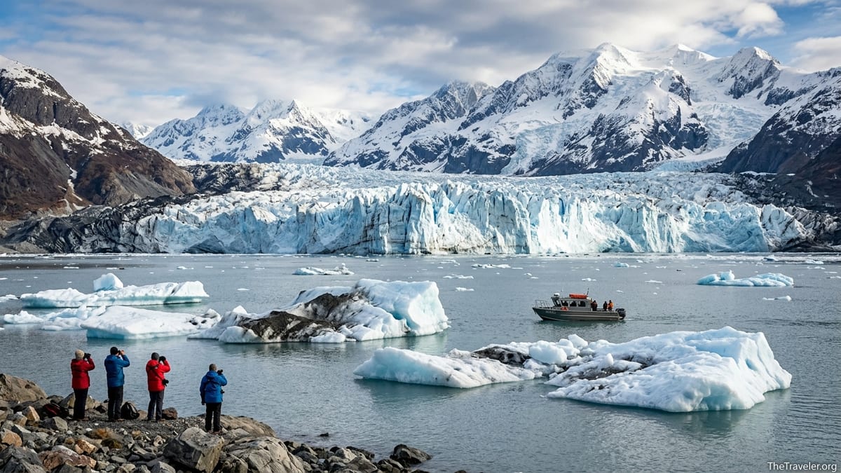
The December 6, 2025 Hubbard Glacier Earthquake: What We Know
According to the United States Geological Survey, the Hubbard Glacier earthquake struck on December 6, 2025 at 20:41:49 UTC, which was late morning local time in Alaska. The event registered magnitude 7.0 on the moment magnitude scale and occurred at a depth of roughly 10 kilometers beneath the Saint Elias Mountains, just inland from the Gulf of Alaska and close to the international border between Alaska and Canada’s Yukon Territory. The epicenter lay beneath or immediately adjacent to the Hubbard Glacier, one of North America’s most prominent tidewater glaciers and a well known feature on Alaska cruise itineraries.
USGS moment tensor solutions and follow up research describe the event as an oblique slip earthquake on or near the plate boundary zone where the Pacific plate and the North America plate interact. In simple terms, the fault moved partly horizontally and partly vertically. Analyses of the rupture indicate components of right lateral strike slip motion combined with thrust motion, compatible with the complex network of faults that link the Fairweather Fault system to the interior of the Saint Elias orogen. Work published in 2026 in a geophysical research journal further characterizes the event as a shallow, unilateral rupture that propagated along a connector fault beneath the glacier, constrained by bends in the fault geometry.
Regional networks including the Alaska Earthquake Center recorded a dense sequence of aftershocks following the mainshock. The main event and its aftershocks occurred in a zone that had already attracted scientific interest as a cluster of crustal earthquakes north of the Yakutat Bay region. From a tectonic standpoint, the quake is part of the ongoing accommodation of plate convergence and lateral motion in one of the fastest uplifting and most heavily glaciated mountain belts on Earth.
Although a magnitude 7.0 event is capable of generating a tsunami when it occurs beneath or very close to the coast, there was no significant tsunami reported in the Gulf of Alaska related to the Hubbard Glacier earthquake. Short lived tsunami watches issued immediately after the event were canceled when analysis showed the earthquake’s mechanism and location were not likely to produce a large ocean wave, and tide gauges did not record damaging sea level changes.
A Remote, Ice Covered Epicenter That Hid the Damage
The Hubbard Glacier region presents enormous challenges for rapid field assessment. The epicentral area lies within the Saint Elias Mountains, where peaks rise above 4,000 meters and are cloaked in thick ice fields feeding glaciers on both the Alaska and Yukon sides of the border. In early December, the area is in winter conditions, with limited daylight, heavy snowfall and frequent storms rolling in from the Gulf of Alaska. There are no permanent settlements near the epicenter, and even summer access typically requires aircraft support, glacier landing strips, or long expeditions with mountaineering gear.
Because of this isolation, there were no widely reported felt reports from nearby communities like Yakutat or Haines Junction that would normally help characterize shaking intensity, nor immediate photographs of surface damage. For travelers, this meant that people in cruise ports such as Juneau and Yakutat were unlikely to notice anything beyond perhaps a brief tremor, and no harbors or urban waterfronts reported obvious earthquake impacts on December 6. The absence of direct human observations did not mean the earthquake was minor. It meant that the evidence for what happened on the slopes and glaciers had to be collected indirectly.
Within hours, scientists began to search for signs of ground failure in satellite data. Optical imagery from commercial providers and Earth observation programs can reveal new scars on mountain slopes, discolored snow from dust and rock, or changes along glacier margins, but winter cloud cover and polar night conditions often obscure standard visible light images in this region. As a result, the first high confidence views of damage came from sensors that can see through clouds and do not depend on sunlight.
The combination of sparse eyewitness accounts, difficult winter flying conditions for survey aircraft, and the hazardous nature of freshly shaken steep slopes meant that detailed on the ground fieldwork near the rupture zone remained very limited through 2026. Instead, the Hubbard Glacier earthquake quickly became a textbook example of how modern satellite based methods can substitute for traditional boots on the ground reconnaissance in extreme mountain terrain.
Satellite Radar and Aerial Surveys: How Scientists Found the Landslides
To map ground failures in the wake of the quake, USGS and collaborating scientists turned to synthetic aperture radar, or SAR. Unlike ordinary cameras, SAR instruments send out pulses of microwave energy and record the echoes, building up images that reveal surface roughness and structural changes. For Hubbard, the key datasets came from the European Space Agency’s Sentinel 1 missions, which routinely image Alaska along repeat ground tracks.
A USGS data release published on May 4, 2026 provided preliminary point locations for more than 700 potential landslides and snow avalanches triggered by the December 6 event. This catalog was built using a change detection map prepared from two Sentinel 1 scenes: one acquired on November 28, 2025, before the earthquake, and another from December 9, 2025, three days after the mainshock. By comparing radar backscatter between these dates, analysts identified pixels where the radar signal changed markedly, then grouped those into candidate slope failure sites.
Crucially, USGS emphasizes that these mapped points represent potential, not confirmed, landslides or avalanches. Radar backscatter can change for many reasons in high mountain environments: snowfall between acquisitions, wind redistribution of snow, minor surface melt or refreeze, and changes in glacier crevassing can all alter the radar signature without a coherent landslide having occurred. That means each point is best thought of as a flag for where something on the surface changed, rather than a guarantee of a discrete rock or ice fall.
Where cloud cover and lighting allowed, aerial reconnaissance and optical satellite imagery were used to validate some of these radar detections. High resolution images from early 2026 show elongated streaks of avalanche debris across the glacier surface, fans of disturbed snow below steep rock faces, and in some cases darker rock rich deposits where bedrock failures occurred. In a handful of locations, particularly closer to notable peaks, aircraft based observers reported fresh scarp zones and deposition lobes consistent with large snow and rock avalanches. These field checked sites helped scientists calibrate how reliable the radar based mapping was in different terrain and snow conditions.
Where the Slopes Failed: Concentrations Near the Rupture and Mount Logan
The May 2026 USGS mapping and related event summaries describe more than 700 potential slope failures triggered by the Hubbard Glacier earthquake across a broad swath of the Saint Elias Range. The highest concentrations of radar detected changes cluster close to the inferred fault rupture, which trends northwest southeast beneath or just inland from the glacier. This pattern is consistent with strong shaking and peak ground accelerations being highest near the rupture zone, a finding that echoes lessons from previous large earthquakes in mountain belts.
In addition to the cluster near the Hubbard epicenter, scientists identified conspicuous groups of slope failures in the vicinity of Mount Logan and surrounding high peaks on the Canadian side of the border. Mount Logan, Canada’s highest mountain and one of the largest ice clad massifs on Earth, hosts extensive hanging glaciers and towering rock walls that are prone to large avalanches even in quiet seismic periods. Post earthquake satellite imagery revealed long avalanche paths and areas of disturbed ice and snow radiating away from some of these steep faces, suggesting that the December 6 shaking acted as a trigger for failures in an already unstable environment.
USGS summaries and NASA’s Earth science coverage refer to large landslides and snow avalanches in this broader Mount Logan region, but as of late 2026 there is limited peer reviewed quantification of individual volumes or precise runout distances tied specifically to the Hubbard event. Scientists are cautious about distinguishing between failures directly caused by the mainshock and those resulting from natural winter avalanche cycles, particularly because heavy snowfall in the weeks before and after the quake can load slopes to the brink of failure on its own.
This uncertainty matters for hazard assessment. A rock and ice avalanche that starts as an earthquake triggered collapse may travel farther or interact differently with glacier surfaces than a purely snow based slide caused by a storm. For now, the Hubbard data set serves more as a regional picture of where slopes were sensitive to disturbance in early winter 2025 than as a complete inventory of exactly how each failure unfolded.
NISAR and Other Satellite Views of Avalanche Debris and Glacier Damage
Beyond Sentinel 1, one of the most intriguing data sources for the Hubbard Glacier earthquake is NASA and the Indian Space Research Organisation’s NISAR mission, an advanced SAR satellite designed with ice, landslides and earthquakes in mind. Although NISAR is still in the early stages of operations, NASA Earth Observatory has highlighted early products that captured the Hubbard region before and after the December 6 event, showing a patchwork of altered radar textures across the glacier surface and nearby slopes.
NISAR’s radar imagery and other satellite views reveal real, observable changes from the earthquake. Bands and fans of avalanche debris can be seen streaking across the glacier in medium resolution images, often extending kilometers downslope from steep rock faces. In some cases, these deposits alter the color or brightness of the glacier surface as dark rock fragments and dust spread over previously clean snow. On nearby ridges, before and after image pairs show fresh scars and disrupted cornices where snow and rock have peeled away.
There is also evidence of damage to the glacier’s upper surface in the form of new crevasse fields and widened existing crevasses, especially in zones of high strain near bends or steep steps in the ice flow. On heavily crevassed tidewater glaciers like Hubbard, such cracking is common even without earthquakes, driven by the glacier’s own flow and by seasonal meltwater. Interpreting which individual crevasses can be attributed to the quake requires detailed time series analysis, and most public facing reports have been careful not to overstate this link.
Importantly, satellite analysts and agencies have not documented definitive, long term shifts in Hubbard Glacier’s flow speed, terminus position or structural stability that can be directly attributed to the December 6 earthquake. While some social media posts and speculative commentary after the event suggested that the glacier might surge, retreat abruptly, or experience imminent large scale collapse because of the shaking, official scientific communications through 2026 have emphasized that any such claims remain unproven. The glacier continues to advance slowly in some sectors and interact with Russell Fjord and Disenchantment Bay much as it did before the quake, with day to day variations driven more by climate and ocean conditions than by a single seismic event.
How Earthquakes Affect Glaciers: What Mechanisms Apply at Hubbard
Experience from other mountain ranges shows that earthquakes can influence glaciers in several ways. Strong shaking can trigger snow avalanches off surrounding peaks that spill onto glacier surfaces, load crevasse fields with debris, or bury blue ice under rock rich layers that change how sunlight is absorbed. Rock and ice avalanches can also plunge directly onto glacier tongues, thickening the surface locally or, in extreme cases, damming side valleys and creating temporary lakes. Within the ice itself, seismic waves may encourage existing fractures to propagate, leading to bursts of crevassing or the calving of ice cliffs at tidewater glacier fronts.
In heavily glaciated settings from the Himalaya to the European Alps, scientists have documented earthquake triggered avalanches that ran for tens of kilometers and left clear thermal and radar signatures. Research in 2026 on rock ice avalanches in Switzerland and the Tibetan Plateau, for example, integrates seismic and remote sensing data to show how failures can evolve into complex “disaster chains” with downstream flooding. These international case studies provide context for Hubbard: they confirm that large earthquakes are capable of mobilizing enough snow, ice and rock to reshape high mountain landscapes far from populated areas.
For Hubbard Glacier specifically, the clearest observed responses to the December 6, 2025 quake are the widespread avalanches and landslides mapped on surrounding slopes and the visible avalanche and rockfall debris now dotting parts of the glacier surface. There is also plausible evidence of enhanced crevassing in some sectors where the ice flows across steep bedrock or bends sharply. However, through 2026 there is no widely accepted documentation of a major change in the glacier’s long term advance rate, a sudden wholesale retreat, or dramatic new calving behavior at its marine terminus that can be tied to the earthquake alone.
Scientists remain particularly cautious in evaluating claims about future instability. Hubbard Glacier has a documented history of natural advances that have dammed Russell Fjord, creating temporary lakes that pose real flood hazards to nearby ecosystems and potential indirect concerns for communities like Yakutat. Those events in 1986 and 2002 were driven by glacier dynamics and climate, not by large earthquakes. Current research efforts around Hubbard focus on long term monitoring of ice motion, lake levels and fjord circulation, so that if tectonic events do nudge the system, any resulting changes can be distinguished from ongoing climate driven trends.
Landslide Data, Scientific Follow Up and What Remains Uncertain
Through 2026, most of the rigorously documented information about the Hubbard Glacier earthquake’s geomorphic impacts comes from official agencies rather than from the open scientific literature. The USGS earthquake event page provides authoritative parameters for the mainshock and outlines the tectonic context, while the May 4, 2026 data release offers a machine assisted catalog of possible landslides and avalanches based on Sentinel 1 radar change detection. NASA’s Earth Observatory and mission teams for NISAR have supplied accessible interpretations of satellite views that show avalanche debris and disturbed glacial ice.
At least one peer reviewed geophysical study published in 2026 analyzes the rupture process of the December 6 mainshock using seismic waveforms and modeling. This work refines the picture of the fault geometry, suggesting a complex, unilateral rupture along a connector fault segment in the Saint Elias region. Although primarily a tectonic study, its results help landslide researchers understand where shaking was strongest and how the pattern of aftershocks evolved beneath the mountains and glaciers.
By contrast, as of late 2026 there are few, if any, detailed peer reviewed case studies that attribute specific large slope failures to the Hubbard event in the same way that famous rock ice avalanches have been tied to other earthquakes. The combination of winter conditions, lack of road access and the cross border nature of the affected terrain complicates field campaigns needed to measure deposit thicknesses, collect rock samples or install new monitoring equipment. Researchers are still sifting through the radar and optical time series to separate earthquake triggered events from background activity.
This means that some important questions remain open. For instance, scientists do not yet have a complete inventory of the largest rock and ice avalanches linked to the quake, precise volume estimates for debris that reached glacier surfaces, or a quantified assessment of how much the earthquake altered erosion rates in the region. Nor is there consensus on whether subtle changes in ice flow speed or crevasse evolution seen in some satellite products are directly attributable to shaking, or simply part of Hubbard’s normal variability under changing climate conditions.
Impacts on Cruise Tourism, Navigation and Nearby Communities
Given Hubbard Glacier’s prominence as a marquee stop on Gulf of Alaska and cross gulf cruises, one immediate question after the December 6 quake was whether marine access or passenger safety would be affected. Major cruise lines that operate ships into Disenchantment Bay and Yakutat Bay, including brands like Princess Cruises, Holland America Line and Norwegian Cruise Line, typically schedule Hubbard visits from late spring through early autumn. The earthquake occurred well outside this season, and there is no evidence from official port records or company statements through 2026 that scheduled 2026 cruises were canceled specifically because of the earthquake.
Harbor infrastructure in Yakutat and other regional communities did not report significant damage linked to the Hubbard event. Unlike a coastal thrust earthquake that displaces the seafloor directly beneath a port, the oblique slip rupture beneath the Saint Elias Mountains transmitted its strongest shaking into uninhabited high terrain. Some residents in coastal towns may have felt mild to moderate shaking, but no major structural impacts or casualties were documented by state or federal agencies. For marine navigation, including local fishing vessels and supply barges, navigation warnings issued immediately after the quake centered mostly on prudent caution until tsunami assessments were complete.
Concerns that the earthquake might destabilize tidewater glacier fronts and increase iceberg production in a way that could threaten cruise ships have not been borne out by evidence available through the 2026 seasons. Ice conditions in Disenchantment Bay continue to vary from year to year based on calving rates, seasonal melt and ocean currents, and cruise operators routinely adjust their approaches using real time pilot reports and local ice pilots. If anything, the Hubbard event has underscored the value of continuous satellite monitoring to complement traditional observations, giving mariners and scientists alike a broader situational awareness of calving fronts and iceberg fields.
For travelers considering voyages that include Hubbard Glacier, the key takeaway is that as of late 2026 authorities do not identify an ongoing seismic crisis or unusual hazard level at the glacier tied to the 2025 event. Earthquakes will remain a natural part of the tectonic environment of the Gulf of Alaska, just as winter storms and shifting sea ice are persistent features, but there is no official indication that the December 6 mainshock has made future cruise seasons inherently more dangerous.
Why the Hubbard Glacier Earthquake Matters for Glacier Research
From a scientific perspective, the 2025 Hubbard Glacier earthquake is significant not only because of its magnitude but because it ruptured beneath one of the world’s great ice clad mountain regions. The combination of a magnitude 7.0 mainshock, roughly 10 kilometer focal depth and location below active glaciers in the Saint Elias Mountains offers a rare natural experiment in how strong ground motion interacts with ice covered slopes and thick valley glaciers far from major population centers.
The preliminary catalog of hundreds of potential landslides and avalanches, even acknowledging its uncertainties, provides an invaluable spatial dataset for testing models of how shaking amplitude, slope orientation, rock type and glacial cover combine to control slope failure. Comparing the Hubbard pattern with better documented events in less glaciated regions can help refine hazard models used for other high mountain ranges, from Alaska’s own Wrangell Mountains to the Andes and the Himalaya, where growing tourism and infrastructure push ever farther into previously remote terrain.
The event also serves as an early case study for how next generation radar missions like NISAR can support rapid earthquake response in polar and high mountain environments. The ability to detect changes in snow, ice and rock surfaces within days of a winter earthquake, even through clouds and darkness, marks a step change from the situation two or three decades ago, when similar events might have gone largely undocumented. As NISAR and similar satellites build longer archives, scientists will be able to track whether specific glaciers experience subtle speed ups or slowdowns in the months after major earthquakes and to distinguish those responses from purely climate driven trends.
Finally, the Hubbard Glacier earthquake highlights the importance of cross border and cross disciplinary collaboration. The fault system beneath Hubbard spans Alaska and Yukon; the affected peaks include national parks in both the United States and Canada; and the data streams come from US, European and Indian satellites as well as regional seismic networks. Drawing all of these observations together takes time, which is why many conclusions in 2026 are still framed as preliminary. Yet even at this stage, the event has advanced understanding of how tectonics and glaciation intersect in one of the planet’s most dynamic mountain systems.
What Scientists Still Do Not Know
Despite the progress made through 2026, key scientific questions about the Hubbard Glacier earthquake remain unresolved. Researchers still lack a fully validated inventory of the largest individual landslides and rock ice avalanches triggered by the mainshock. Many of the more than 700 radar detected change points are likely to be ordinary snow avalanches or weather related surface changes rather than catastrophic slope failures. Distinguishing among these types requires painstaking manual inspection of imagery and, ideally, field visits that have so far been limited.
Another uncertainty lies in the glacier’s subtle dynamic response. While there is no evidence of a dramatic shift in Hubbard Glacier’s long term behavior, scientists are still analyzing time series of ice motion from radar and optical feature tracking to see whether the quake induced small but measurable perturbations. If such signals exist, they could shed light on how seismic waves affect basal sliding, crevasse opening and internal stress within thick, fast flowing ice.
There are also open questions about cascading hazards. In some mountain regions, earthquake triggered landslides have dammed rivers or buried glacier outlets, setting the stage for delayed outburst floods months or years later. As of late 2026, no such major hazard chain has been definitively linked to the Hubbard event, but this is an area of ongoing monitoring. Agencies and researchers are watching for new lakes forming behind landslide deposits, unusual changes in river turbidity and shifts in glacier fed lake levels in the surrounding Saint Elias region.
For now, the Hubbard Glacier earthquake stands as a landmark case in high mountain seismology whose full geomorphic consequences will likely be documented gradually over the rest of the decade. The data already gathered ensures that future studies will be able to revisit the event with improved analytical tools, even if winter snow and ice have long since covered many of the visible scars.
Frequently Asked Questions
How big was the Hubbard Glacier earthquake? It was a magnitude 7.0 event on the moment magnitude scale, large enough to cause strong shaking near the epicenter and trigger widespread avalanches and landslides in steep terrain.
Where exactly was the epicenter? The epicenter was located beneath or immediately adjacent to the Hubbard Glacier in the Saint Elias Mountains, near the border between Alaska and Canada’s Yukon Territory, at a depth of roughly 10 kilometers.
Did the earthquake cause hundreds of landslides? USGS mapping based on Sentinel 1 radar change detection identified more than 700 potential landslides and snow avalanches across the region. However, these are preliminary locations where radar backscatter changed between late November and early December 2025, and not all of them have been confirmed as true landslides through optical imagery or fieldwork.
Was there a tsunami? There was no damaging tsunami associated with the Hubbard Glacier earthquake. Initial tsunami watches issued as a precaution were canceled once analysis showed the rupture mechanism and location were unlikely to produce a large ocean wave, and coastal gauges did not record significant tsunami signals.
How badly was the glacier damaged? Satellite images show widespread avalanche debris on the glacier surface, areas of disturbed snow and rock, and some zones of enhanced crevassing. What they do not show, as of 2026, is a clear, quake induced change in Hubbard Glacier’s overall advance or retreat pattern or in the stability of its ice front. Any long term impacts on flow speed or calving behavior remain the subject of ongoing study.
Are future cruises to Hubbard Glacier at risk because of this earthquake? As of late 2026, there is no official indication that the December 6, 2025 earthquake has created an ongoing seismic or glacial hazard that would make future cruise visits inherently more dangerous. Cruise operators continue to work with pilots, harbor authorities and ice observers to evaluate day to day conditions in Disenchantment Bay, including ordinary risks from icebergs, weather and navigation channels.
What does this earthquake teach scientists about glaciated mountains? The Hubbard event demonstrates how a large, shallow earthquake beneath heavily glaciated peaks can trigger widespread slope failures that are only fully visible from space. It provides a valuable test case for satellite based landslide detection, improves understanding of how faults behave beneath thick ice and helps refine hazard assessments for other high mountain regions where glaciers and earthquakes coexist.