


More news on this day
Travelers planning late‑week and weekend trips along the U.S. East Coast face growing disruption risks from a developing coastal storm that forecasters expect to organize off Florida on Friday, November 20, then track northward with heavy rain, strong onshore winds and hazardous surf from Florida to at least southern New England.
Get the latest news straight to your inbox!
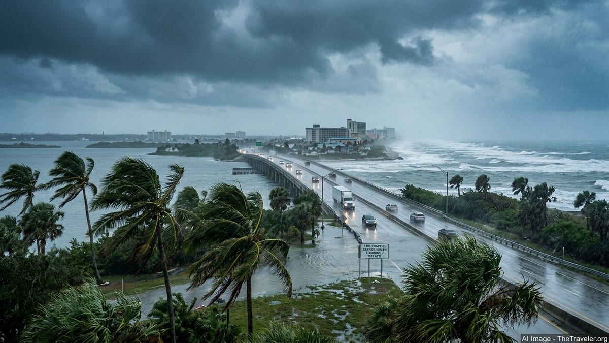
Storm Organizing Off Southeast Coast With 60% Development Chance
The National Hurricane Center’s Thursday morning Tropical Weather Outlook describes a broad area of disturbed weather offshore of the Southeast U.S., expected to consolidate into a coastal low between Friday and Saturday before moving generally north or northeast just off the coastline. As of November 19, forecasters give the system a 60 percent chance of becoming a tropical or subtropical cyclone within seven days, but stress that impactful rain, wind and surf are likely regardless of whether it is ever named.
The National Weather Service’s Weather Prediction Center highlights “heavy rainfall/flooding and wind/wave threats with a weekend coastal storm off the Southeast to up the East Coast” in its extended forecast discussion, signaling a multi‑state event that will evolve over several days rather than a quick‑hitting squall line. Excessive rainfall discussions call out a multi‑day heavy rain episode focused first along Florida’s east coast, where recent downpours have already saturated soils and increased sensitivity to new flooding.
At the same time, local NWS forecast offices along the corridor from Florida through the Carolinas, the Mid‑Atlantic and into southern New England are increasingly tying their late‑week and weekend outlooks to the same organizing coastal low. NWS Boston, for example, notes that a disturbance near Florida is expected to intensify into a coastal storm and bring “windswept heavy rain” and marine impacts to southern New England sometime late Sunday into Monday, November 22–23.
Florida’s Atlantic Coast: Repeated Rounds of Heavy Rain and Coastal Hazards
Florida is set to bear the brunt of the storm’s early stages. Forecast discussions from NWS Jacksonville, Melbourne and Miami on Thursday emphasize repeated bands of heavy rain and persistent onshore winds along the Atlantic coast from November 19 into November 20. This new event overlaps existing flood concerns after earlier October and early‑November coastal systems, which prompted localized emergency declarations in some communities and left soils and drainage systems strained.
For travelers, this means an elevated risk of ponding and flash flooding on major routes such as Interstate 95, U.S. 1 and parallel coastal connectors, particularly in known low‑lying stretches of the Space Coast, the Treasure Coast and South Florida. Short but intense rainfall bursts may quickly overwhelm urban drainage, temporarily closing underpasses and access roads near canals and bays even outside any formal evacuation or closure orders.
Aviation and cruise‑connected travel may also be affected. Low ceilings, gusty onshore winds and heavy showers could trigger delays at airports including Miami, Fort Lauderdale and Orlando Sanford, as well as at Jacksonville, especially during peak departure and arrival banks. As of Thursday morning there are no system‑wide airline change‑fee waivers publicly posted that are tied specifically to this storm, so passengers with near‑term bookings into Florida should check their carrier’s travel advisory page frequently and be prepared for evolving policies if conditions worsen.
Carolinas and Mid‑Atlantic: Onshore Winds, Coastal Flooding and Ferry Risks
Farther north, NWS offices in Wilmington, Charleston, Morehead City and Wakefield report rising confidence that strong onshore flow and building seas will accompany the storm as it tracks near the Carolinas and Virginia coastline over the weekend. Forecast discussions point to a combination of high surf, beach erosion and minor to potentially moderate coastal flooding during times of high tide, even if the system’s center remains offshore.
These conditions could ripple through surface and marine travel plans. Drivers along coastal portions of the Carolinas and southeast Virginia should anticipate localized road closures in flood‑prone neighborhoods, tidal marsh crossings and barrier‑island causeways, particularly around morning and evening high tides. High‑profile vehicles such as RVs and box trucks may encounter temporary wind restrictions on exposed bridges if gusts reach forecast thresholds.
Ferry and island access are another concern. While no blanket shutdowns have been announced as of November 19, the combination of rough seas and strong onshore winds may lead to schedule adjustments or weather‑related cancellations for services such as North Carolina’s Outer Banks routes, links to barrier islands in South Carolina and Virginia, and smaller private or county‑run operations. Travelers heading to or from islands should monitor operator alerts closely in the 24 hours before departure for updated sailing decisions tied to marine forecasts and gale warnings.
Late‑Weekend Impacts Into the Northeast and Key Travel Hubs
As the coastal storm lifts farther north, NWS forecast offices in the Mid‑Atlantic and New England expect its impacts to shift toward marine, coastal and aviation concerns late Sunday into Monday. NWS Philadelphia/Mt. Holly and Boston explicitly reference the Florida‑origin storm in their discussions, noting the potential for “windswept heavy rain,” gusty coastal winds and episodes of tidal or coastal flooding from New Jersey through Long Island and into southern New England.
The degree of impact in the New York metropolitan area and Massachusetts still depends on the system’s exact track and intensification. Current guidance on November 19 suggests that inland flooding may be limited compared with coastal and marine issues, but bands of heavy rain and strong crosswinds could still disrupt operations at major airports late in the weekend. New York’s airports and Boston Logan may face periods of reduced visibility, low ceilings and gusty approach and departure paths that can trigger air traffic control delays, particularly if the storm’s wind field expands as models suggest.
Rail and highway travel could also feel knock‑on effects. Amtrak and regional commuter services along the Northeast Corridor sometimes reduce speeds during strong wind or heavy rain events, extending journey times even without outright cancellations. On the roads, hydroplaning risk will be elevated where heavy rain coincides with heavy traffic on I‑95 and connecting arteries during one of the last weekends before U.S. Thanksgiving travel peaks, though current forecasts stop short of predicting widespread, long‑duration closures.
What Travelers Should Watch Between November 19 and 23
Forecasters currently expect hazardous conditions linked to this coastal storm to persist in some form from Thursday, November 19 through at least Monday, November 23, as the low forms, matures and then lifts northward parallel to the coast. The greatest confidence is in multi‑day heavy rain and localized flooding along Florida’s Atlantic coast into Friday night, followed by increasing wind, surf and coastal flooding risks along the Carolinas and Mid‑Atlantic coastlines over the weekend, then a shift toward windswept rain and marine hazards in southern New England late Sunday into Monday.
Because the system’s exact structure and track remain uncertain, travelers should treat all timing and impact information as conditional and monitor authoritative updates closely. Key resources include local NWS forecast offices along the route, the Weather Prediction Center’s rainfall and flooding outlooks, and the National Hurricane Center’s tropical outlooks and any future advisories if the storm acquires tropical or subtropical characteristics and is designated as a cyclone.
Anyone with itineraries touching Florida, the coastal Southeast, the Mid‑Atlantic or southern New England between November 19 and 23 should recheck forecasts and any airline, rail, cruise or ferry alerts within 12 to 24 hours of departure. This is especially important for trips involving low‑lying coastal roads, barrier‑island bridges, smaller regional airports or marine connections, where localized tidal flooding or high seas can force rapid operational changes even when skies are improving a short distance inland.